
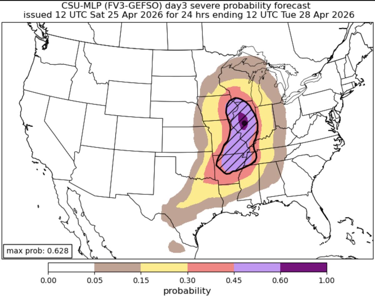
Cool 50° lake breezes will be the #Spring curse for #Chicago today and Sunday while the burbs away from the lakeshore enjoy 60s and 70s once the sun pops back out midday. Sunday the cool gradient will hig the lakeshore a bit tighter where even western city locales might tap the 60s And then comes Monday where Illinois gets center stage for the next big severe weather event Current odds put the biggest risk over the IL/IA/MO junction with all ingredients in play for rapid, large, rotating storms to form. Large hail and tornadoes would be favored in that area by late afternoon. How far north that development can get will be the main factor for severe chances in NE IL in the evening We currently sit split on the Enhanced/Slight risk zone. Models a bit split on main low pressure storm track but ones I favor push the low thru Iowa to SE MN and Lake Superior which could keep the storm track into all of our area. Should a more southern solution evolve then worst of the worst stays south of the metro. Much of this depends on how storms Sunday evolve over Kansas and Nebraska and what leftovers from those pollute our storm environment as they die out Sunday night and track east across northern IL Stay tuned! But keep weather plans top of your list for late Monday activities