After more than 35 years as a meteorologist in the National Weather Service, I will retire today. What a ride it has been. Thank you to my team, colleagues, core partners, friends and family that supported me on this wonderful journey. #ohwx#clewx#nwscle
Good morning Gary! I’m with @StoryfulNews - we help newsrooms like the Weather Channel, AccuWeather, ABC News, + more. Did you take this video? May we distribute to our news partners for their coverage, with full credit given to you (terms: storyful.com/clearance)? Thanks, enjoy your day!
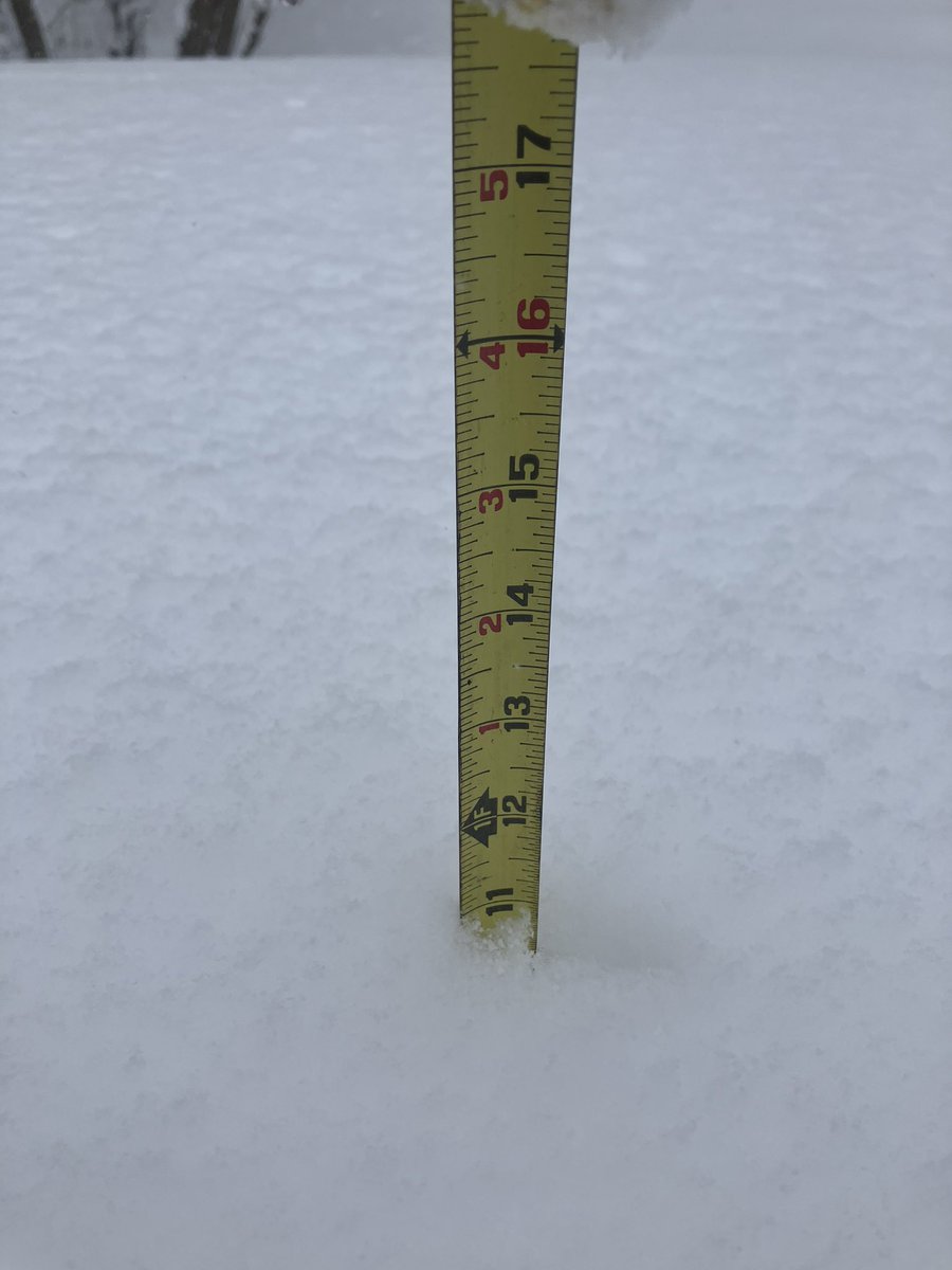
Lake Effect snow bands off and on last night and this morning south of Cleveland in North Royalton OH. A winter wonderland with 11 inches snow depth. #ohwx#snow#LakeEffect#clewx
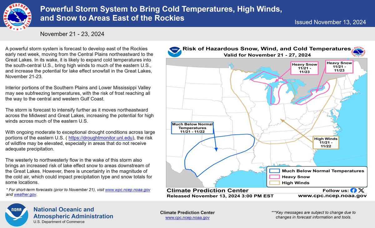
Something to keep an eye on for late next week. A pattern shift will allow cold air to finally move into the Great Lakes region. With lake temperatures near record highs, the lake effect snow machine may be primed for a big event.
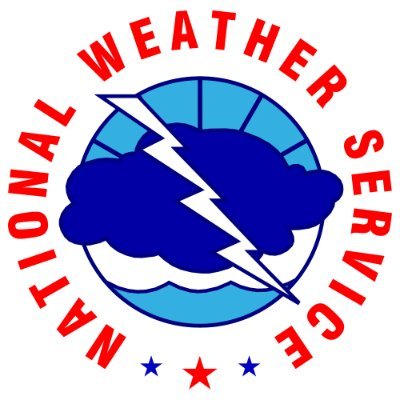
The remnants of Tropical Depression Beryl will approach the region overnight into Wednesday. Isolated to scattered thunderstorms are possible this afternoon. Rain will increase after midnight with locally heavy rain possible but widespread flooding is not expected. #Beryl
OVER THE CARIBBEAN - Inside the eye of Category 5 Hurricane #Beryl!
NOAA WP-3D Orion #NOAA43 “Miss Piggy” continues operations into Hurricane #Beryl to collect data for hurricane forecasting and research.
Visit hurricanes.gov for the latest forecast and advisories. #FlyNOAA
📸: Lt. Cmdr. Kevin Doremus, NOAA Corps
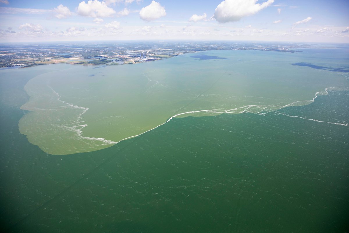
Just in: NOAA is forecasting a moderate to larger-than-moderate #HarmfulAlgalBloom for western #LakeErie this summer. This year’s bloom is expected to measure 5, with a potential range of 4.5 to 6 on the severity index, similar to last year’s bloom (5.3). coastalscience.noaa.gov/news/moderate-…
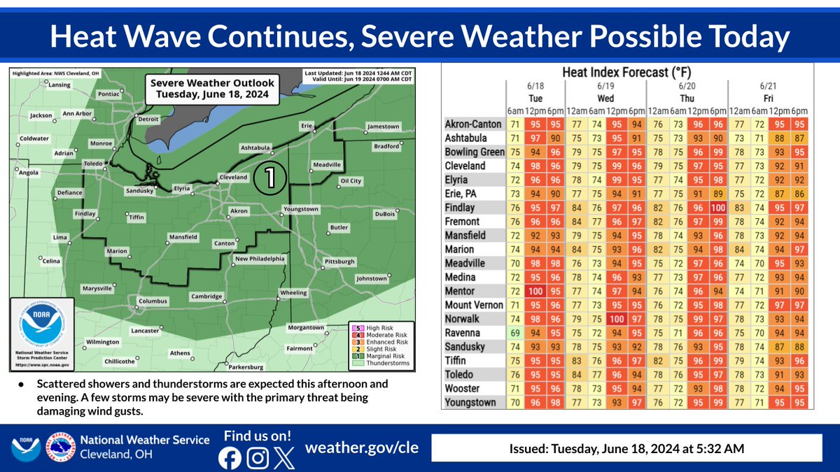
⚠🔥 The heat wave will continue through this week with heat indices in the upper 90s to near 100. ⛈⛈ For today, there is also a risk for isolated severe thunderstorms in the afternoon and evening with the primary threat being damaging wind gusts.
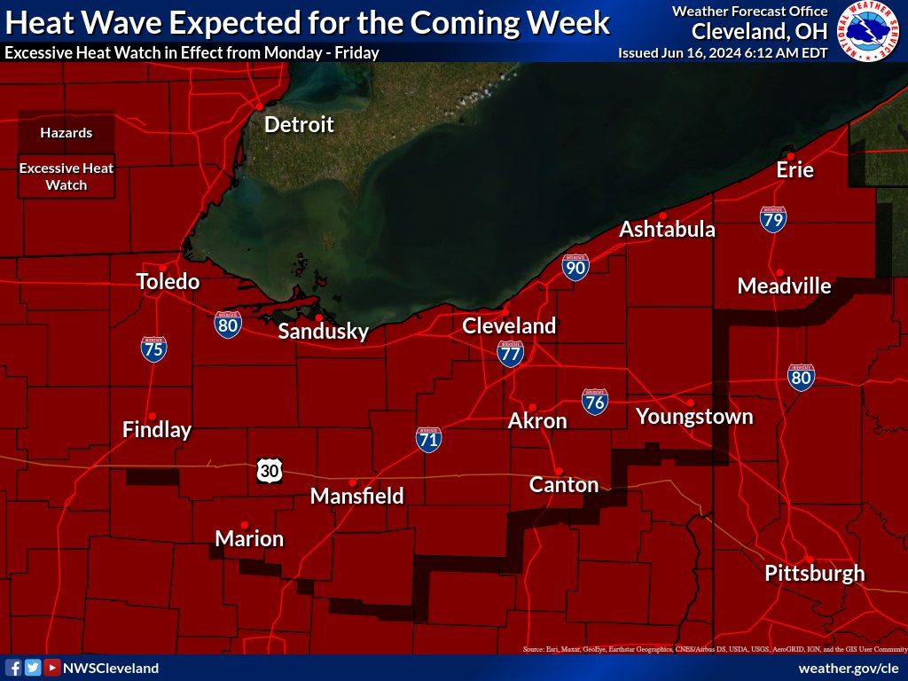
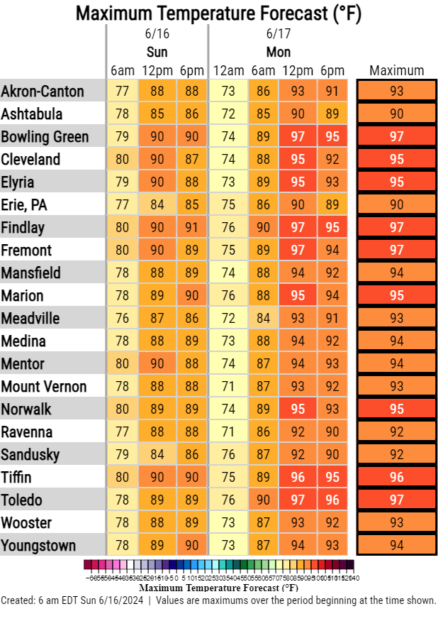
All the dark red on that map is an Excessive Heat Watch in effect from Mon. through Fri. of this week. Temps well into the 90s during the day only cooling into the 70s at night. The table shows temperatures that will be very warm today, only to increase for Monday. #ohwx#pawx
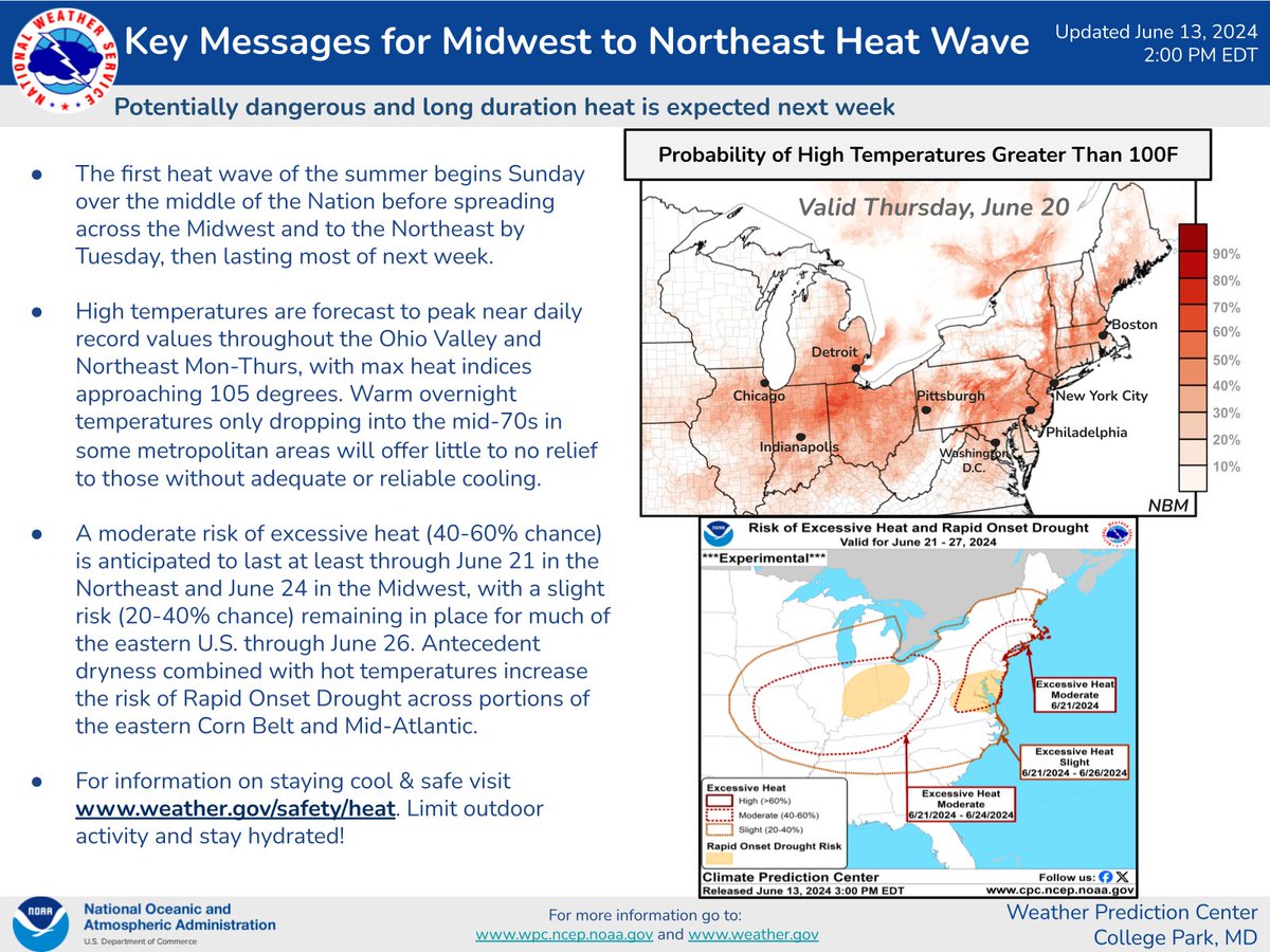
Several days of temperatures exceeding 90 degrees are expected all next week and possibly into next weekend as well. Here are the latest key messages for this heat wave.
(1/2) We live in a different world today when it comes to radar resolution. This is what the radar operator saw back on May 31, 1985 when tornadoes raced across the region. #weatherthrowback#wxhistory#pawx