Storm chase day WILL be activated tomorrow in Kentucky! Targeting central KY
I will be continuously LIVE on YouTube! Been working hard on the chasing setup!
I will post this link again tomorrow before going live. Appreciate all support 🫡 #KYwx@Kentucky_WX" target="_blank" rel="nofollow noopener">youtube.com/@Kentucky_WX
This is truly the ugly period of Summer. Mid to late July sucks. You’re past the 4th (peak Summer IMO).. it’s hot as hell. You’re still far away from Fall.
Once you get into August, it can be just as hot as July… but the anticipation of Fall builds & powers us through the brutal heat.
Meanwhile, it feels diabolical outside.
@Kentucky_WX I noticed the eastern part of the band east of I-65 seems to be weaker in intensity for now. Will that be filling in or do you think the bigger threat is further west where it is now?
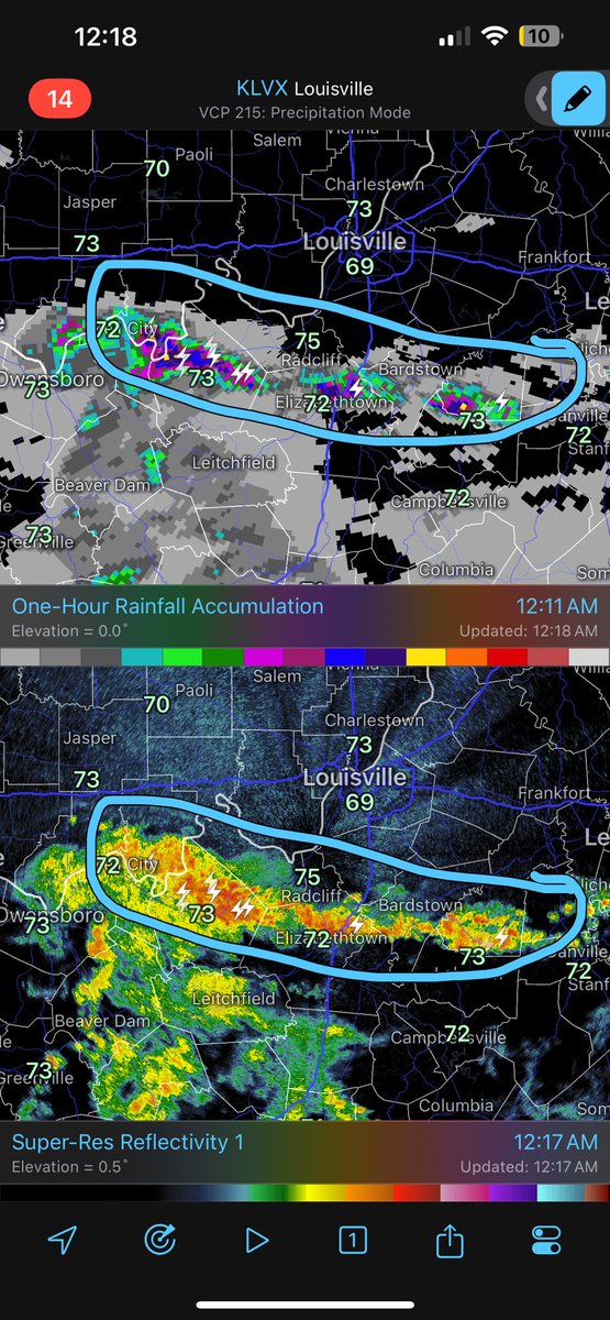
This stationary band is dropping 1-2” QUICKLY and will likely trigger some flash flood warnings in the next couple of hours. Not liking the trends.
If you HAVE to be out tonight in this area please use caution.
Turn around, DONT drown! #KYwx
@0meterChasers I noticed the eastern part of the band east of I-65 seems to be weaker in intensity for now. Will that be filling in or do you think the bigger threat is further west where it is now?
11:20PM CDT:
Getting concerned about this small band parallel with this Frontal Boundary from Owensboro to E’Town along & S of US-60. Already pushing 2” within one hour in Western Breck Co & 2.5” in E’Town area. The Low is not moving as Boundary is stalled just S of the River. Flood threat is Increasing!
-Mike
@bam_weather Seems like it’s been quite the challenge to get real organized development into southern IN and north central KY the last couple of days especially compared to what modeling advertised. But then overachieved further south and west than data showed. I wonder why?
Yes indeed, it's been a challenge to get these storm cells to push into south central Indiana! Saturday is our last opportunity to see showers and storms before a 4 day dry gap begins.
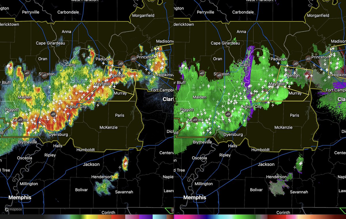
Really interesting choice here by NWS Memphis by not having any severe thunderstorm warnings out for there part of the line in western TN, not even any special weather statements. NWS Paducah however has there entire part severe. Interested to see what all reports come in over the next hour or two in this area.
12:15pm ET:
~ There's some clearing trying to shoot North in Western Kentucky, while another developing line of storms is moving East. That was an awful lot of rain activity this morning. I don't know if our atmosphere is going to have enough dry time to rebound from that morning activity. It's going to be close! I'll keep you posted. Right now, we're just watching the clouds to see if they're going to keep us cooler and wet, or if the sun comes out to heat things up. - George
@Kentuckyweather after a quick glance at model data and what happened in Lex early Monday, do you feel another flash flood risk is possibly with these rounds of storms Friday/Saturday?
Really liking my positioning just south of Mount Vernon….
Still thinking a couple of supercells this afternoon with all hazards in southern Illinois! #ILwx
🚨 Early Alert: We're tracking another serious storm system for Fathers Day.
- More details starting tomorrow morning, will be delivered to you. Looks like another odd June time system with ample wind energy along with humid summer time conditions. This would likely target Western and Central Kentucky. Critical data will arrive overnight. - George
@bam_weather What is the likely pattern for mid-June to follow this early June pattern? We have several travel plans in the southern Appalachian region during this time
Cooler northerly flow will allow temperatures to average out a few degrees cooler than normal as we close May and start June.
No big time summer heat in the cards for the time being as we roll into the start of the meteorological summer!
@NWSLouisville do you still feel the severe thunderstorm watch is needed for counties south and east of the river in KY? I’m having a hard time finding any short range guidance showing hardly any activity this evening for much of the KY counties that are in the watch….
@WeatherNowKY I’m having trouble finding any short range guidance in the last couple hours that shows anything south of the river 🤷♂️ Seems like it wants to trend this evening’s threat even further north.
⚠️ Severe Thunderstorm Watch Issued ⚠️
- This watch has been issued for the main risks of wind gusts up to 70mph and hail up to 1.5". If any tornado does occur, it would be very weak and brief. Hail and Winds remain as the primary threat!.
- This could be expanded East eventually, I don't think it comes any further South. We're monitoring. - George