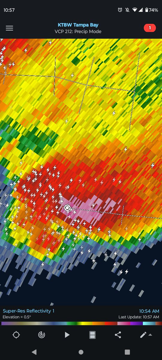
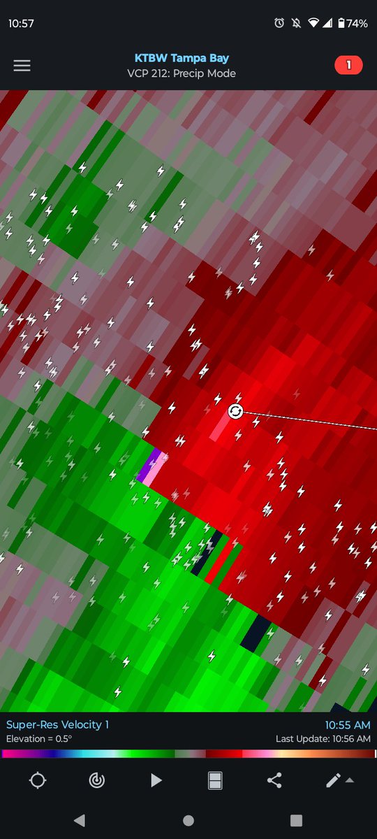
NEW VIDEO: Severe weather today in Central #Florida brought strong wind and hail to Oviedo, northeast of Orlando. Even a possible tornado is currently being investigated in Hudson too. @stormhour@stormchaser4850@JimCantore@spann
A few strong to severe thunderstorms are possible today, with the activity shifting towards the east coast later this afternoon. We still have a ways to go until our rainy season gets going. #Florida
@tropicalupdate Same meteorologists who yell don't share long range models are the same ones who posted big rains coming to Florida over a week + away. Just nature of the internet.
Trying to reason with Hurricane Season. Seeing posts showing yesterday's GFS 18z (top). Some asking me. So will try to make some sense of it all. And my style of doing things. You can pretty much find a model long range showing something during the season. Does it mean its likely. No. But shared. Yes. It's just the nature of the internet. Interest and Intensity drives these posts. The wonder. And yes engagement. I likely was guilty of that years ago too. This happens every year. Especially early season when things kick off. GFS has been one of the worst models in recent years. Especially at guessing long range formation. For example the graphic here. An 18z storm. Surrounding other runs show nothing. Zippo. EURO, others, nothing. But the 18z gets the attention. Not the other dozen that say no. I watch all models. Yes. But more than this. Ensembles. History. Weather patterns. Highs. Lows. Jet Stream. When I start to believe there is a legitimate chance of something to track then I will start teasing ideas. It is a fine line to when to start as sometimes things bust. Many want to be first. Too many times of crying wolfe loses trust. That then turns to hype. Tough. I know many want MWP to dive deep. I will when the time is right. You can count on that. This is not one. Eventually though one of these runs will be right and someone will claim victory. But what week, month, year, decade, will that be. Cheers. Makes a little sense I hope haha.
@blamarre Above avg Gulf and shelf waters likely aiding in the maintaining of the line as it moves through with better available CAPE, with discrete isolated supercell or two ahead of the line possibly.
Temperatures are running above normal across the Tampa Bay region today (Sunday) and Monday, with afternoon highs climbing into the low to mid 80s for many locations - a few degrees warmer than our typical upper 70s this time of year and with morning lows also running milder than the usual upper 50s.
A stronger cold front than the one we experienced last Thursday will arrive Monday afternoon, bringing a noticeable pattern change for the rest of the week.
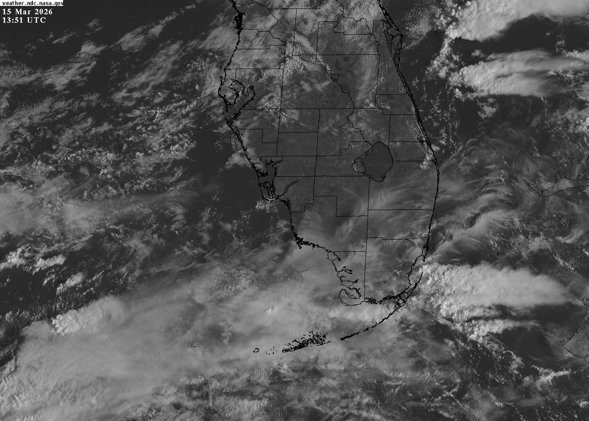
This morning’s satellite imagery shows deeper Gulf and Caribbean moisture pooled over South Florida, and that moisture will lift northward over our area today and Monday ahead of the front, helping to fuel scattered showers and thunderstorms this afternoon and evening, with a more organized line of storms expected along the front around the Monday afternoon and evening commute.
High‑resolution guidance from the HRRR and NAM Weather models, along with both deterministic (single solution output) and ensemble (probabilistic, multi-solution output) guidance, are in good agreement on the timing of the front and the axis of highest moisture, which increases confidence in that late‑day Monday line of storms.
Behind the front, cooler and drier air spills into west-central and southwest Florida. The official NWS low temperature forecasts show widespread 40s along the west and southwest coast and across the greater Tampa Bay region Tuesday and Wednesday mornings, which is below our climatological normals for mid‑March, with below‑normal temperatures lingering through much of the week before a gradual warmup late week.
I’ll share supporting imagery, including satellite data, HRRR/NAM model output, and the National Weather Service Tampa Bay low temperature forecast maps to show what to expect for timing, rain and storm coverage, and how long the cool-down will last.
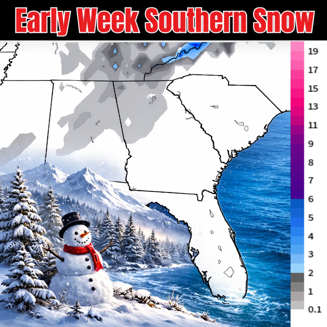
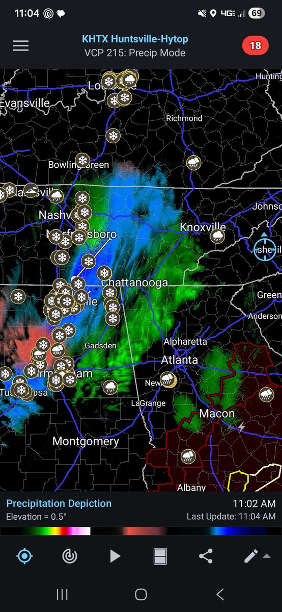
Powerful cold front incoming bringing all kinds of weather. Smokies likely seeing some good snow. With some flakes dipping south into Georgia and Alabama. Most falls around Monday. GFS here. It's done good this winter. Any Spring Break snow chasers out there? spaghettimodels.com
This is no joke Florida. Big cold front coming early week. Wednesday AM temps here. 30s return to the north, with 40s and 50s deep down into the state. I blame that dang Groundhog Phil. Socks and flops once again!
Mike Evans decided Baker isn’t good enough, Bowles’ defense isn’t good enough, and revolving door of OCs wasn’t good enough. Strong indictment against the Bucs overall with his move to San Francisco
Tampa hit 90° late this afternoon for the first time this year, breaking the old record high of 89° set on this date in 2022. Just 1 month ago, the high was 60°. #flwx
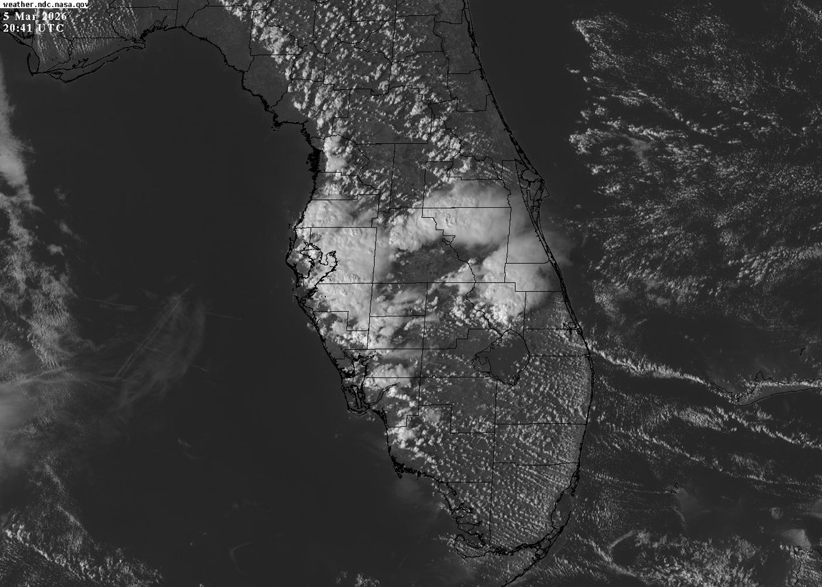
Temperatures in the mid 80s and dew points in the upper 60s across the Tampa Bay region. Nice to see the Florida sea breezes ignite showers and thunderstorms this early March Thursday afternoon, as shown in weather satellite and radar data…and a view outside!
📡⚡️⛈️ #FLwx
@blamarre@NWSTampaBay Ahh so that's the reason I figured it had to do with storms being over the radar site, but it's a wet dome that causes that. I know the Macdill site has been beneficial with picking up those quick spin ups esp in Pinellas county at times bc of it's slightly lower tilt.
Excellent point. ⚡️🔥 At least there are some beneficial downpours. I may see some rain!
Note the attenuation evident on the terminal radar at MacDill AFB due to a wet radar dome giving a reduced reflectivity appearance when compared to the NWS radar @NWSTampaBay in Ruskin. #FLwx