Sabitlenmiş Tweet
JraStorm
24.6K posts


JraStorm retweetledi

JraStorm retweetledi

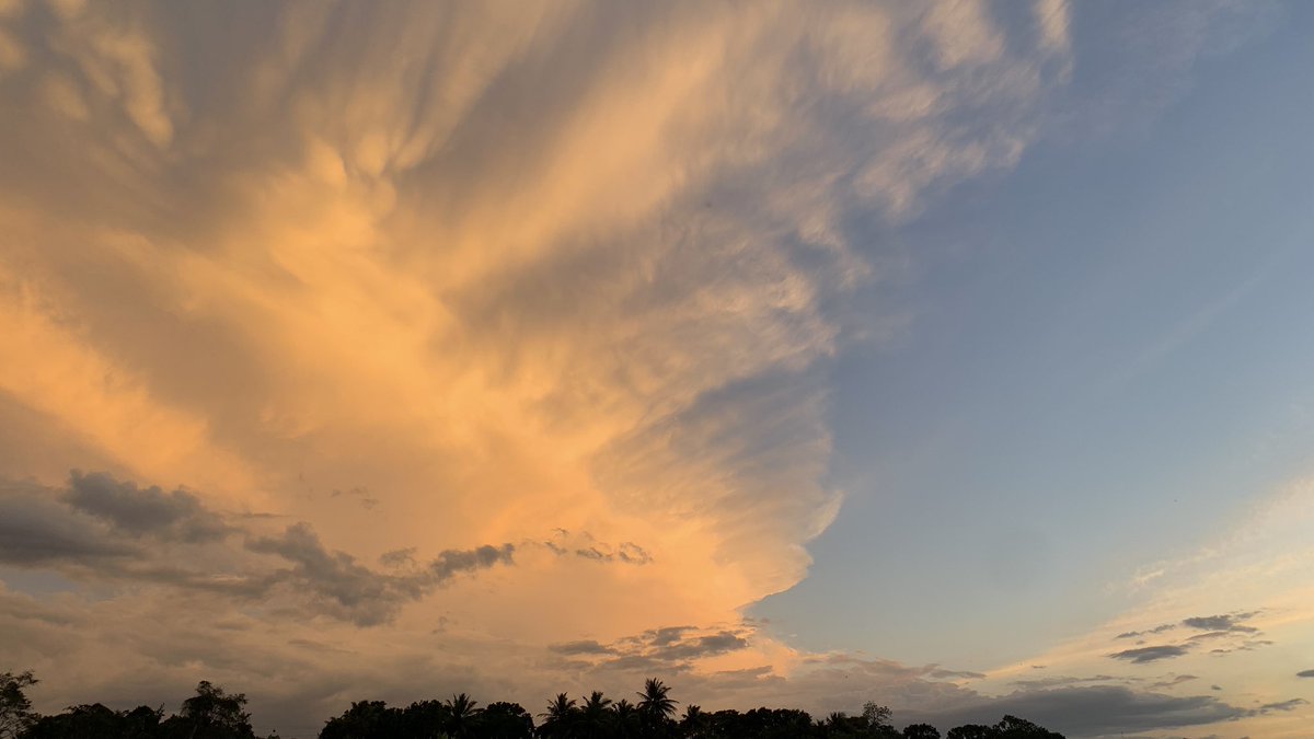
⛈️☔️ Domingo lluvioso ☔️⛈️
🛑 Lluvias Moderadas a fuertes (Posibles Inundaciones y crecidas de los ríos, Tronadas y ráfagas de vientos) sobre Santiago de los Caballeros, Santiago Rodríguez, Dajabón, Hermanas Mirabal y La Vega.
Lluvias Débiles a Moderadas sobre Gran Santo Domingo, San Cristóbal, San Pedro de Macorís, La Altagracia, Hato Mayor, El Seibo, Barahona, Puerto Plata y María T. Sánchez

Español
JraStorm retweetledi

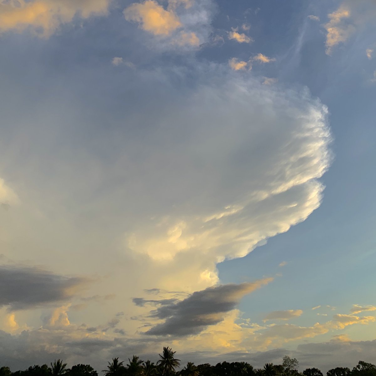
Esta onda esta saliendo bastante activa. Posee bastante nubosidad sin embargo no significa que se vaya a mantener así ya que una vez salga completamente a las aguas del Atlántico estará luchando contra el aire seco. De todas formas estará llegando a la región la próxima semana.

Español
JraStorm retweetledi
A new tropical wave has been analyzed for the 1800 UTC surface analysis. While some convection is active near this new wave, tropical cyclone development is not anticipated.
Visit hurricanes.gov for more info.
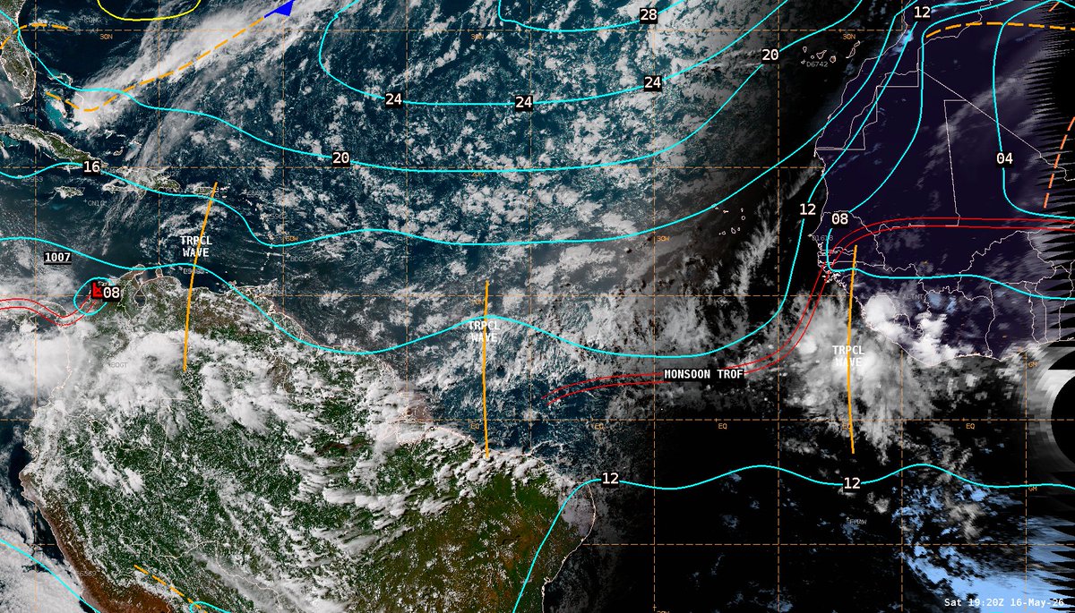
English
JraStorm retweetledi

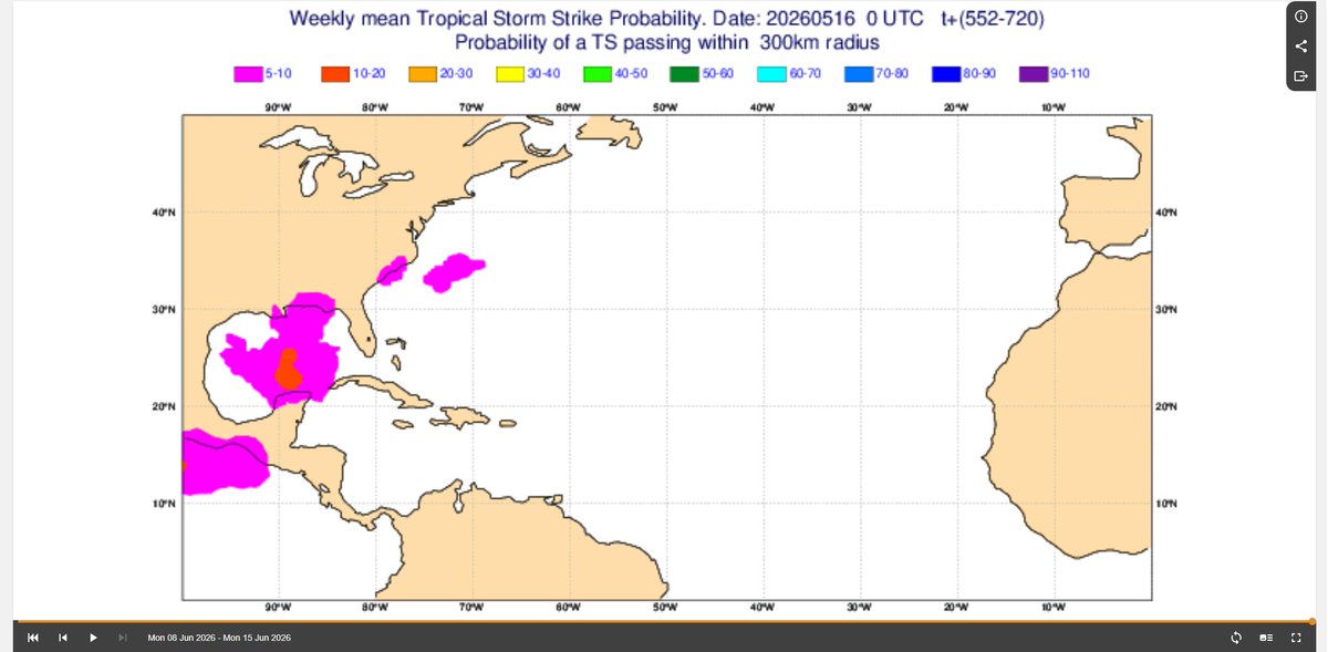
The 2026 hurricane season should be rather inactive due to the strong Nino and -AMO pattern, but the 2nd week of June may be one to watch for a sloppy GOMEX TS, a climatologically favored area in the early part of the season.


English
JraStorm retweetledi

JraStorm retweetledi

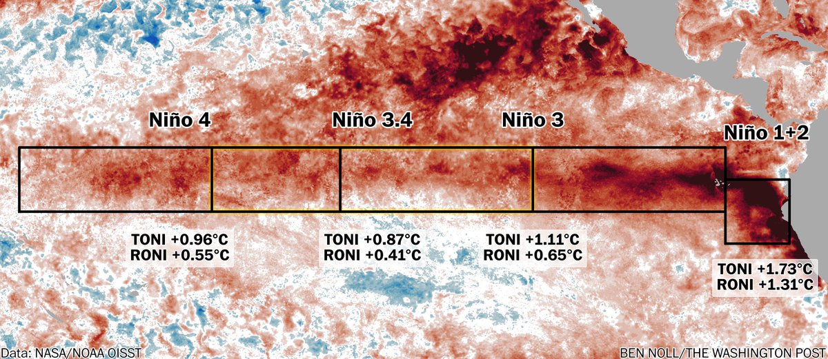
An El Niño signature is emerging.
The developmental pace has been quicker than at this time in 1982, 1997 and 2015, considering traditional indices over the past week.
But, based on new relative indices, the 1997 and 2015 events were slightly further advanced than 2026 is now.
English
JraStorm retweetledi

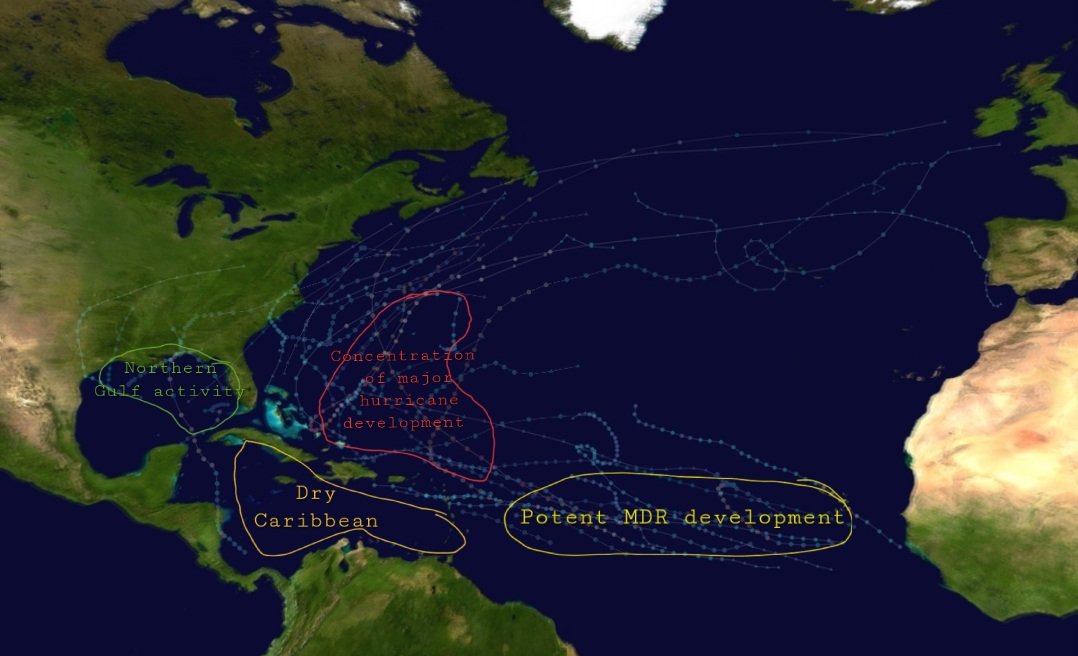
So I did an overlay of some el niño years: 2015, 2009, 1997 and 1982, and this is what I've got.

English
JraStorm retweetledi
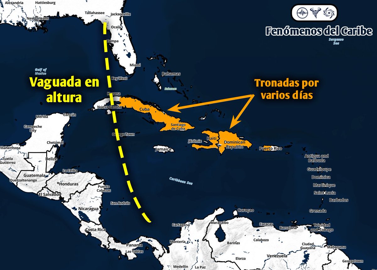
Se esperan tronadas por varios días en Cuba, república Dominicana y posiblemente Puerto Rico debido a la vaguada en altura que se moverá sobre la zona. Algunas tronadas podrían ser severas o sub-severas.
Español
JraStorm retweetledi

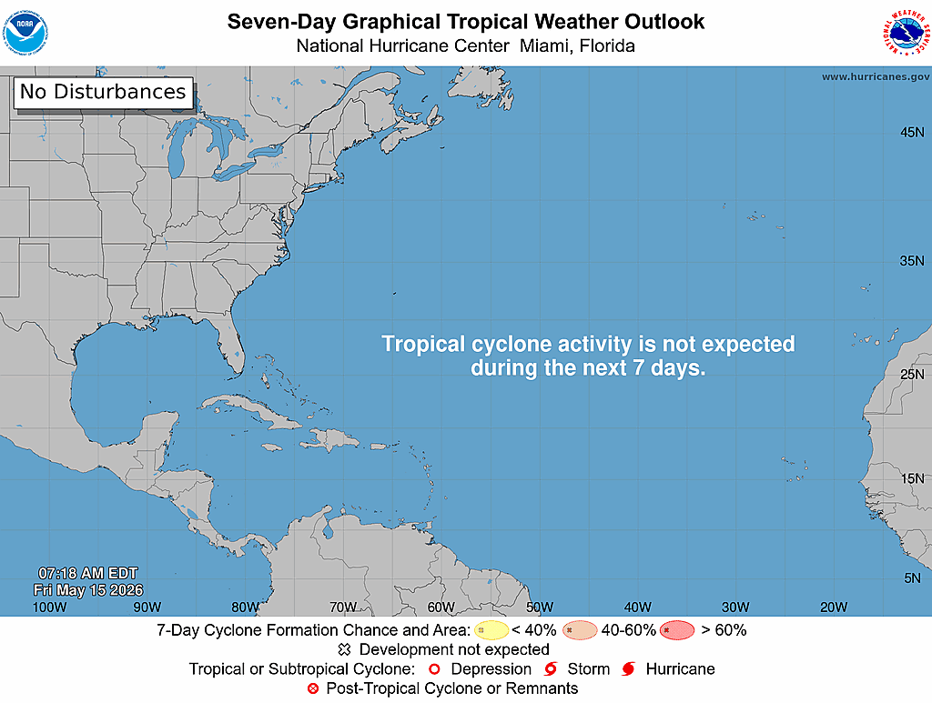
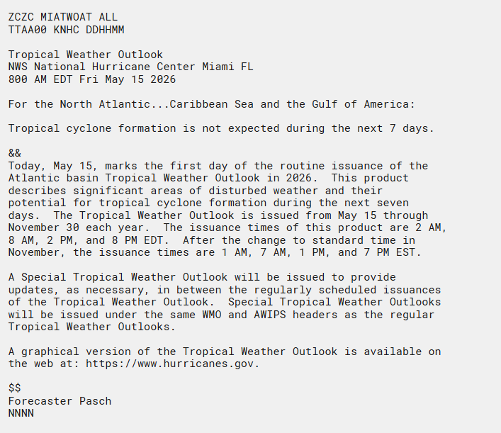
The first Atlantic Tropical Weather Outlook of 2026 is out.
Good news: No tropical cyclone formation is expected over the next 7 days across the Atlantic, Caribbean Sea, or Gulf.
Today (May 15) marks the start of daily Tropical Weather Outlooks, issued through Nov 30 at 2 AM, 8 AM, 2 PM, and 8 PM EDT.
Stay informed all season long: hurricanes.gov
English
JraStorm retweetledi

Kom sa te prevwa retrè anticyclone lan ap rann kondisyon yo pi favorab pou lapli ak loray devlope sou plizyè rejyon peyi a.
🌦️ Perturbasyon nan van alizé yo, rechofman lajounen ak relief la ap ede aktivite yo ogmante, espesyalman sou Plato Santral la.

HT
JraStorm retweetledi

Looking at the 1000-member ensembles, it's looking like a signal is starting to emerge near the southeastern United States over the next 7-12 days. Will definitely want to watch this signal to see if it uptrends further or backs down!
#hurricane

Noah Bergren@NbergWX
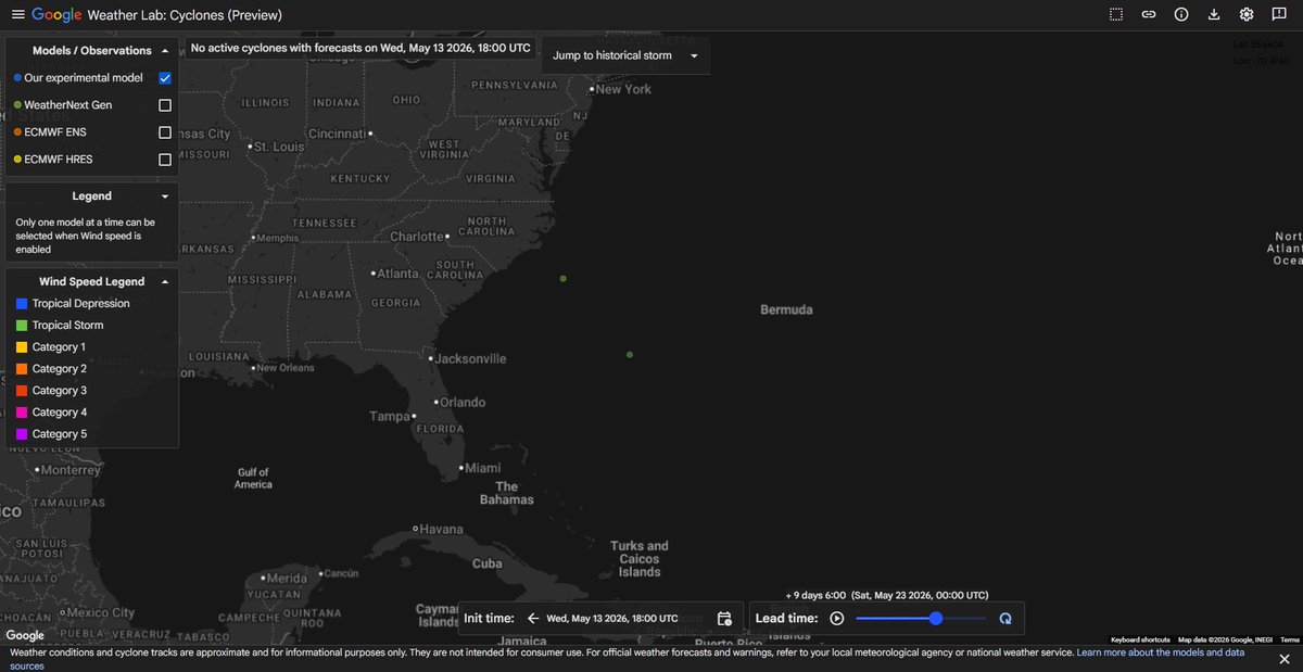
Low probability but worth mentioning more just because it's the first time in 2026 the Google AI has showed some sign of tropical chance in the Atlantic. About 8-10 days now in the SW Atlantic. Only a handful of ensemble members show something skirting out to see. Other models do too. Unlikely but if anything else, a sign the season is quite literally around the corner.
English
JraStorm retweetledi

NEW VIDEO: Severe weather today in Central #Florida brought strong wind and hail to Oviedo, northeast of Orlando. Even a possible tornado is currently being investigated in Hudson too. @stormhour @stormchaser4850 @JimCantore @spann
English
@CycloforumsPR Cyclo, caerán muchas lluvias y sequías para ese entonces 😂
Español

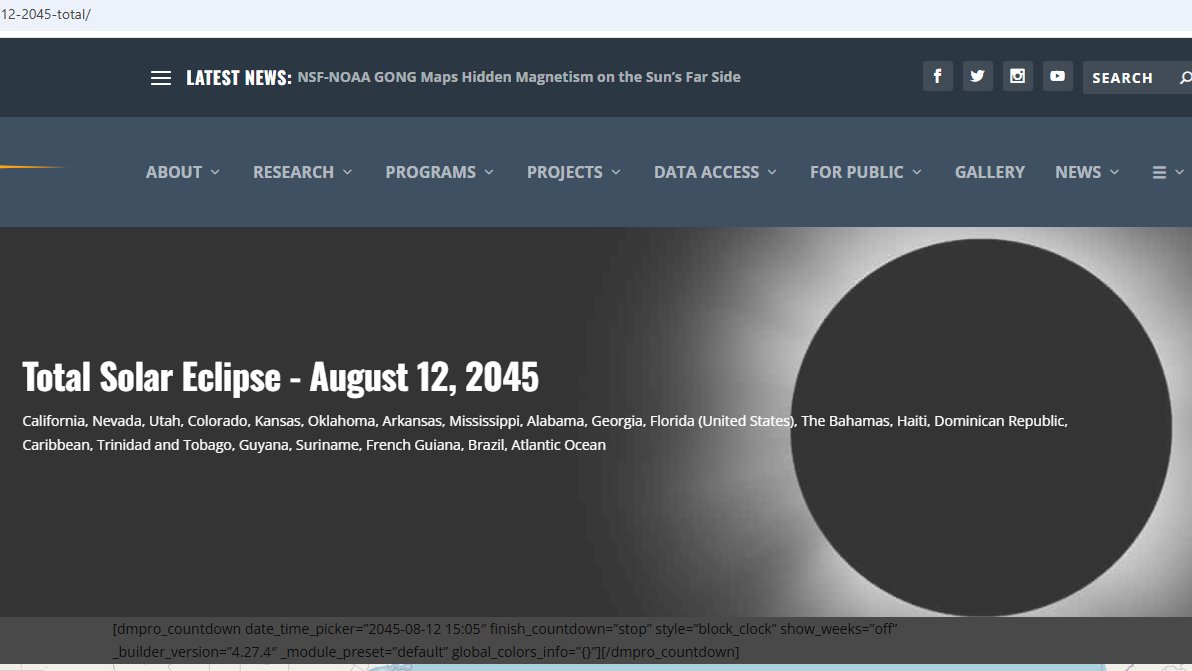
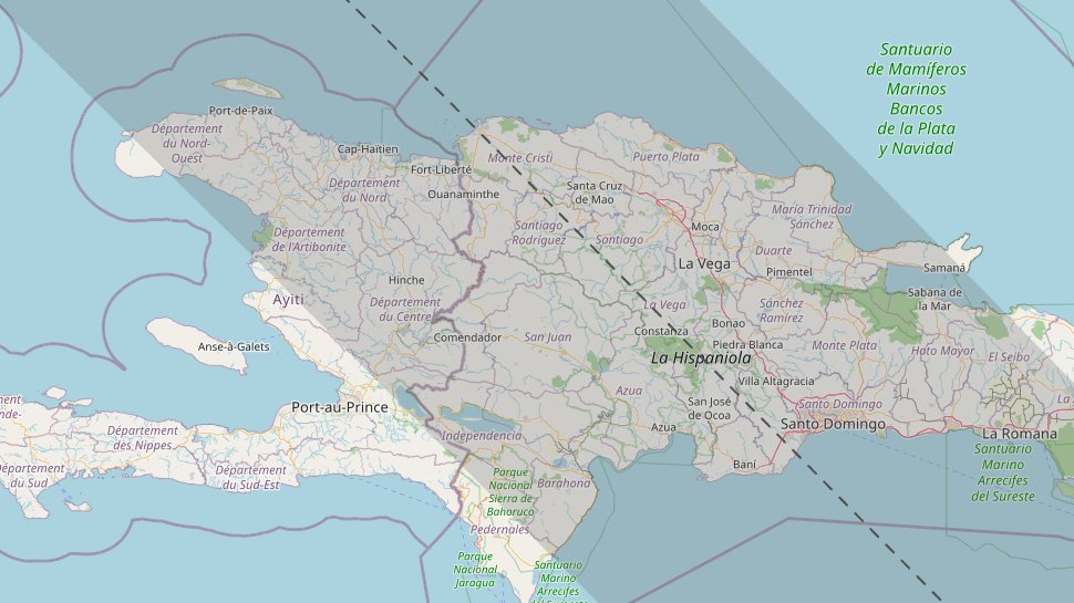
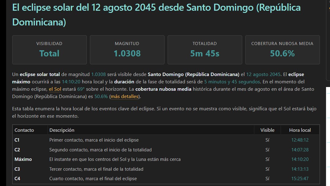
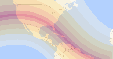
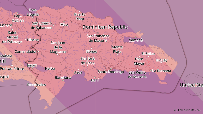
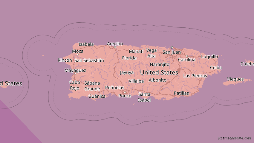
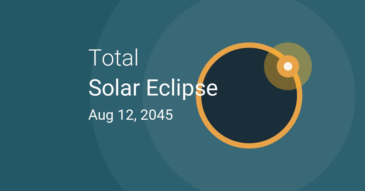
Nosotros hemos mencionado esto hace tiempo, pero vamos a recordarles que va a occurir un eclipse total de sol el 12 de Agosto de 2045 para la parte central de Estados Unidos hacia Florida, California, Nevada, Utah, Colorado, Kansas, Oklahoma, Texas, Arkansas, Luisiana, Misisipi, Alabama, Georgia y Florida. Entre las principales ciudades en la trayectoria directa se encuentran Salt Lake City, Tulsa, Orlando y Miami. Luego van las Islas Bahamas, Republica Dominicana, y sigue hacia la parte norte de Suramerica.
Para Puerto Rico, se va a ver casi total con Mayaguez en 98% del sol obscuro y San Juan con 94%.
Donde va a ser total y se va a ver en casi todo el pais va a ser en RD. Hagan planes con tiempo para verlo en ese pais si ese es su destino desde otro lugar para verlo. Empieza como parcial a las 12:42 PM para llegar a totalidad a las 2:01 PM y va a durar hasta las 2:05 PM para despues comenzar a desaparecer la obscuridad.
Les vamos a tener más información sobre este evento. #StayTuned
LMR
Español
JraStorm retweetledi
La actividad volverá a la región desde este martes/miércoles cuando una vaguada en altura se moverá sobre gran parte de la zona incluyendo, Florida, Cuba, Bahamas y Centroamérica. Un sistema frontal también se estará moviendo cerca de la región del caribe. Veremos que pasa.

Español
JraStorm retweetledi

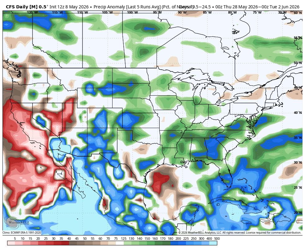
Models have been strongly hinting at an active end to May and early June for Colorado.
While severe weather season is certainly off to a late start here, (and it'll stay relatively calm over the next 10-14 days), it may come in fast and furious in a few weeks' time.
#COwx
English
JraStorm retweetledi


JraStorm retweetledi

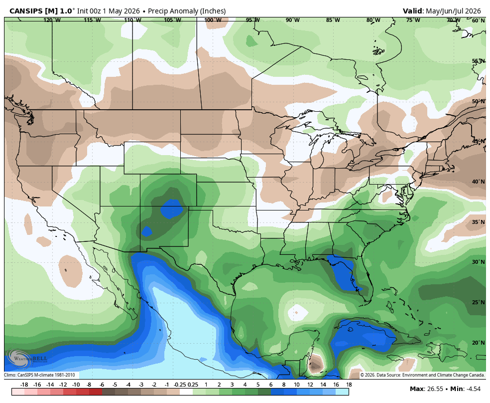
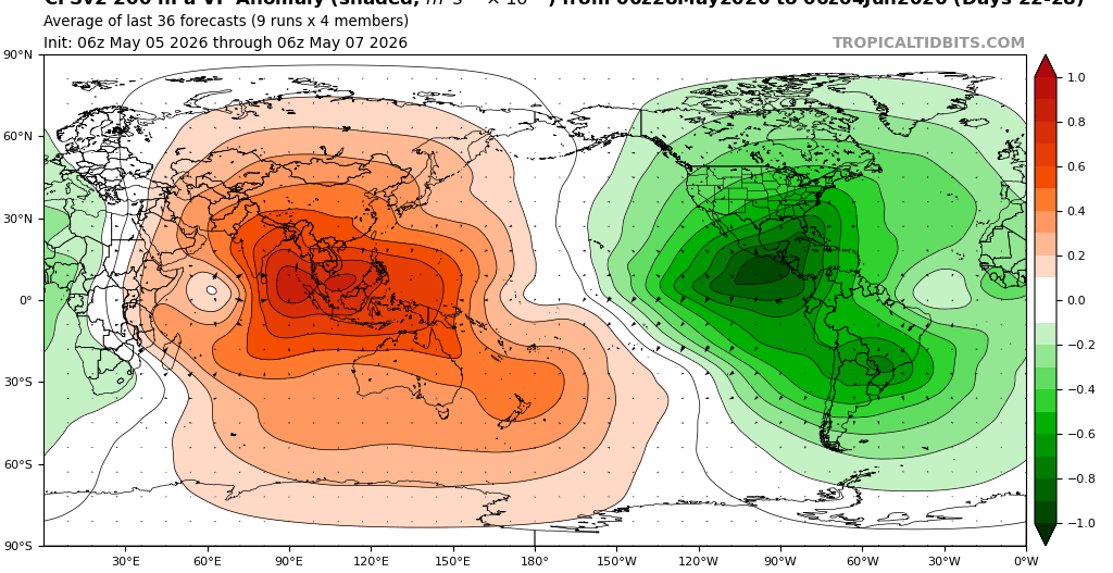
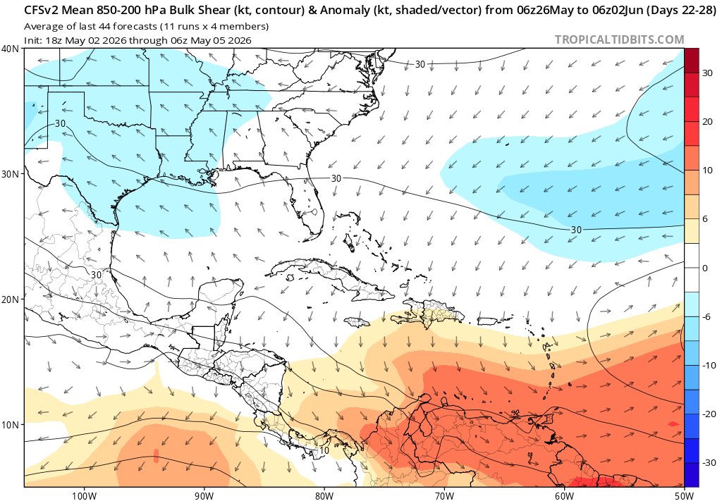
I've seen a decent bit of chatter for the potential that we may need to watch for development late May-early June. Around this time, we have will have a massive rising cell centered over the EPac and Caribbean, which is reflected pretty well in the precip anomaly forecast.
English
JraStorm retweetledi

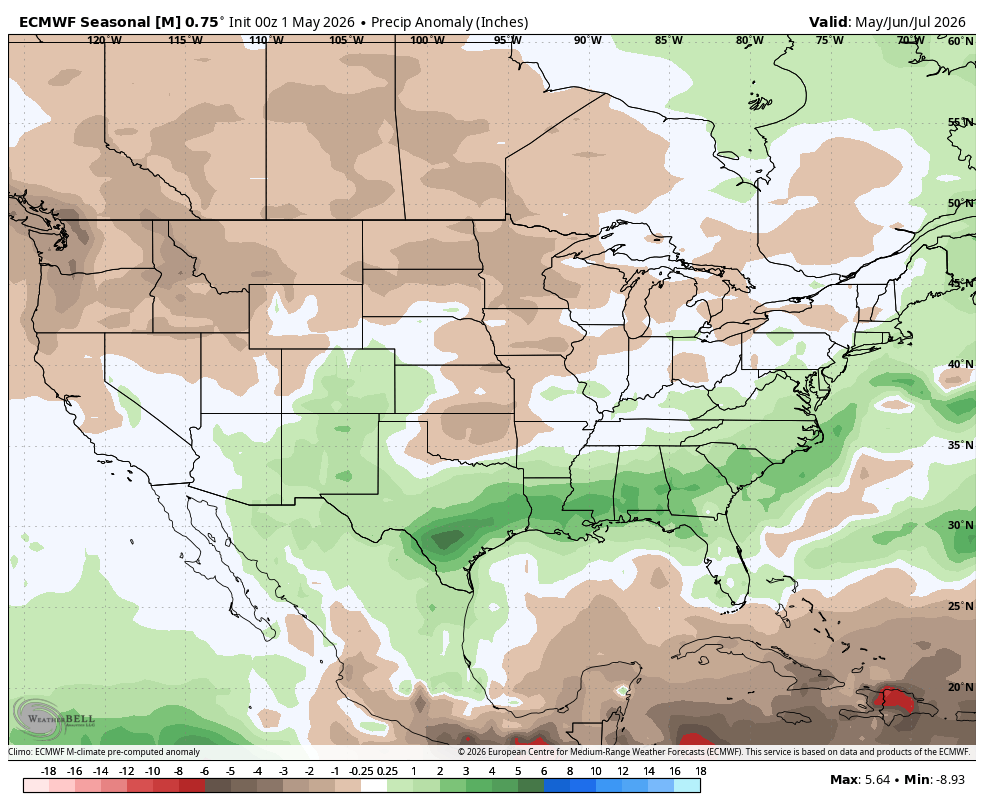
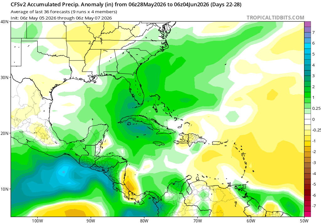
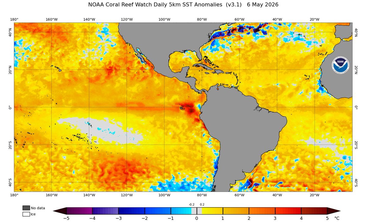
The CFS climate model continues to hint at a very wet Caribbean at the end of the month into June.
In that same timeframe, low-level shear drops off, leaving a generally favorable environment.
It is possible, that during this timeframe, organized convection/weak cyclone activity could be sustainable.

English