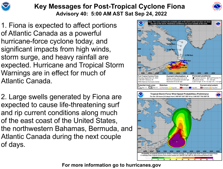
Here are the 5 am AST Saturday Key Messages for Post-Tropical Cyclone #Fiona. High winds and heavy rainfall are spreading northward over much of Atlantic Canada. Latest at hurricanes.gov
Post-Tropical Cyclone #Fiona Advisory 42: Hurricane and Tropical Storm Warnings Discontinued in Atlantic Canada. This is the Last Nhc Advisory. hurricanes.gov
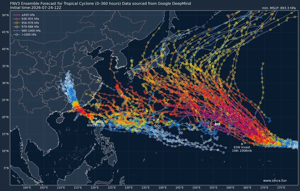
After Severe Tropical Storm #Noul (Typhoon #KiyapoPH), two potential tropical cyclones could develop in the Western Pacific (WPAC) basin next week. ⚠️
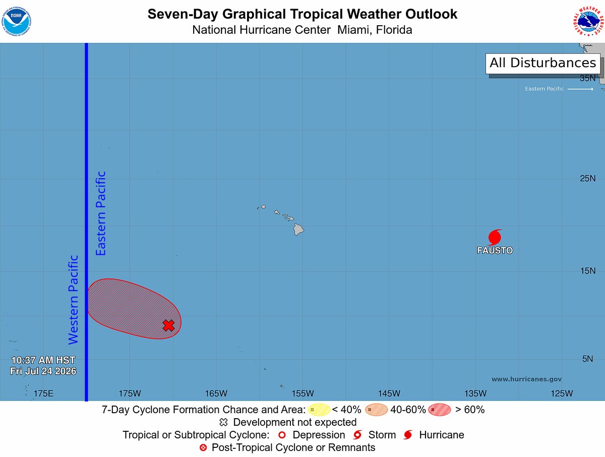
A trough of low pressure located in the Central Pacific (CPAC) basin has a high chance of developing into a tropical cyclone within the next seven days, according to the Central Pacific Hurricane Center (CPHC).
The agency reports that the disturbance is expected to enter the WPAC basin this weekend or early next week as a tropical depression. Model guidance has remained consistent in indicating the potential for the system to develop into a significant typhoon as it move towards Japan.
Meanwhile, an area of low pressure (Invest #93W) west of the Marshall Islands is moving westward and may dissipate early next week.
However, another disturbance may form over the Federated States of Micronesia next week. Some deterministic models are beginning to indicate the potential for this disturbance to develop into a tropical cyclone as it moves northwestward.
Disclaimer: There is currently considerable disagreement among the models regarding the development of the second-mentioned disturbance. Meanwhile, the models have become increasingly consistent in indicating that the first-mentioned disturbance in the Central Pacific (CPAC) is likely to develop into a typhoon in WPAC late next week. Continuous monitoring is recommended, as forecast changes may occur.
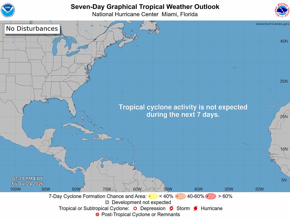
📷: Himawari-9 via NRL-Monterey, NHC, DeepMind (via SMCA)
The symmetrical, buzzsaw radar signature of Typhoon Noul is about to make landfall between Hong Kong and Shanwei, China, with the extremely heavy rain and damaging winds of the eyewall now moving onshore.
Her 960 mbar eye is ~19 miles (30 km) wide.
#Noul is rapidly intensifying, now at C1 status & heading towards #Guangdong as a C2. Dual rotating hot towers with some clearing in the center. So we are well on our way towards seeing a stronger storm upon landfall which is in less than a day.
#CHNwx#tropicswx
Tropical Storm #Genevieve Advisory 3 (9 PM CST, Fri Jul 24): Genevieve Forecast to Strengthen to a Major Hurricane Over the Next Couple of Days. hurricanes.gov