Sabitlenmiş Tweet
🦺🦅
27.3K posts


Ukisikia surveyor kapigisha msamba total station🤣🤣🤣 ndio hii
®RuithaFelix@Ruizlex_0
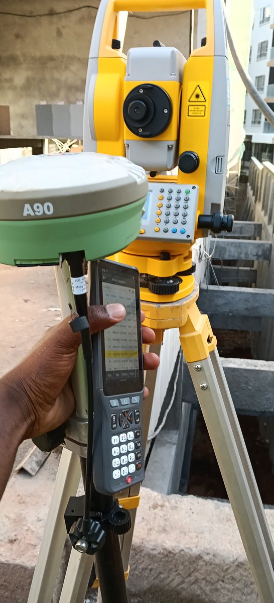
Some site challenges 🙃
Filipino
measuring distance along a fixed from a set starting point (2+662 represents a distance of 2 kilometers + 662 meters from the starting point (0+000) of the project)
Masaki@selemasaki
Engineers and surveyors here, please what does this number mean???
English
🦺🦅 retweetledi

Combining forces. Lazima beacons zipatikane katikati ya izi ukuta. Lakini developer mbona hua mnaita surveyor tu kikiumana. Wakati mnataka kupelekana korti na jirani.
Indonesia
🦺🦅 retweetledi

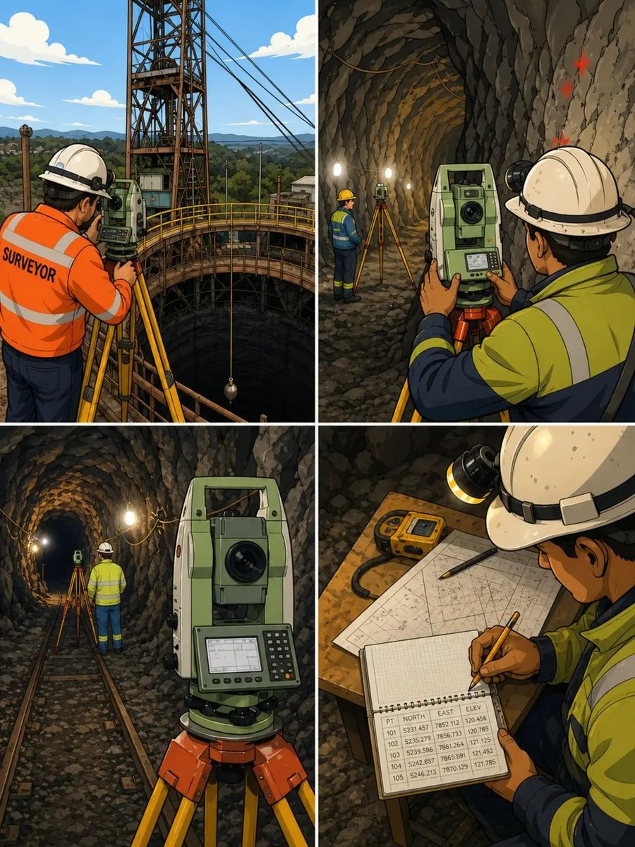
𝖶𝗁𝖺𝗍 𝖾𝗋𝗋𝗈𝗋𝗌 𝖽𝗈 𝗌𝗎𝗋𝗏𝖾𝗒𝗈𝗋𝗌 𝖾𝗇𝖼𝗈𝗎𝗇𝗍𝖾𝗋 𝖽𝗎𝗋𝗂𝗇𝗀 𝖼𝗈𝗇𝗍𝗋𝗈𝗅 𝗍𝗋𝖺𝗇𝗌𝖿𝖾𝗋 𝗂𝗇 𝗆𝗂𝗇𝗂𝗇𝗀 𝖾𝗇𝗏𝗂𝗋𝗈𝗇𝗆𝖾𝗇𝗍𝗌?
Control transfer in mining is one of the most sensitive stages of the entire operation.
It is where surface truth is carried into a more complex, restricted environment.
And because of that, even small errors at this stage do not remain small; they grow with distance, depth, and development.
One common source of error is plumbing instability.
When control is transferred through shafts using plumb lines or wires, air movement, vibration, and shaft depth can cause slight shifts.
These movements may seem minor, but they affect the exact position being transferred.
Another issue is instrument setup error.
Underground conditions are not always ideal.
Limited space, uneven ground, and poor visibility can affect centering and leveling.
If the setup is slightly off, every measurement from that point carries the error forward.
Orientation errors are also critical.
If the directional reference (azimuth) is not accurately transferred,
the entire underground network begins to rotate away from true alignment.
At first, the difference may be small; but over long distances, it becomes significant.
There is also the problem of distance measurement distortion.
Temperature, humidity, and confined environments can influence measurements.
Inconsistent conditions between surface and underground can introduce subtle differences.
Human factors play a role as well.
Rushing the transfer process, skipping verification, or assuming previous data is correct can introduce errors that go unnoticed at the early stage.
Another major challenge is lack of redundancy.
Relying on a single transfer method or a single set of observations increases risk.
Without cross-checks, there is no way to confirm if the transfer is truly accurate.
Then comes progressive error accumulation.
Even if initial errors are small, they grow as the control network extends deeper into the mine.
What started as a minor misalignment becomes a major positional problem over time.
The deeper truth is this:
Control transfer is not just about moving coordinates; it is about preserving accuracy under more difficult conditions.
Mining environments do not forgive small mistakes.
They amplify them.
That is why control transfer must be treated with patience, repetition, and strict verification.
Because once underground development advances, correcting these errors becomes complex and costly.
In the end, the quality of the entire mining operation depends on how well this stage is handled.
So the real question is:
During control transfer, are we truly confirming every detail, or are we allowing small uncertainties to pass, knowing they may grow into bigger problems later?
#Surveying #MiningSurvey #ControlTransfer #UndergroundSurvey #EngineeringAccuracy
English

Before site opens,
IF YOU ARE AN:
1. Architect
2. Interior Designer
3. Structural Engineer
4. Civil Engineer
5. Water & Environmental Eng
6. Mechanical engineer.
7. Technician
8. Quantity Surveyor
9.Developer.
10. Real estate agent
11. Contractor
12. Foreman
13. Member of any construction trend mason, bricklayer and capenter
.......and related fields
Let's Connect 🍃
English

🦺🦅 retweetledi
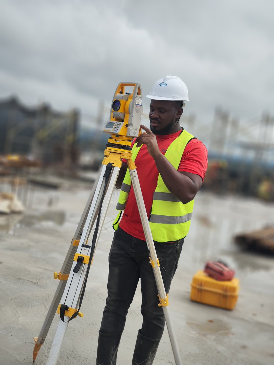
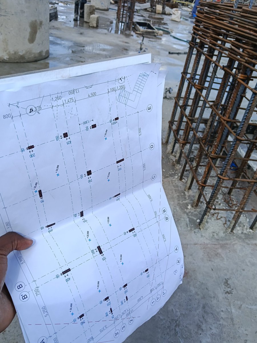
Good morning sunshine. Positioning grids and columns.

English
🦺🦅 retweetledi


Wee msee mapenzi yanakutesa hivyo
H E R R Y 🦉@Uherry14
Kuna muda hadi unaona mbona hupati mpenzi kumbe wazazi wanaomba Mungu mtoto wao akae mbali na mashetani
Indonesia
🦺🦅 retweetledi

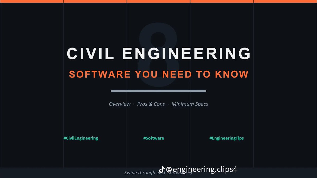
Civil Engineering Software You NEED To Know:
1. AutoCAD (2D Drafting & Annotation)
2. Civil 3D (Road/Infrastructure Design)
3. SAP2000, STAAD Pro & ETABS (Structural Analysis & Design)
4. EPANET (water distribution)
5. Revit (Building Information Modeling)
English
🦺🦅 retweetledi
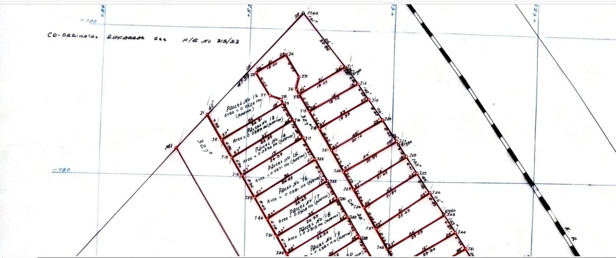
I love cul-de-sacs in land subdivisions and planning the way @Bossyator loves A-frames. But sometimes it is good to look at the geometry and orientation of your parcel. I feel the cul-de-sac in the largest parcel is not only wasteful but creates a narrow neck (a pinch point), almost splitting the parcel visually and functionally into two halves, resulting in quite awkward geometry for planning. Here, I would prefer a linear access road. Access should serve the land, not fragment it. I already feel planning will be kizungu mkuti. @SurveyorOfKenya umepatana na izi scenarios?

English
🦺🦅 retweetledi