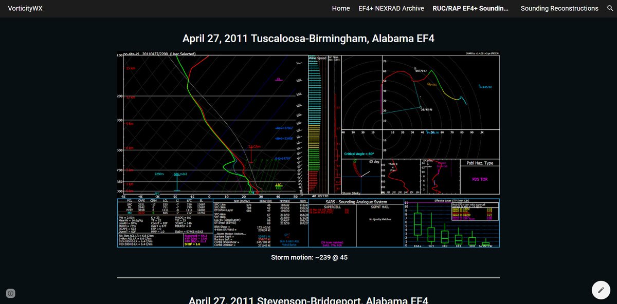
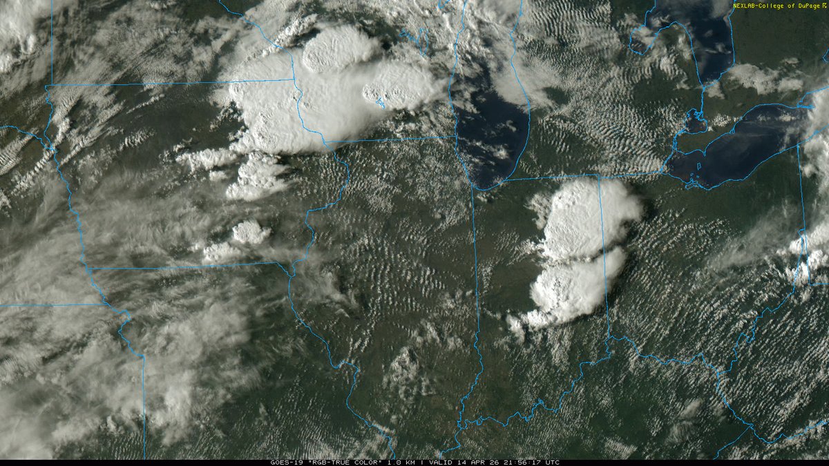
Nick Krasznavolgyi@NickKrasz_Wx
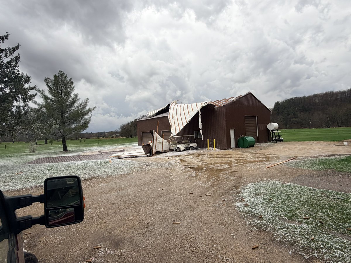
Egan shared a few photos with me from the Union Center, Wisconsin tornado earlier today. I will not share them here, but here are some observations I made.
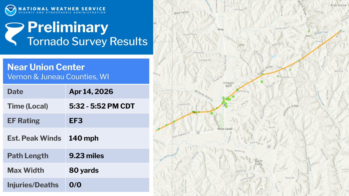
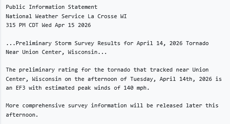
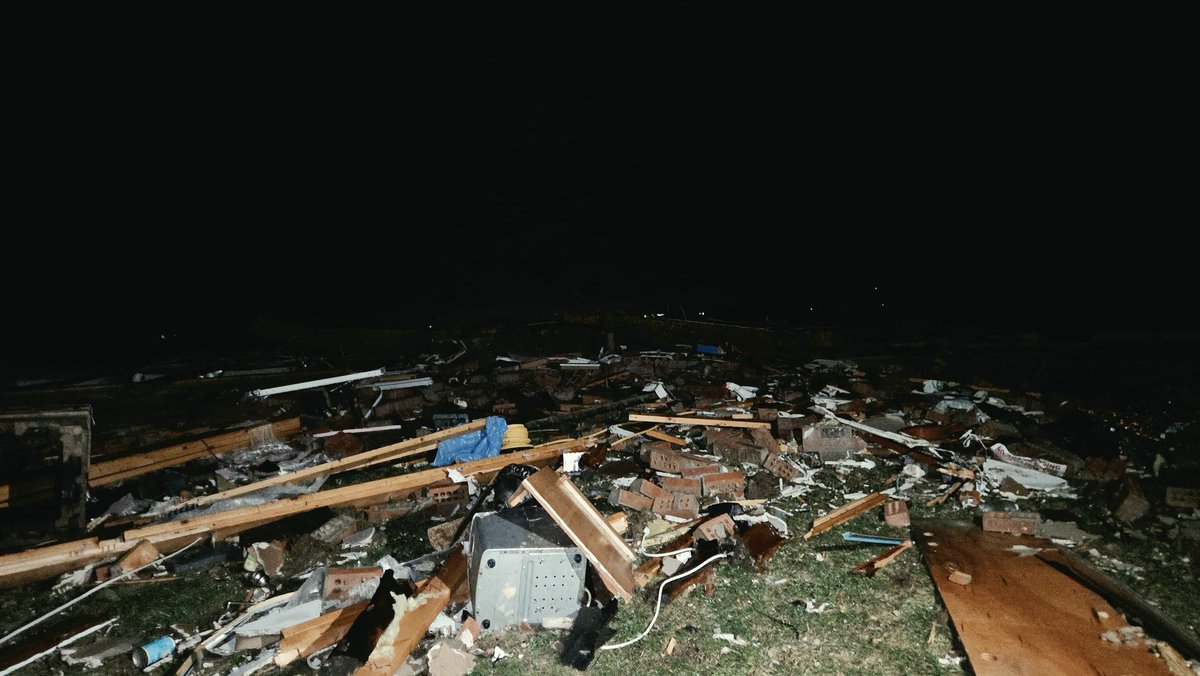
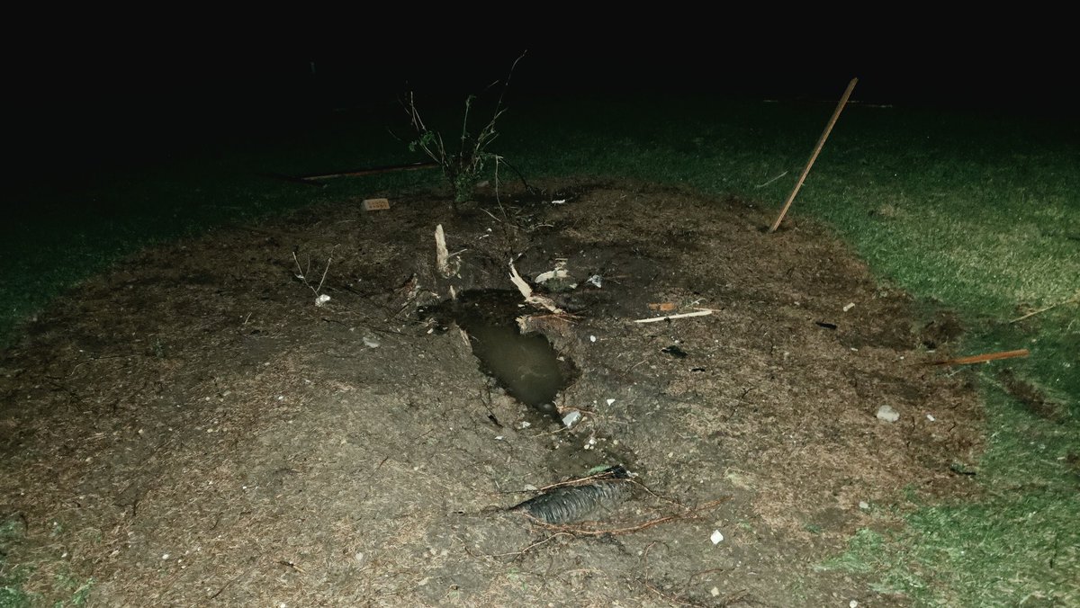
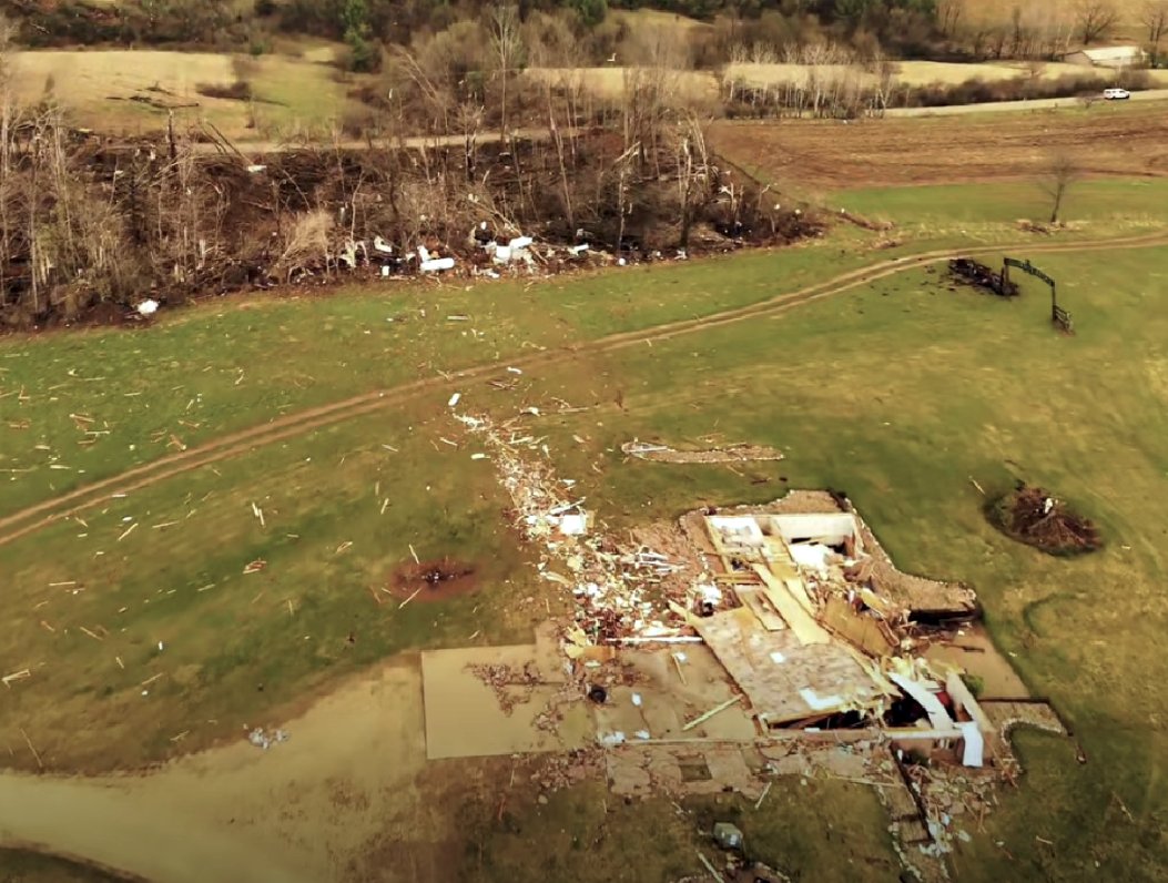
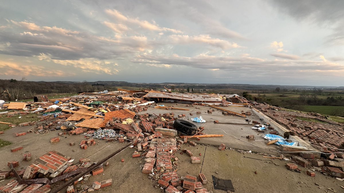
Information on this home:
N1503 Raese Rd, Elroy, WI
- Single-story residence with a walkout basement (effectively two stories)
- Constructed in 2000
- Structure largely destroyed; most debris swept from the foundation
- Some subflooring and floor joists remain on foundation
- Majority of the home is gone
- Foundation appears to be secured with concrete nails, suggesting lower-end anchoring/construction quality
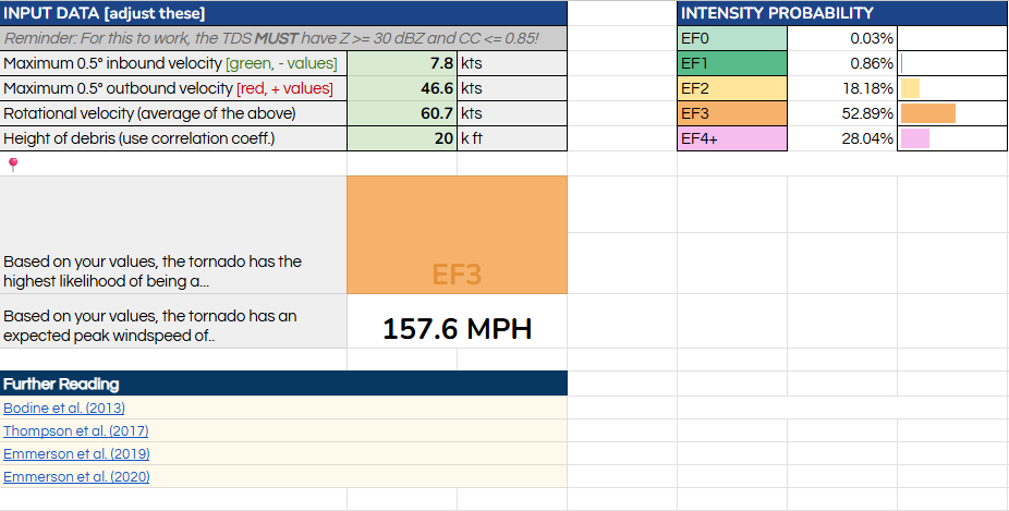
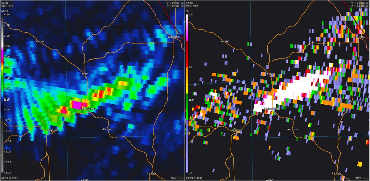
- The damage in my perspective supports at least a mid- to high-end EF3 rating (150-165 mph), though, this is up to the National Weather Service in La Crosse, Wisconsin.
Thankful the homeowners weren't there, it was pretty gnarly.