Sabitlenmiş Tweet
David Gold
244 posts

David Gold
@dgoldweather
Atmospheric Scientist/AI Professional/Certified Consulting Meteorologist
Katılım Haziran 2026
80 Takip Edilen365 Takipçiler

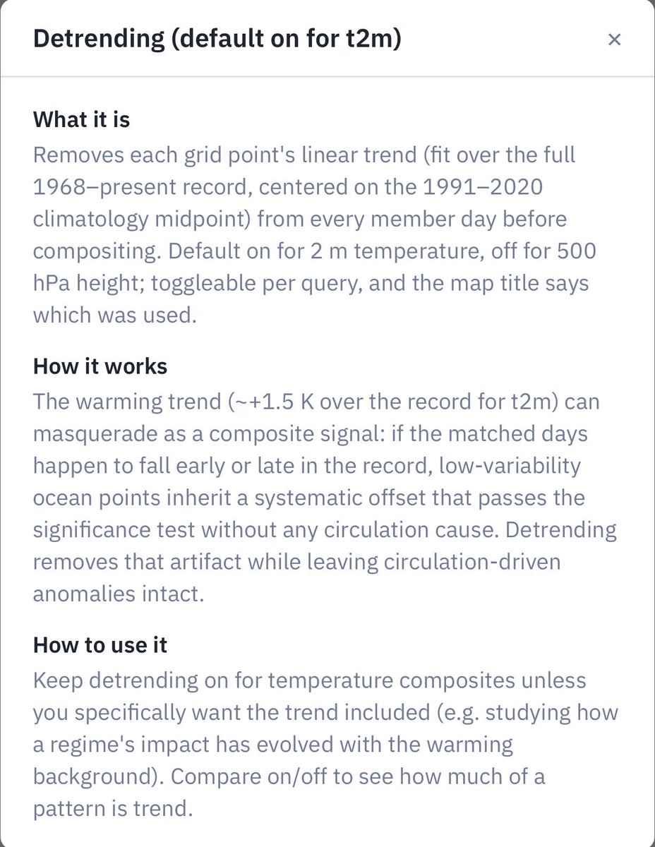
@phillywxguy_ I’ve tried to guard against that in my composite engine at gsdmsolutions.com by applying by default detrending on the 2-m temperature. composites:

English

I agree with this, and I’ve fallen “victim” to it as well.
This has not been necessary a cooler than average summer, with the east being warmer than average for most of June and obviously July as well with the heatwave.
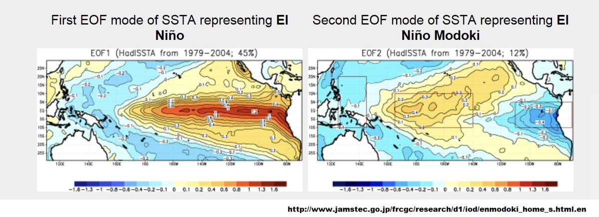
No too El Niño’s are the same.
sbm@Bliz966
@phillywxguy_ Hint. Don’t use older El Niño analogs. 2015 would be as far as I’d go. I see a lot of people referencing 97. The climate is completely different now. That’s why so many cool summer forecasts in the northeast have been destroyed so far. With another high heat period incoming
English

@Atrarbfraga @webberweather It’s higher latitude impacts almost certainly will
English

@webberweather @dgoldweather Cmcc model in niño 3.4 showing anomaly at least + 5,3 degrees. Perhaps this el niño Will delay into northern hemisphere summer 2027 and perhaps early fall.
English

Lol yikes.
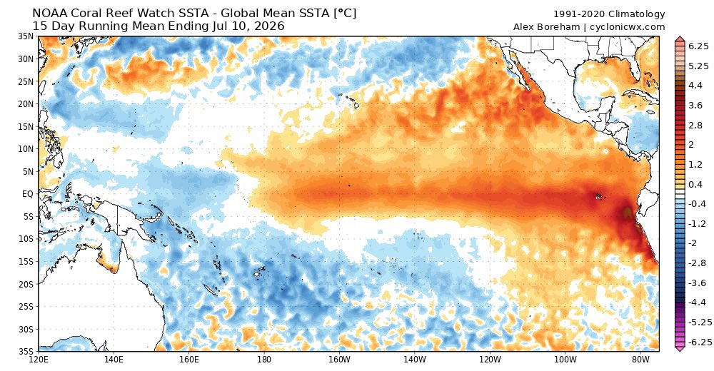
The mean warm pool is incredibly far east at this stage of our El Nino event.
As high as those SSTa are in the East Pacific now, this Super El Nino is honestly just getting started.
Just wait til we advect in those 29-30C SSTs to the east later this year 😬 😳
Paul Roundy@PaulRoundy1
The east Pacific cold tongue is basically eliminated, and 30C isotherm region is east of the dateline.
English

@Weather_West Part of a regional circulation response to potent background/low-frequency forcing over the C-E tropical Pacific associated with El Niño.

English

New Weather West post is now out: Exceptionally broad and persistent west-central U.S. ridging to bring periods of elevated heat and monsoon moisture to CA and the SW, with record heat across Intermountain West. Plus: dry lightning risk in California?
weatherwest.com/archives/43915
English

@BigJoeBastardi @Superchri90 @PvForecast Yeah in such scenarios the jet often outruns the convection and firehoses CONUS
English

@dgoldweather @Superchri90 @PvForecast phases 6/7 in winter are the kiss off death once past December, where 7 is still favorable
English

The strong El Niño background state looks to be relentless - probably indefinitely!


Eric Webb@webberweather
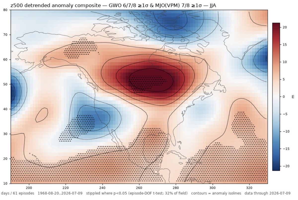
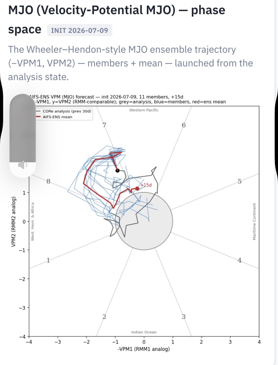
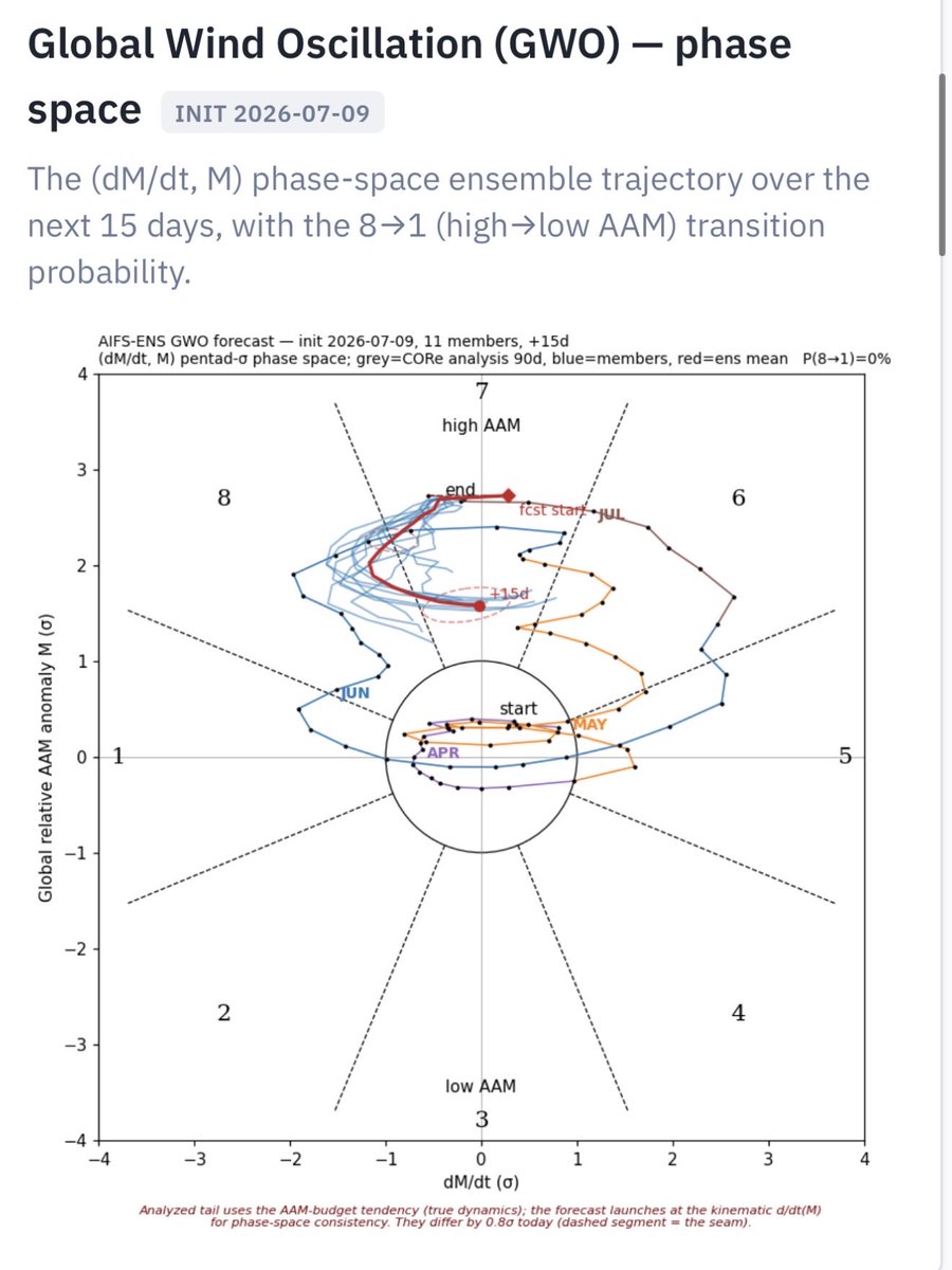
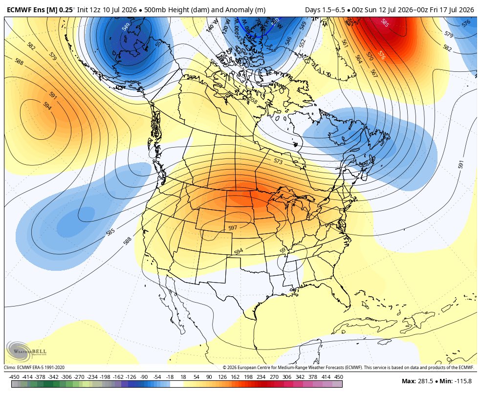
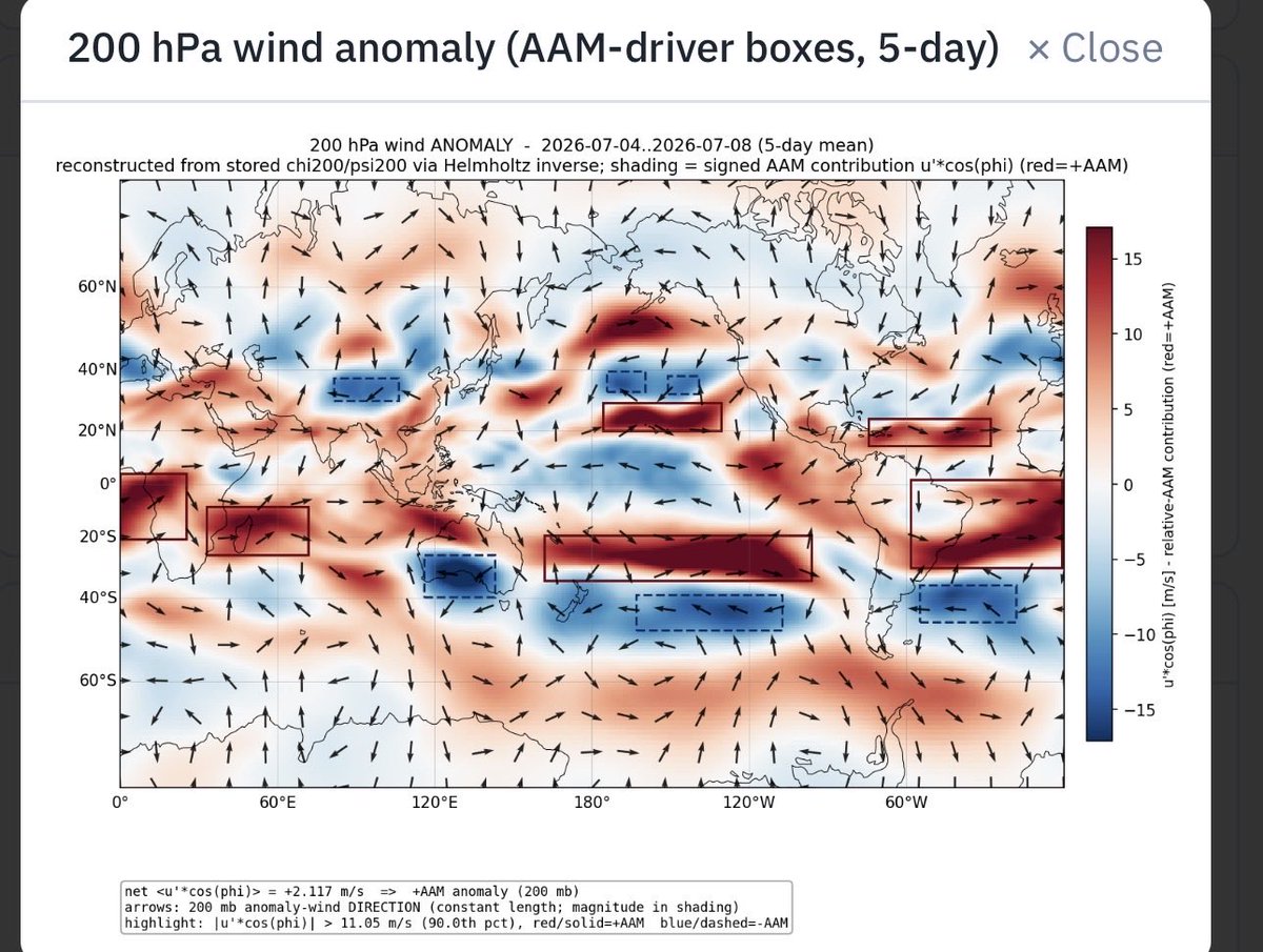
A very El Nino-like AAM/GWO & MJO background state is driving a large component of the record-breaking ridge over the Upper Midwest next week. Left image from @dgoldweather’s site gsdmsolutions.com
English

@MichaelMarz1 You have some of the most spectacular tornado vids and pics ever seen.
English

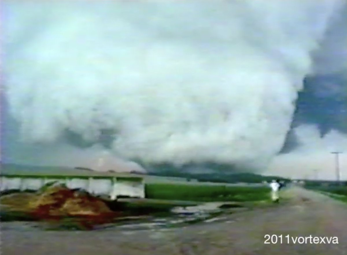
most of the time, when I post an old tornado video or picture (not just Ashby) across all different platforms of social media, I’ll see a lot of instances of “how have I never seen this before?!” in the comments section - there is constantly a new customer - sure, you’re gonna come across some eye rolling too, because a lot of your audience has probably seen what you’re posting hundreds of times - but I’d suggest to continue posting your old, cool tornado videos and pictures whenever you feel like it! You really never know whose eyes it might come across or what it might lead to -

English

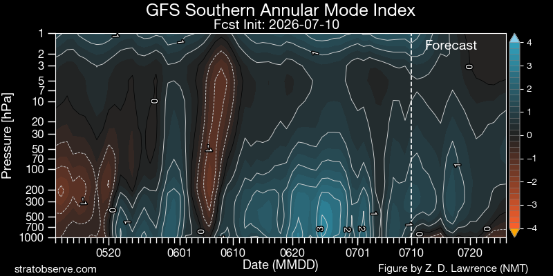
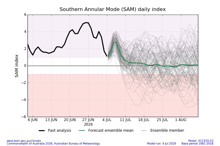
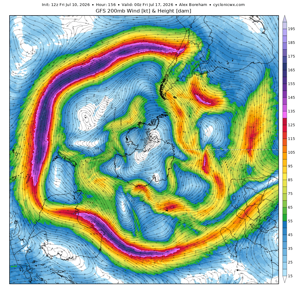
@PvForecast Yes, but be careful because too strong angular momentum with GWO in stationary phases 6-7 can lead to a very strong jet stream, as is happening in the southern hemisphere with a positive SAM. It also takes proper interaction with Rossby waves (wave breaking)


English

@webberweather @WXL39_nerd @dgoldweather I love your posts Eric. You are so informative, and I have learned a lot from them.
English

A very El Nino-like AAM/GWO & MJO background state is driving a large component of the record-breaking ridge over the Upper Midwest next week.
Left image from @dgoldweather’s site
gsdmsolutions.com


English

Wow! Thank you so much for this! I’ve tried to build something that really meets the needs of those of us that love trying to connect the dots when making forecasts without jumping around to 1000 different sites or relying on data sources prone to frequent disruptions and brittle processing (eg OLR). It’s so gratifying to get some validation that this is meeting some needs!
English

DAVID GOLD ...just signed up the year!!
What you designed/ built here is absolutely amazing. This is one of the most easy to use and well designed weather atmospheric websites I have ever seen. I am very happy to get a subscription for the full year. I will be sharing and using your images as much as I can on my social media platforms and I hope to drive as much business as I can your way. I am surprised that you haven't been bought out yet by one of the other big companies. Anything I can do to help please feel free to ask!! WXRISK
English

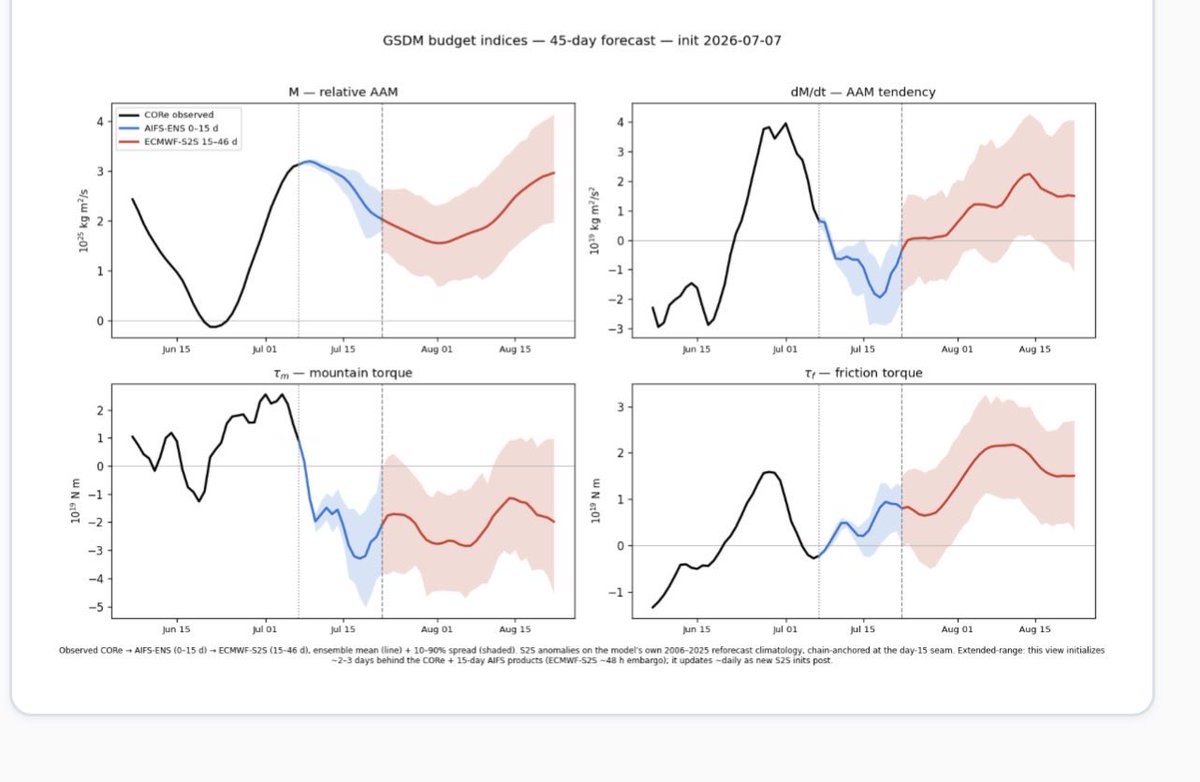
While the atmosphere has likely reached peak AAM loading, the circulation is going to remain in a configuration consistent with a very eastward shifted Walker cell and seasonally enhanced/intense belts of subtropical westerly wind flows for the remainder of boreal summer. The expected regional responses are likely still well captured by variations of MJO 8-1 and high amplitude GWO 7-8, respectively.


English

Well as I said the vast majority of surviving video comes from chase partners. There are a couple tornadoes on my list where I was solo and had no recording device at all! The 93 Big Spring tornado was a fat cone that looked like 5/23/24 El Dorado and lasted 12 minutes. I gave the IMAX guy a three minute warning. We got set up & film rolling right as the rope out ended.
English

@dgoldweather @Enhanced_wx are there any vintage tornado clips you did get?
English

While the atmosphere has likely reached peak AAM loading, the circulation is going to remain in a configuration consistent with a very eastward shifted Walker cell and seasonally enhanced/intense belts of subtropical westerly wind flows for the remainder of boreal summer. The expected regional responses are likely still well captured by variations of MJO 8-1 and high amplitude GWO 7-8, respectively.


English

@thestormandsky @wxmann I know some chasers were blocked by construction traffic
English

@dgoldweather @wxmann Umscheid just missed it. Think Jay was with him. Saw the rope from a distance.
Chasing is 99% just hug the roll clouds. That location just loves to manage.
English

@thestormandsky @wxmann Not I. I would have for sure followed the 78 TD parcel into that WF.
English

@dgoldweather @wxmann 22z and 0z surface. Wonder how many would have been too far west. Especially given just how fast it did it.


English

Yeah processes are going to act to rapidly reduce AAM for a while, but not to the point where the circulation goes into a low AAM state. Will probably see some fluctuation in the intensity and coherence of the l-s heat engine tied to ENSO as well. Accordingly can expect some wave pattern adjustments. This can include flexes of the ridge eastward into the northern and even NE US at times as modeled for next week. But not durable.
English

@dgoldweather Interesting, JMA tries to keep it in 7 for the next 3-4 weeks. I like it moving over (high correlation in close development with the Vitarts scale, so concern about in-close spin-up later in the month). JMA tho wants it stalled


English

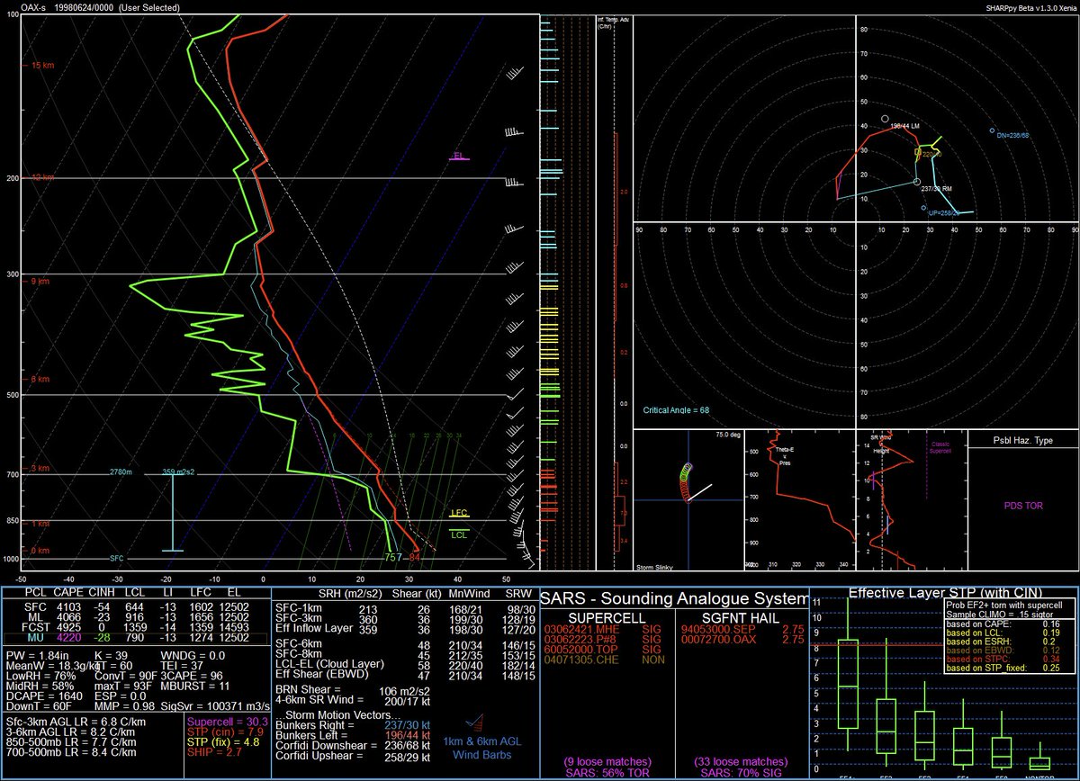
@wxmann Yeah that sounds right. But I think there was even more flow aloft ripping across the warm sector on 6/23/98 if I recall
English

@dgoldweather Similar to the Pilger-Coleridge 2014 sequence with massive CAPE on a diffuse warm front I assume?
English

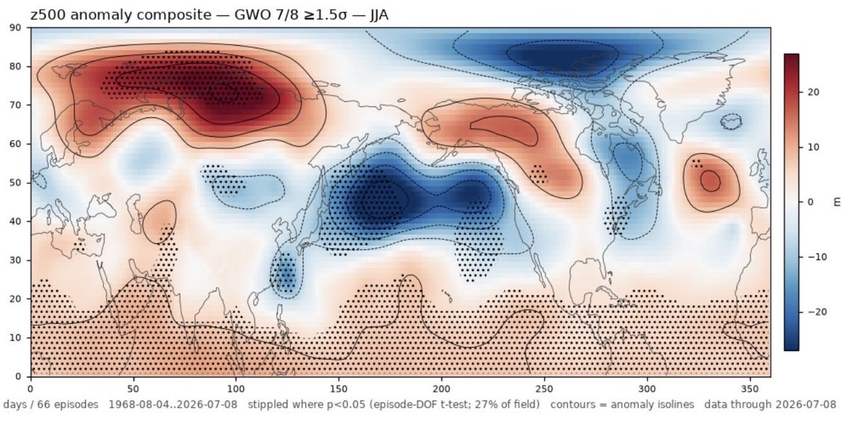
Some plausible composites for NH z500’. We may see regional circulation responses with some of these characteristics at many times during the next few weeks, including:
* an extended or strengthened Pacific subtropical jet
* increased Rossby wave activity entering the North Pacific waveguide
*cyclonic height anomalies over the extratropical central/eastern Pacific
*anticyclonic wave breaking or ridge amplification downstream toward Alaska and western Canada


English