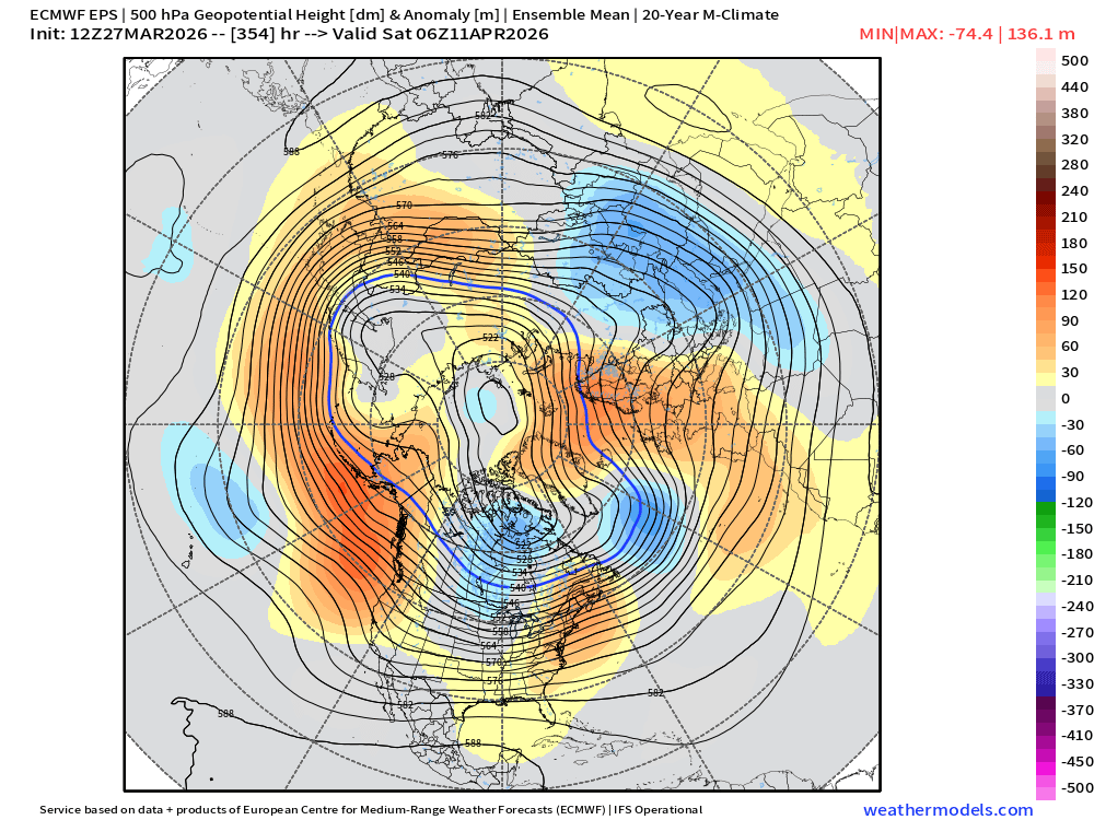
Not one but two #PolarVortex splits & yet impressive warmth dominates the Northern Hemisphere, Models playing "she loves me, she loves me not" if Greenland blocking will occur in response & a period of cooler weather. I share my thoughts. Blog now public: published.aer.com/aoblog/aoblog.…
#tropicswx |
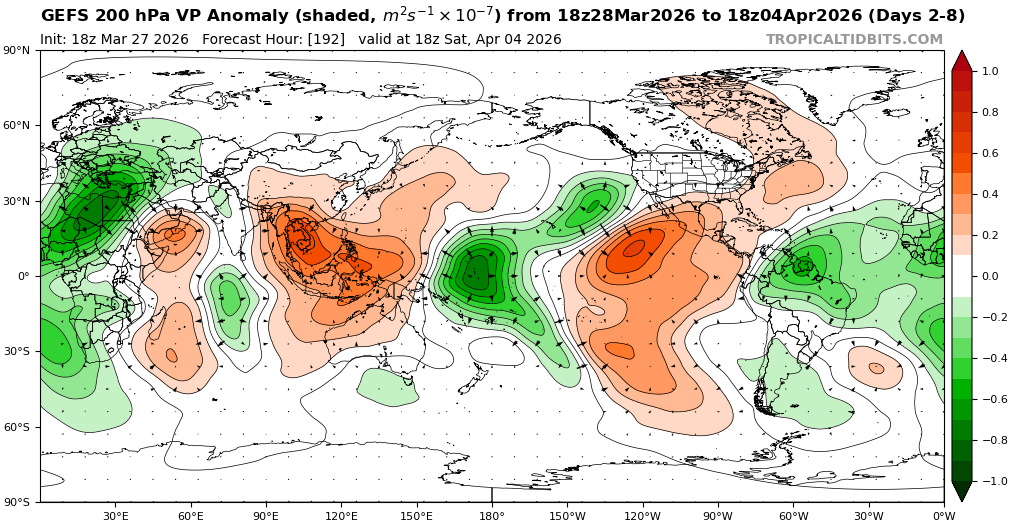
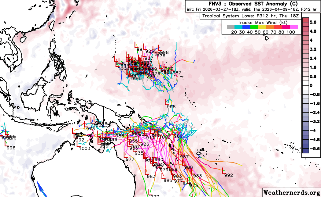
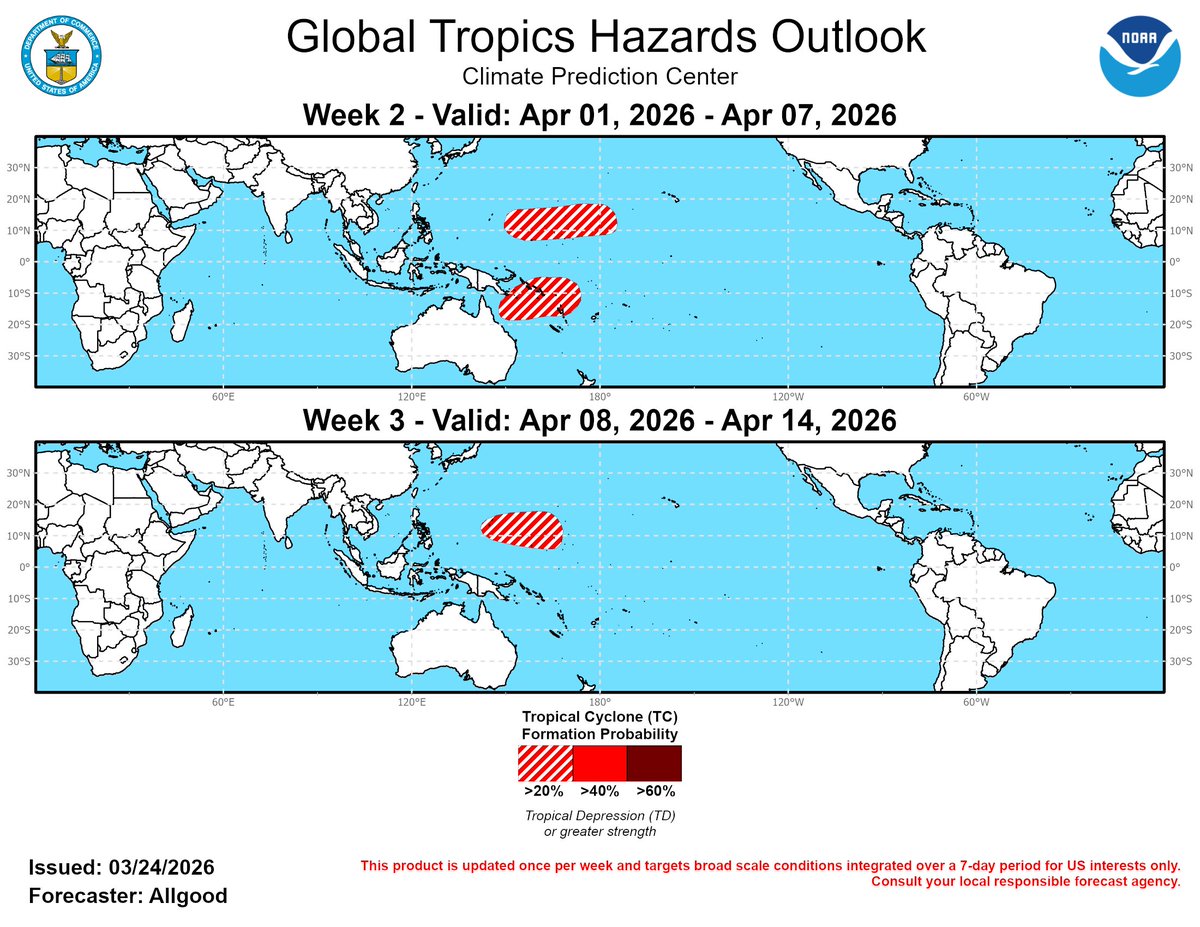
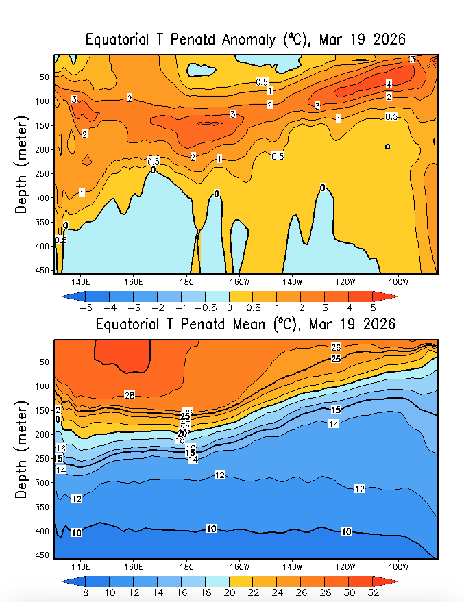
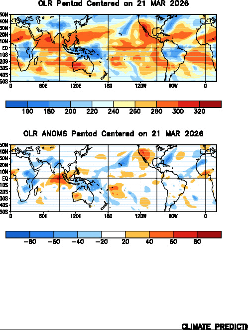
It's likely that we will see a westerly wind burst in the Pacific. This will help in the formation of duel tropical cyclones in both hemisphere. We have a good deal of divergence aloft & a huge area of w-erly winds seen in the red & pink range W of 180 shows it will help create some spin in the upper atmosphere to aid in tropical cyclogenesis. The CPC has noted this as we get into April.
In terms of land impacts, they are uncertain for the WPac albeit a few small islands in the way but as for the SPac, they have a lot of land real estate that could get impacted, perhaps some more than others. We shall keep an eye on them as time goes on.
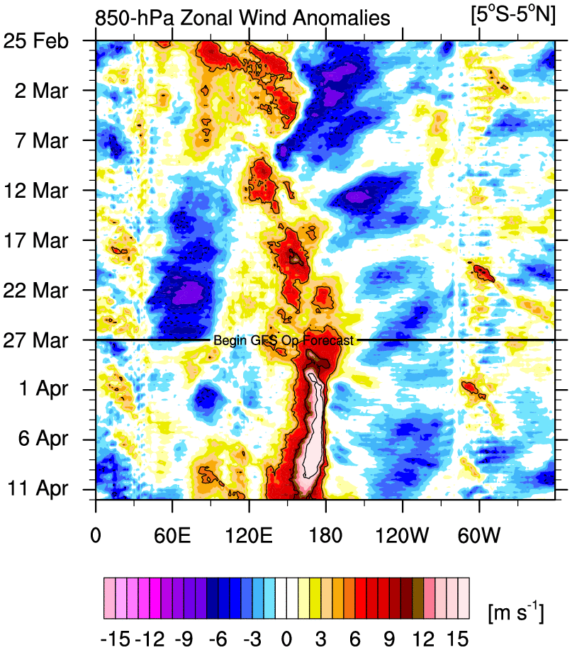
Looking at subsurface SSTs, we can see plentiful warmth below the sea surface, heading eastward as WWB has been ongoing since late last year. This is a classic sign of an El Niño on the way.
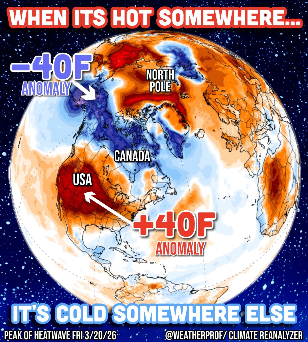
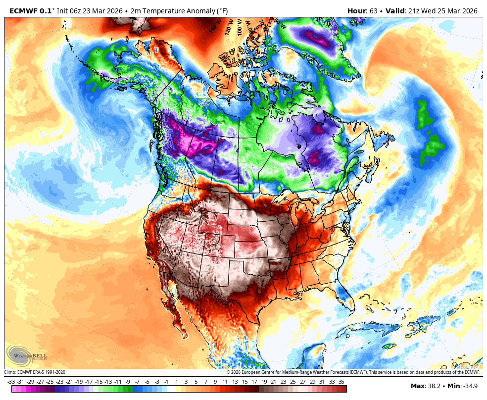
Its been a record warm March in the US. In contrast its been very cold in Canada & especially Alaska. If this were fall I would say the cold is heading south into the US but spring much less certain. But increasing the risk are models flirting with Alaskan &/or Greenland blocking
Sandwiched in-between two relative heatwaves (US and Arctic Circle), has been extreme cold in Canada & Alaska. You can’t have extreme heat or cold without having the opposite dipole elsewhere. In the case of the height of the #heatwave late last week, Parts of Canada & Alaska were - and to some degree - still are - record cold. So far Alaska is having one of its coldest March’s in a long time. Some cities, like King Salmon, are having their coldest on record.
It’s dipoles like this which is why we don’t say “climate change caused the heatwave”… that’s still not accurate. The dominant hemispheric pattern dictates amplification and location of extremes. Climate change then amplifies that pre-existing pattern… making formerly impossible events, not just possible, but probable. Climate change makes every heatwave more robust. But these heatwaves don’t happen without the governing large scale dynamics, much of which is driven by natural variability, being established. That’s not to say that global warming can’t influence steering patterns or even potentially Sudden Stratospheric Warming events through Arctic Amplification (more research needed), but as far as we know natural oscillations still set the table.
With all this said, the heat extremes now-a-days are simply more extreme than the cold extremes in the vast majority of cases, as the climate baseline continues to warm.
Odds for a super El Niño would get a boost if twin tropical cyclones form in the West Pacific during April.
The circulation around these storms would cause another vigorous westerly wind burst, sending yet more warm ocean water toward the east.
We are in the "Golden Age" of numerical weather prediction led by ECMWF (European Center) 🇪🇺
Another "pole vault" in global prediction skill 🏆
New research combines machine learning with their world leading full-physics ensembles yielding "major" skill score gains especially for tropical cyclones (hurricanes)
arxiv.org/abs/2603.05570
ENSO will return to neutral in the next month or so as cool pool over the central equatorial #Pacific continues to shrink. +OLR anomalies over the region are also fading. #ElNino conditions will likely develop during boreal summer/austral winter.
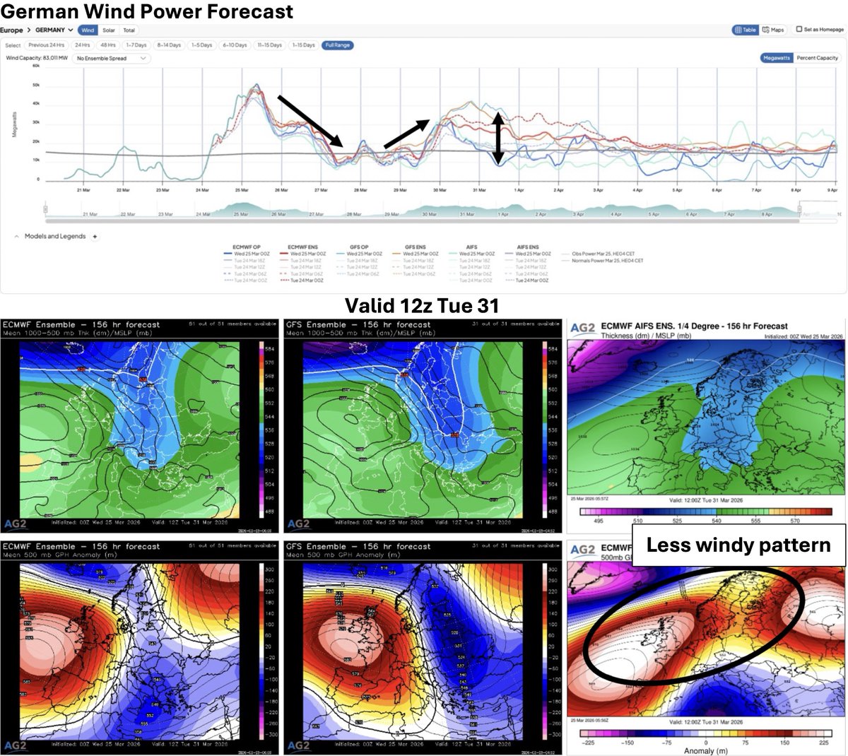
Two blocking ridges + (Rossby) trough thinning in between --> spawning "crazy cut-off lows"
European weather in Spring is not the easiest to predict with so many "moving parts" to keep track of during these blocking events.
weather.substack.com/p/march-24-202…
Blog update (@weathertrader)
Here we go again..
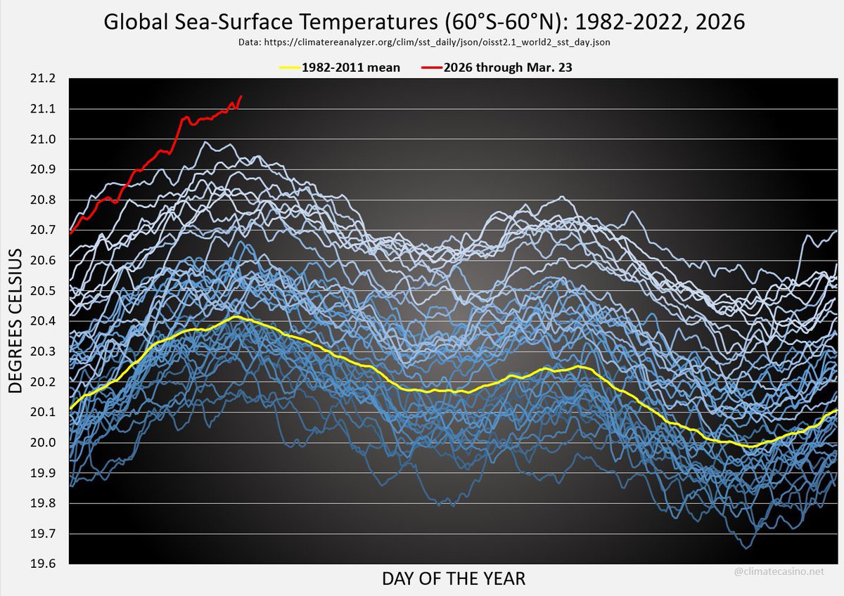
Global sea surface temperatures are yet again at extreme record warmth values, beating the previous record set in 2024.
Unprecedented. Climate change really is running away from us.
ℹ In the coming days, the jet stream over Europe will become strongly meandering, allowing colder air from the north to push much further south across large parts of the continent. The video shows wind speeds at the 500 hPa level (~5.5 km), capturing the structure and evolution of the mid-tropospheric flow. These amplified waves enhance meridional transport, with cold air advecting deep into Europe while warmer air is drawn poleward ahead of the troughs. This pattern will lead to sharper temperature contrasts and more variable weather conditions. #p=55.4;9.7;3&t=20260326/00&src=link" target="_blank" rel="nofollow noopener">ventusky.com/wind-speed-map…
A significant winter storm is on the horizon, bringing cold temperatures and snow back to Europe. Warm spring weather shuts down this week.
severe-weather.eu/global-weather…
The record-breaking U.S. warmth is reminiscent of March 2012
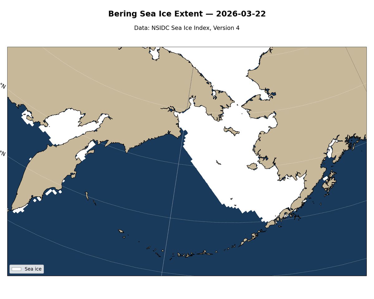
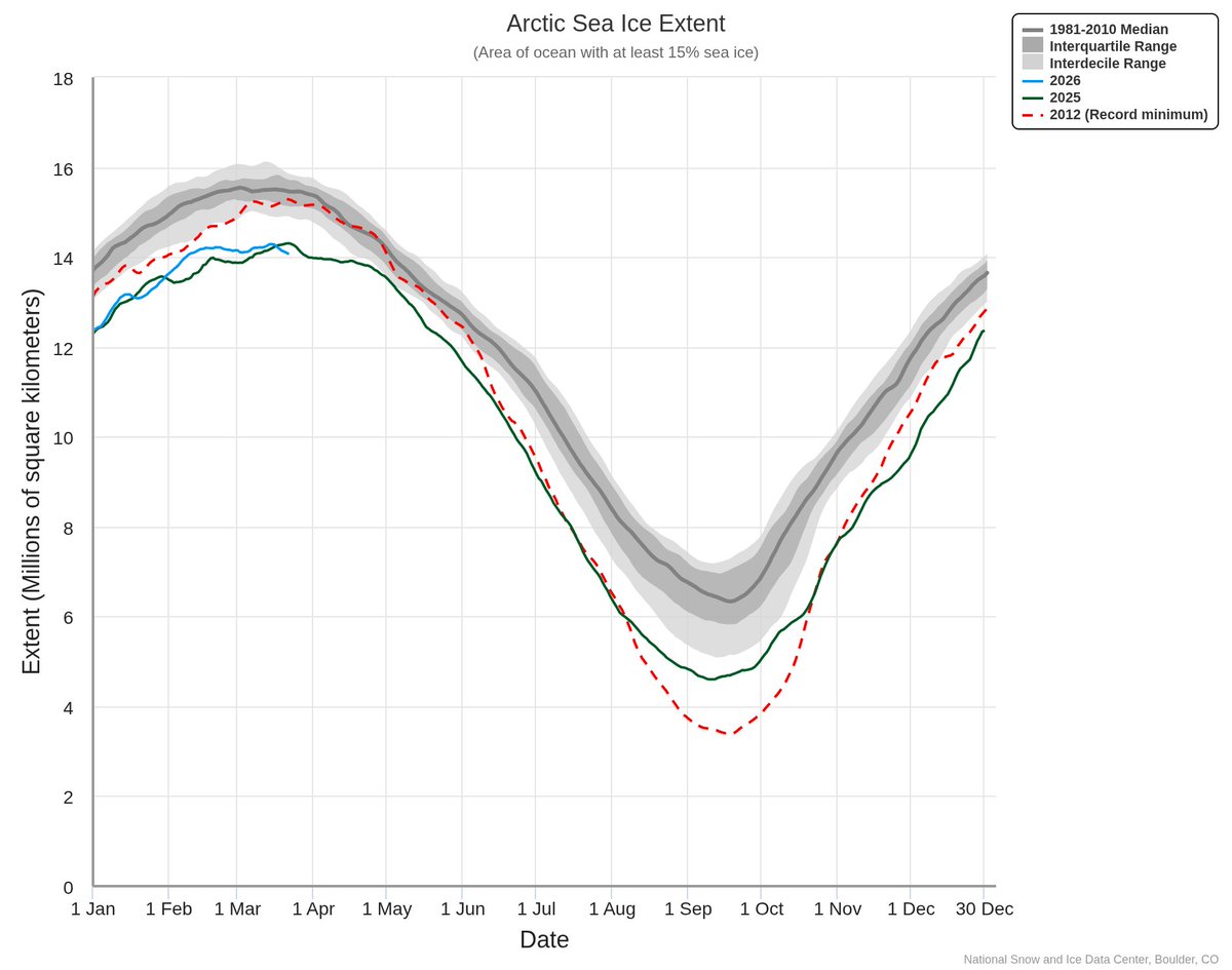
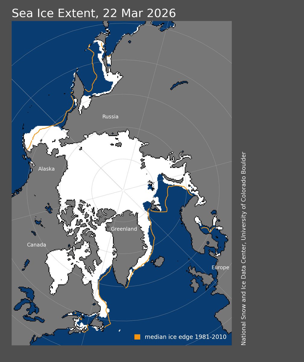
At the same time, Bering Sea ice extent near Alaska is now the greatest on record - exceeding the March 2012 record
2012 was also the year of the Arctic-wide ice minimum; and Arctic-wide sea ice is now at record lows
This month could become the warmest March on record for the United States, surpassing March 2012 — and become one of the country's most anomalous months on record overall.
Western heat will linger until the end of the month, periodically pulsing east.
A late final warming this year will take place around mid-April with cold and decreasing temperatures over central and eastern Europe during this week. While over the US there will be a strong heat dome very anomalous