
Flukewx
2.2K posts
Flukewx
@flyingfluke35
Atmospheric Science 27'
United States Katılım Temmuz 2016
37 Takip Edilen59 Takipçiler

🌪️ Would you rather chase 30 marginal days or one high-risk day?

English

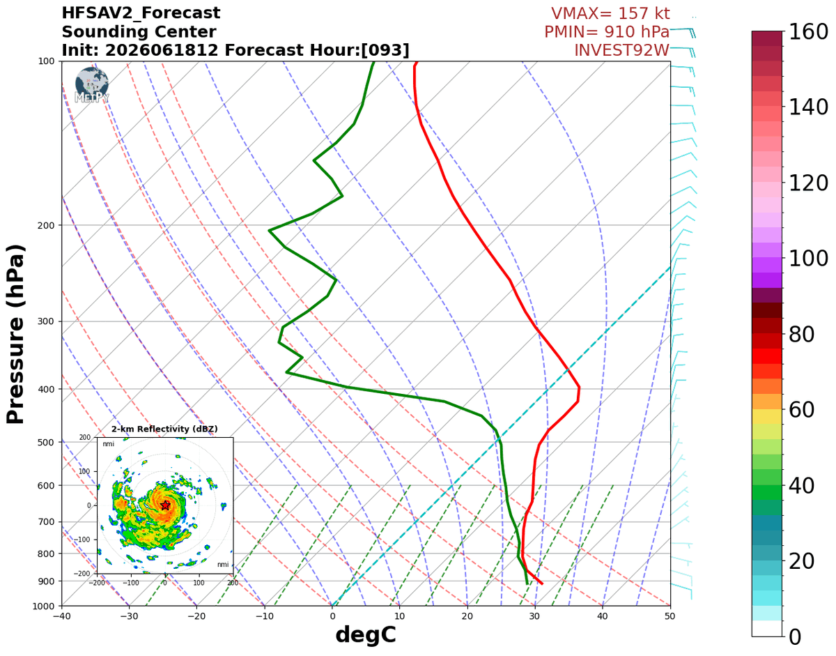
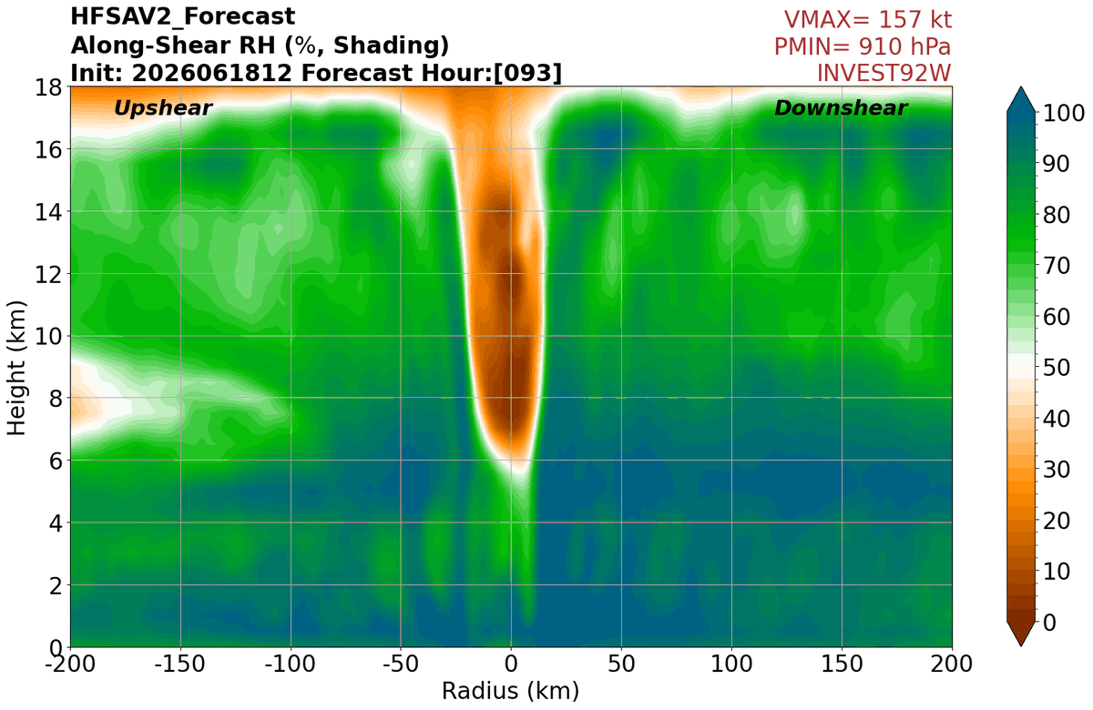
HAFS-A is really going crazy with Invest #92W in the West Pacific. That's one of the more impressive eye subsidence signatures I've ever seen on a model.
We're introducing a new plot this year that's a bit nerdy - wavenumber decomposition of vertical velocity (basically shows the symmetric and asymmetric parts of the vertical motion field).
This forecast shows the symmetric ring of an outer eyewall starting to develop, and also a little bit of asymmetry due to some moderate NE shear (notice increased rising downshear to the southwest where most of the bands are).
Hoping to have all these updated products on the website soon!

English

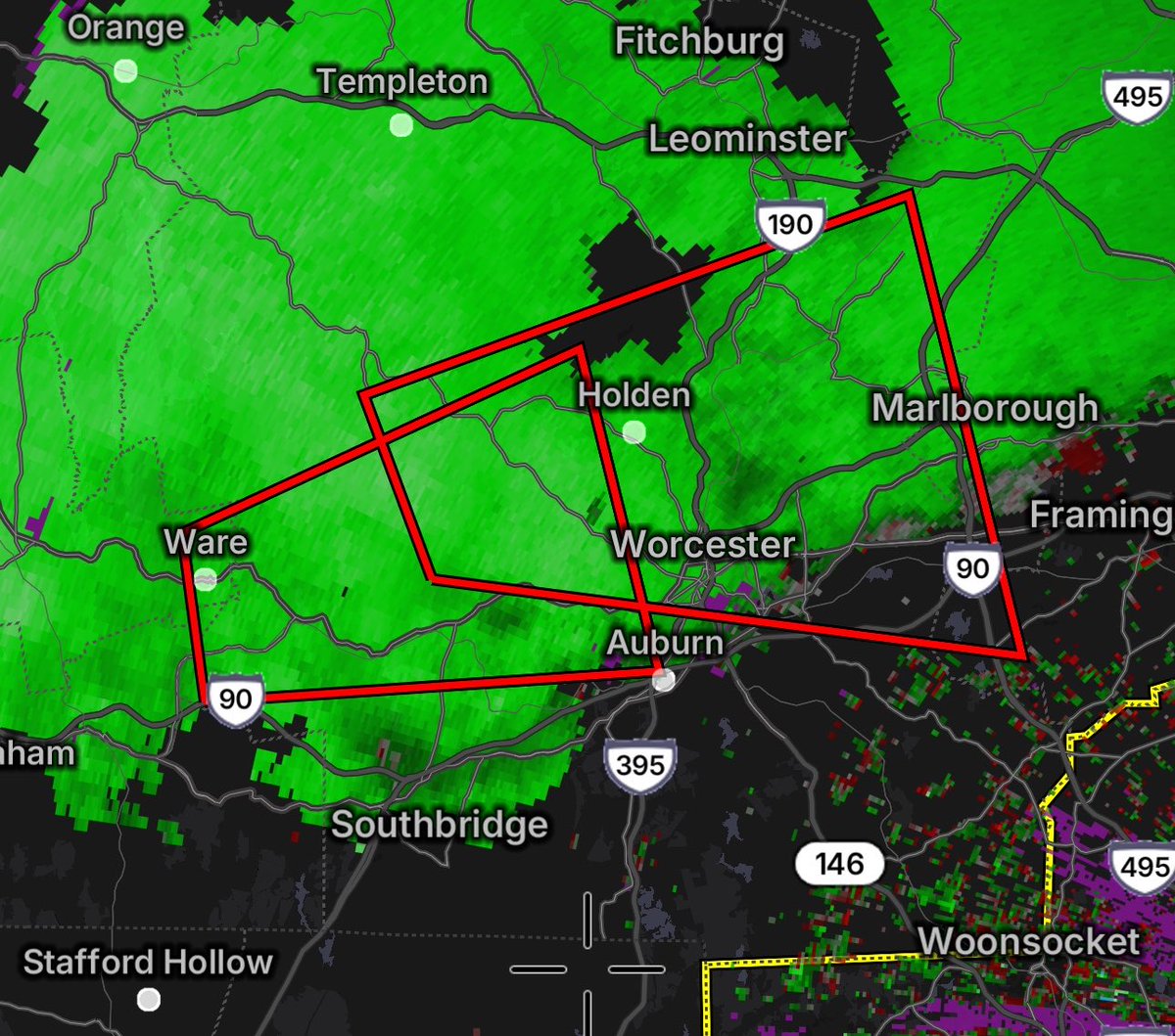
No idea why these tornado warnings are in effect in Massachusetts. There was some solid spin with the southern cell 20 minutes ago. Now we’re making close to a million people shelter needlessly.
Casting a giant net with big polygons and a low threshold degrades credibility.
English


Okay real talk
Why do so many chasers intentionally get in the outer circulation or knowingly drive into the ghost train when they could be 1000-2000 feet further back getting a much better angle? Every chaser that gets that close is risking being Jonas Miller'd by a nefarious tree branch.
Just, why? What's the purpose? What do you get out of that that's not possible 2000ft further back?
And no I'm not talking about research teams or projects, im talkin regular ol chasers.
I'm not upset, I'm just confused as to why.
Does it have an actual reason or is it just thrill seeking?
English
Flukewx retweetledi

Tropical Storm #Arthur Advisory 7A (7 PM CDT, Wed Jun 17): Center of Arthur Re-Forms Northeastward Near Galveston Texas. Life-Threatening Flooding Expected Across Portions of the Southeastern United States. hurricanes.gov
English
@GraceCWeather Purdue has a radar in the middle of the radar hole but its down for repairs and I don't believe the data is available to the general public.
English

if i had like a billion dollars im putting a radar here
English


@HurricaneImelda Extremely unlikely Arthur reaches hurricane intensity imo, especially with the completed pass showing that the 66kt wind probably wasnt very representative
English

@flyingfluke35 there’s no way we get a hurricane in this el nino atlantic season BEFORE the pacific does
English

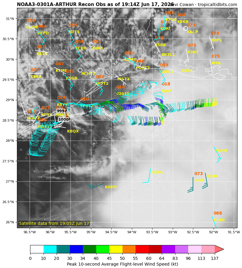
Seeing some evidence of an attempt at "downshear reformation" in TS #Arthur, with a new center trying to form closer to the convection. This is pretty common in weak, sheared systems like this. The center will "jump" in the direction of the deep thunderstorms, which continously get blown off in the direction of the strong upper-level winds (in this case, to the East). Due to this strong shear, this new center probably won't change much in terms of the intensity of the storm, and rainfall remains the biggest threat.
English


@DerekOrtt Yeah that 52kt FL should be enough for 45kts especially with the surface obs from roughly the same time corroberating.
English

given the buoy, aircraft, and surface obs, I fully expect the winds in Arthur to be increased to the 40-45 kt range on the best track
English

You really know it’s June when you get a pathetic excuse of a tropical cyclone to waste away the first name

English
Say hello to our first tropical storm of the year. #Arthur is current packing 10mph sustained winds over its center but the Eastern blob has sustained winds near 50mph. The storm will be one for the recordbooks as it has never ventured further than 10 miles from land.

English
Flukewx retweetledi
Tropical Storm #Arthur Advisory 5 (10 AM CDT, Wed Jun 17): Tropical Storm Arthur Develops Near the Middle Texas Coast. Life-Threatening Flooding Expected Across Portions of the Southeastern United States. hurricanes.gov
English
@Jackalope1234vd @NWSSPC They forgot to add the tornado probs in Louisiana
English


1:28pm CDT #SPC Day2 Outlook Moderate Risk: across parts of central Illinois into northwest Indiana spc.noaa.gov/products/outlo…

English