Currently have a handful of severe warnings for severe straight line winds mainly, maybe a few hailstones. Severe straight line winds are the main risk right now with these storms, and we'll continue to watch for any misbehaving rotation.
Morning Storm Threat (Through 9 AM): Ongoing Severe Thunderstorm Watch in northwest Middle Tennessee. Damaging winds and hail are the main risks this morning.
Main Severe Threat (8 PM–2 AM Tonight):
A highly dynamic system will bring all hazards: damaging winds, large hail, and tornadoes.
Stay weather aware today. Make sure you’re connected to multiple sources for weather information. Prepared Not Scared. spc.noaa.gov/products/outlo…
Prepare now for low probability of a high impact straight line wind, large hail, tornado tonight/overnight. Have a wake me up app like @stormwatchplus, turn on your phone’s WEA alerts, and set your weather radio.
Main line ETA 12 AM-3AM but supercells could develop *before* then. Stay connected.
With severe weather approaching, we aim to reach as many people as possible in Montgomery County. We’re on Facebook too, so if you know someone who could benefit from our updates but doesn't have an X account, please share!
facebook.com/share/191NZB1p…
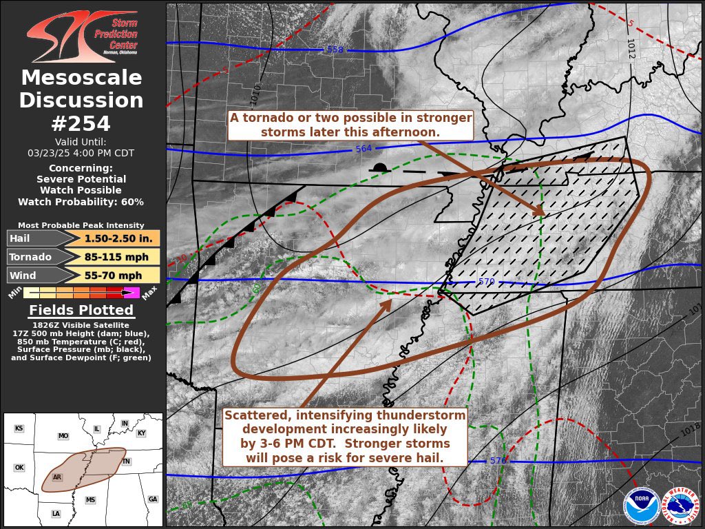
Eyes on Sunday. Shear and instability as a cold front arrives. SPC keeps us outlooked for severe potential. “This far out, there is still plenty of uncertainty in specifics
such as timing and specific hazards. But stay tuned for forecast updates for the upcoming weekend.” NWS-Nashville.
New tornado watch does include Davidson & Williamson Counties until 11:00 pm. Over the entire watch area (pictured)...a few tornadoes are possible, scattered hail up to two inches in diameter and scattered gusts to 70 mph are possible. As always, stay connected! More soon.
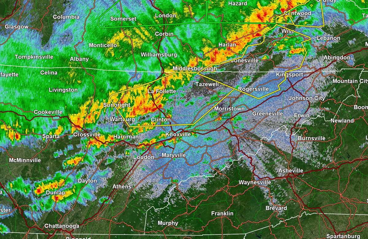
A tornado watch has been issued for W TN until 3am and carries the Particularly Dangerous Situation designation. Comes right up to the TN River and does not include us right now. But, it has our full attention. Latest radar images for free here: nashvillesevereweather.com/radar/
The first round of thunderstorms will impact Middle TN late Friday night through early Saturday morning with the main timing window between 12 AM and 6 AM. Greatest risk for severe weather is along and west of I-65, and all hazards are possible with any severe storm.
Don't rely on luck, Tennessee - plan ahead, be prepared.
Severe storms are possible Friday and Saturday across the state. What can you do today to prepare?
📳Have multiple ways to get weather alerts and updates. Make sure you are following your local NWS Office and trusted sources.
➡️ Know your safe places.
✅ Have a family communication plan.
⛈️ Consider adjusting outdoor plans.