
Robert G. 🇨🇦
1.2K posts
Robert G. 🇨🇦
@robertgwx
Meteorologist in NL. Nova Scotian. Usually geeking out about weather somewhere ⛈️☀️// #NLwx #NSStorm // Views do not reflect those of my employer.
Gander Katılım Temmuz 2022
145 Takip Edilen368 Takipçiler
Would love some more snowfall observations from areas seeing the storm today! From GFW to the Avalon, including the metro area. It would be greatly appreciated! #NLwx
English
@rcbstormpost How much snow you got? Airport is only reporting 8 cm total, but if you're saying 2cm/h, I presume you have more :P
English
@TheNLWX Not sure where you’re getting the idea that rain is at all possible from this system. If, and that’s a big if, it comes close enough to the Avalon, it would be all snow… 🙃
English

Weather Watch
A developing system could bring heavy rain, strong winds, and possible snow to parts of eastern Newfoundland this Saturday. Forecast details are still coming into focus. Stay tuned for updates.
#NLwx #nlstorm #nltraffic
nlwx.ca/potential-week…
English


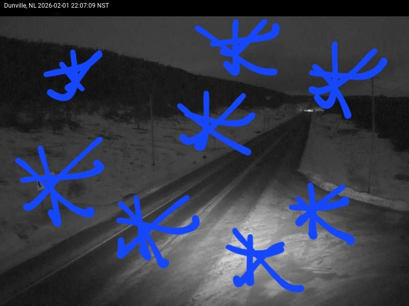

Despite the look on radar that snow is moving in quick, there seems to be a considerable amount of virga ahead of this system.
Webcams over the southern Burin & Avalon show that although radar suggests snow has begun, it has yet to begin. It should very soon, however. #nlwx


English
Virga is the scientific term that describes precipitation falling from a cloud that evaporates before making it to the surface. The air between the cloud and the surface is too dry, causing the snow to evaporate.
That should change soon and snow will begin. It’s still coming!
English
@rcbstormpost Had a feeling the observations at YQX were wrong when I did a little quick clear of my walkway 😅
English

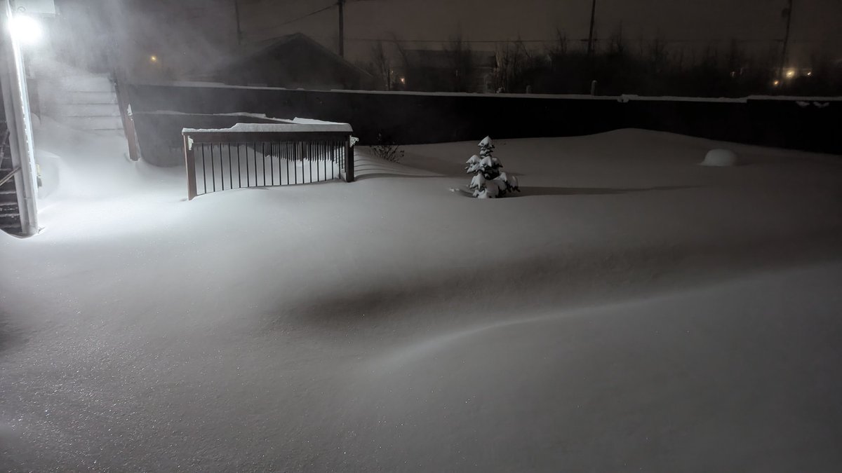
Some very efficient dendritic action today! Measuring 25 cm through 7:30 pm in #GanderWest... quite powdery.
Will get updated amount and water equivalent later as it's still coming down at a strong pace. #nlwx

Gander, Newfoundland and Labrador 🇨🇦 English
Some pretty poor visibility over parts of southern and eastern Newfoundland this evening, especially over the Burgeo and Bay d’Espoir highways! #NLwx


English
@allistercanada @msstate Congratulations Allister! Well deserved ☺️
English

@TheNLWX Not a malfunction. Crews had to do work on a tower nearby and due to safety reasons the radar gets blanked out in the sections that could pose a safety risk to those crews.
Should be back to full images later this afternoon or early evening.
English
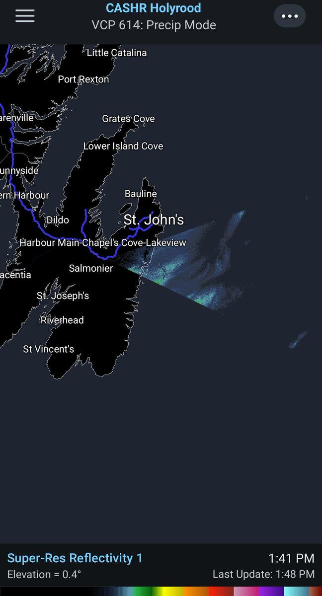
The #Holyrood radar station seems to be malfunctioning at this hour and only displaying a small sliver of the 360 degree radar scope. #nlwx #nltraffic
English
@Newfie15243 @EddieSheerr You’re welcome! We have a good amount of people that use #NLwx and I would hate to see people stop using it because of this decision.
English

@robertgwx @EddieSheerr Thanks Robert, appreciate the reply 👊
English
How much will this affect our forecasts in Atlantic Canada? #nlwx @EddieSheerr
Also why is this a thing?
English
If only the warning said something along the lines of “High-sided vehicles will be overturned by the wind.” *sigh* 🙃
Peak gust of 134 km/h in the Wreckhouse area as of 10:30 P.M. NST. #NLwx

RCMP Newfoundland and Labrador@RCMPNL
⚠️ UPDATE (November 16, 2025, 10 :20 p.m.) : Channel-Port aux Basques RCMP advises that due to an additional incident and extremely high winds, both lanes of the TCH in the Wreckhouse area between Red Rocks and St. Andrew’s are now closed to traffic. Police request that motorists throughout the Wreckhouse area drive with caution this evening as extremely high winds are creating dangerous conditions.
English
I can confirm there is wet snow mixing in at times near the airport in St. John's.
#NLwx
English
@rcbstormpost That was the lowest I could find as well, glad it lines up. :)
English
@robertgwx Lowest I'm seeing is 950.6 mb at Nain (Nov 7, 1987). Lot of stations don't have SLP history going back much past the early 2000s, but that seems to be the best candidate.
English
As for NOVEMBER barometric pressure history, the previous lowest value recorded at St. John's #YYT during the month has been shattered (963.1 mb on Nov 30, 3019). Dataset goes back to 1959. #nlwx
Rodney Barney@rcbstormpost
St. John's #YYT minimum barometric pressure 950.5 mb this evening marks the lowest value recorded at the location since Feb 11, 2003 (when it reached 949.3 mb). #nlwx
English
@MyRadarWX This is actually the island of Newfoundland, not Nova Scotia :)
English

Wow. The explosively-intensifying storm over Nova Scotia has developed an EYE-like feature! It also has strengthened at twice the rate needed to achieve “bombogensis,” and produced a 100+ mph “sting jet” south of the center.
Technically-speaking, nor’easters and mid-latitude storm systems don’t have eyes in the way that hurricanes have eyes.
A strong hurricane can develop a clear eye when rising air in the eyewall collides with the “ceiling” of the lower atmosphere; some of the air bounces back down, subsiding, sinking, heating up and drying out. That punches out a hollow, clear eye at the storm’s center. Hurricanes are warm-core systems, and the eye may be 10 to 20 degrees warmer than the surrounding air.
Mid-latitude cyclones form from, and feed off of, completely different processes. So what’s causing the eye-like feature? It’s just a “seclusion,” or a pinched-off pocket of dry air from the “dry slot,” as the storm wraps back on itself.
It doesn’t have any significance other than looking cool — and marking where the center of low pressure is.
Cool stuff though!

English
@joeyp239 @kellymbutt Also concerning is that this is going to be coinciding with perigean spring tides…coastal flooding is definitely going to be a big concern here too.
English

@robertgwx @kellymbutt yeah that featue is looking very concerning for cape breton and maybe the avalon to a weaker degree
English
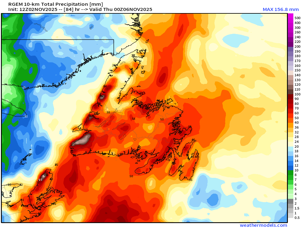
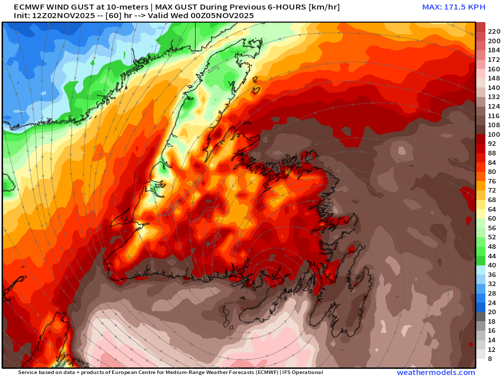
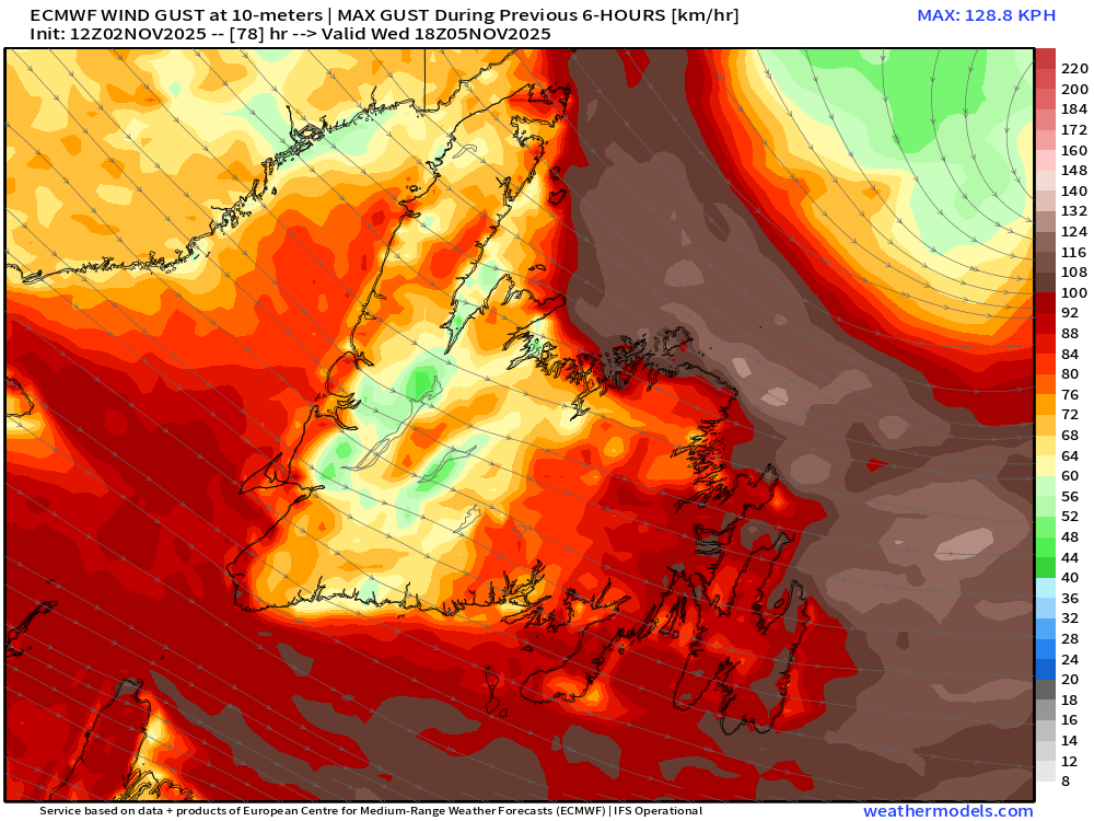
Our next #NLwx maker will be a strong Fall storm that moves over the island Tuesday into Wed.
Rainfall is likely in the 30-50mm+ range for most of the island.
West & central may see wet snow mixed on Wed.
Wind gusts will be near or in excess of 100 km/h, esp for coastal areas.
GIF
English