Post

Python Maps
Python Maps@PythonMaps·
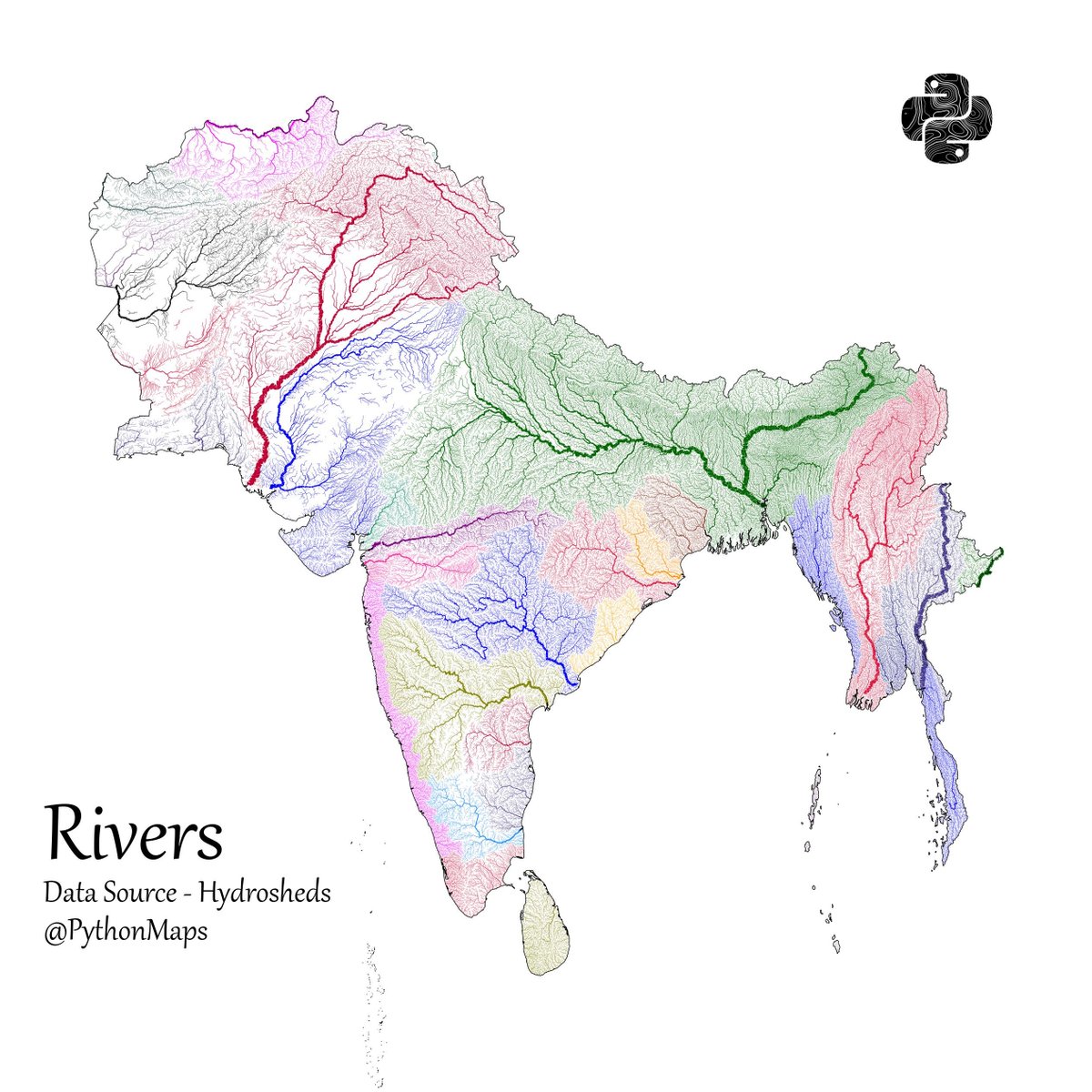
Another thread of maps I like. This time we are looking loosely at the Indian sub continent. Included are India, Pakistan, Afghanistan, Nepal, Bhutan, Bangladesh, Sri Lanka and Myanmar. First up, Rivers! 1/13
Python Maps tweet media
English
145
1.3K
10.8K
1.6M
Rolle
Rolle@Rolleuni·
@PythonMaps Shouldve included the Tibetan plateau too for continuity of the rivers
English
4
0
163
32K
슬렛지
슬렛지@Enthalimon·
@PythonMaps Always love your maps thanks! Can you also make topography+river system maps, as you once did for african one?
English
2
0
31
28.1K
Yajur
Yajur@realyajurved·
@PythonMaps Are the maps not distorted ? Please be sensitive when posting.
English
1
0
11
6.8K
Śaciṣṭha
Śaciṣṭha@RiseBharata·
@PythonMaps The map is incomplete as you haven't included aksai Chin, Indian map is incomplete without it,
English
1
0
27
2.8K
Tomato🍅🍅
Tomato🍅🍅@Tumhotoh·
@PythonMaps Great maps, but in other maps of this thread I think you can make it more easy to understand by using color label, 'light to dark' for 'low to high'. Otherwise it is little bit confusing at first look. Ex- here light color represent high forest cover twitter.com/PythonMaps/sta…
English
2
0
19
3.9K
RNM
RNM@RNMPro·
@PythonMaps I love the river map. Would you mind sharing notes on how you coded this?
English
0
0
5
6.8K
Anant Shukla
Anant Shukla@Anantt1809·
@PythonMaps Good representation. But one thing, you should use right maps, India is not represented correctly.
English
1
0
4
903
India Infographics Guy
India Infographics Guy@Deshpacito661·
@PythonMaps I’d like to think that major river basins are the atomic units of a common civilization/culture. You are an empire if you govern more than one major river basin, because you are truly uniting two different cultural traditions
English
1
0
2
2K
Shubham joshi
Shubham joshi@shubhxvi·
@PythonMaps India is not represented correctly in these maps. You haven't shown North eastern region of ladakh and pok in India please rectify ASAP.
English
0
0
2
528
Abhishek
Abhishek@abhisheknndi·
@PythonMaps so intricate! See how thick Ganga is made to represent its largeness. It can be concluded by observing the thickness of rivers that rivers in north India are larger than those in south India.
English
1
0
2
67
Paylaş