New ECMWF data shows near a 100 percent chance of a super El Niño by October.
The central equatorial Pacific is forecast to surge 2.7˚C above average by then — approaching record levels — and this major climate event will still be intensifying 🧵
Severe thunderstorms broke out across the Southern U.S. yesterday afternoon, lasting into the nighttime hours.
A tornadic storm in North Texas caused extensive damage to the town of Mineral Wells.
Big El Nino’s have a big impact on hurricane season!! So, what does this upcoming Strong El Niño mean for Hurricane Season? Here I take a short, in-depth look how the strongest El Nino’s changed the Atlantic hurricane season. You’ll be surprised how big a difference it makes!! #ElNino#HurricaneSeason#hurricane
3D Radar Northern Oklahoma Tornadic Supercell
Epic radar view of this amazing supercell in its early stages Thursday evening.
@weatherchannel#okwx#tornado
مقطع متداول اليوم
لسحابة سوبر سل من نوادر السحب الربيعية على ظهرة الطوقي شمال شرق الرياض، والشكر موصول للمصور والناقل، وللفائدة يفضل تصوير السحابة بالعرض الافقي وامرار الجوال بهدوء يمين ويسار؛ لتحقيق كمية كافية من الامتاع البصري.
⛈️ A deep low-pressure system will bring active and potentially very dangerous weather through Friday across a broad area from the central Mediterranean through Greece to western Turkey. Follow official warnings and forecasts. More in the thread.
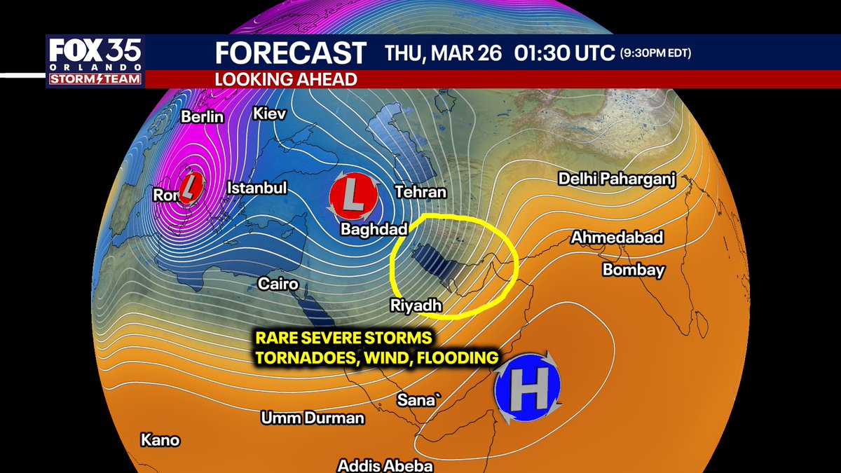
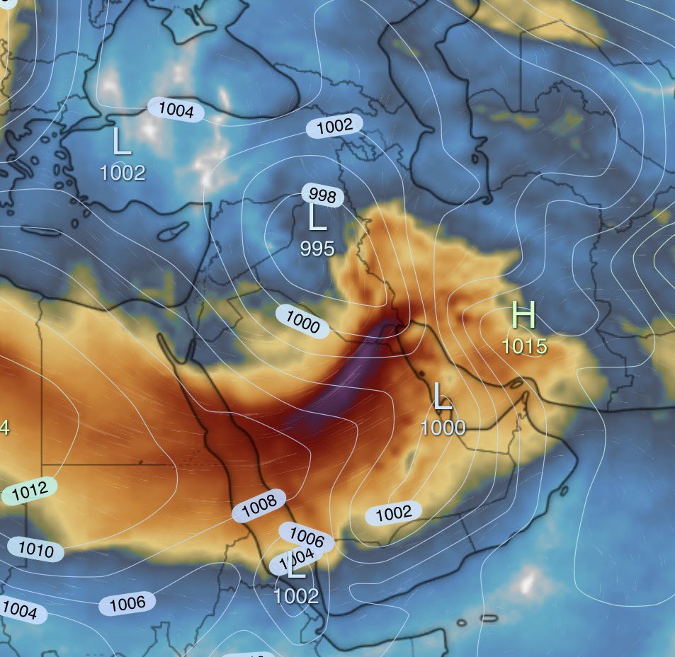
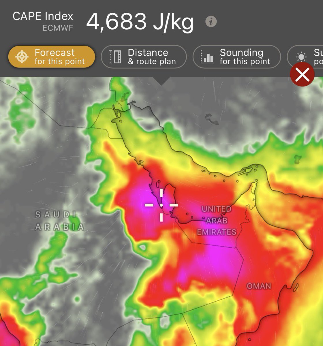
Been a bunch of global extreme weather events lately. That continues this Thursday. A rare setup that may produce widespread severe storms, and the potential for tornadoes with hail around Dubai, the UAE, and around Qatar. Haboobs (dust storms) across Saudi Arabia possible. Some places could get an entire year's worth of rainfall.
Tornadoes and higher end severe storms happen but are extremely infrequent to very rare in these parts of the world.
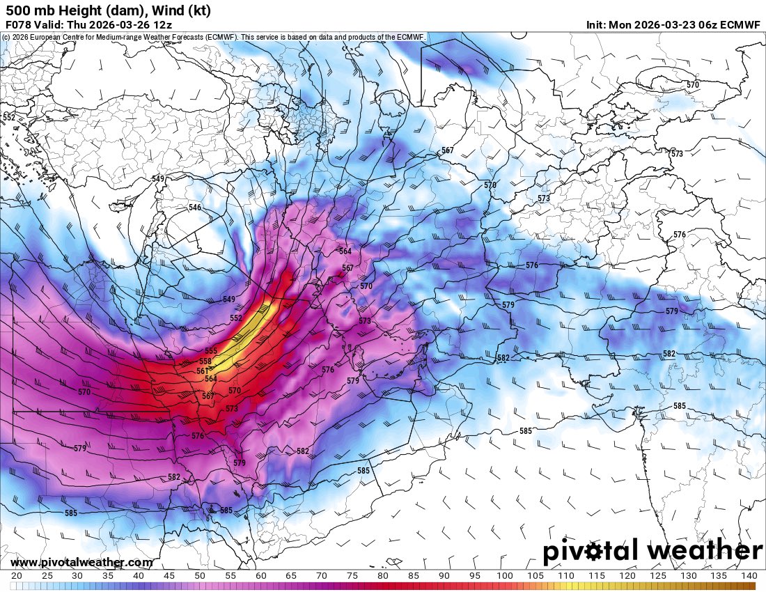
A near record strong trough of low pressure over Egypt & Saudi Arabia is expected to yield a severe weather outbreak & torrential rain capable of extreme flooding over UAE, parts of Iran, and the Strait of Hormuz. Tornadoes in the desert are pretty rare.
This Thursday in eastern Saudi Arabia show a potential for strong tornadoes, significant severe wind gusts and large hails. Main concern is dry air since it's in a desert region and warm nose in the 850mb-700mb layer. Another area with potential tornadoes along with large hail in Southeastern Iraq/Southwestern Iran. Quite an event!
Again, this is unofficial model and is best used for forecast. Given the circumstances that there's no official model at this resolution as far I know. This is a rare treat for you guys! #wx#wxtwitter
Extremely impressive yet highly concerning dynamics at play in the Middle East this week. An area of low pressure deepening over Iraq is accompanied by very strong wind shear and massive instability across Saudi Arabia, Kuwait, UAE, and Oman. Thunderstorms forming in this environment have the potential to be dangerous and destructive with intense precipitation leading to flooding, large to very large hail, severe winds, and even tornadoes.
While the weather is currently on the quieter side here in the CONUS, parts of the Middle East may experience a rare, high-end (even by our standards) severe weather setup on Thursday.
A closed, compact and powerful upper trough will move across the region, with the exit region situated over parts is Saudi, Kuwait, Bahrain, Qatar and UAE. Seasonally deep moisture will be present, with high instability likely.
Some capping may be present, which could limit storm development, but could be just weak enough to promote more isolated supercellular storms, capable of all severe hazards.
If storms form, a significant severe weather/tornado event may ensue across parts of the region, mainly closer to the coastal regions.