
Anthony M
10K posts

Anthony M
@AnthonyMweather
I track tropical cyclones around the world, severe weather & winter storms❄️/patterns. Also a future meteorologist who loves weather, dogs🦮 & Chicago Bears🐻⬇️
Charlotte, NC Katılım Nisan 2020
371 Takip Edilen3.3K Takipçiler


@AnthonyMweather Do u have a ensemble for snow for Morristown Tennessee if so could you post it would love to see what it shows
English
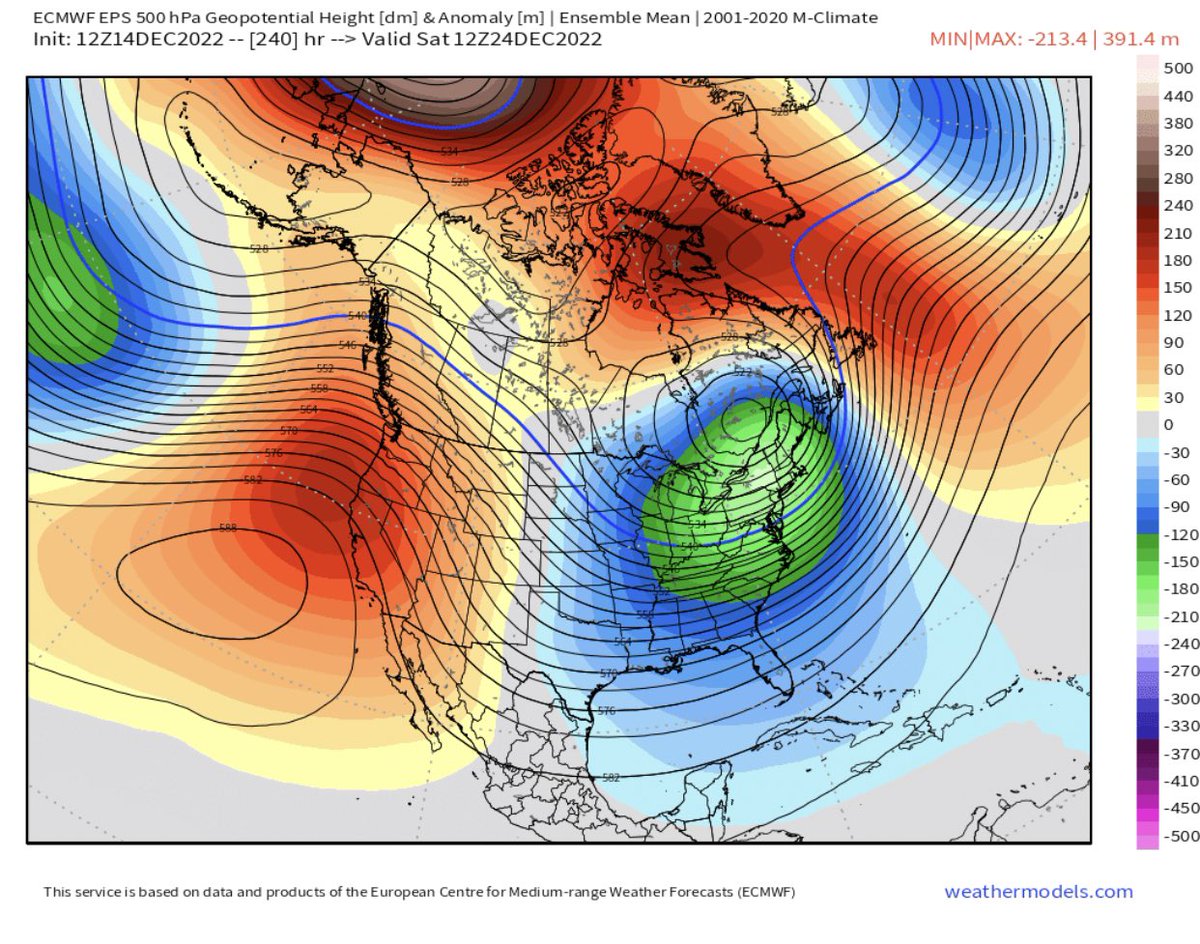
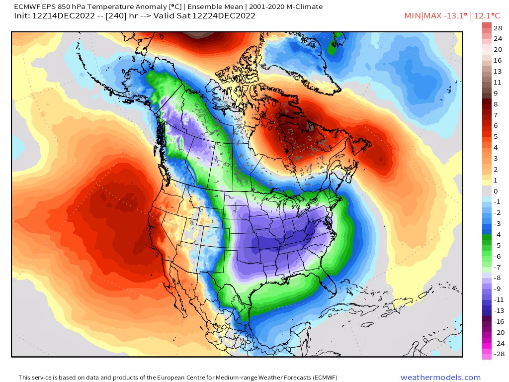
It is not often you get a pattern this favorable to come together especially around Christmas. Now this doesn’t guarantee snow in the southeast, but as shown on the 12z EPS the 23rd through the end of the month has potential. We just need everything to come together right.


English


@AnthonyMweather Is there a snow ECMWF map for Charleston/Monks Corner (if that’s an opinion)
English
@12_mehtab Through the end of the month at least, definitely looks to have some staying power. It’s not one of those in and out cold shots.
English

@AnthonyMweather How long does it look like the cold pattern will be around
For a while perhaps?
English
@12_mehtab The GEFS one is acting weird, it doesn’t seem to be loading properly.
English
@CacaceWX @SCweather_wx It’s possible, it’s also possible the energy gets suppressed and we stay cold and dry. We are from a final solution but the setup has high potential if everything goes right.
English

@AnthonyMweather @SCweather_wx Think it’s possible for a major storm during that period 24th , or am I too over the top
English

Man it’s there on the GFS… right in the timeframe you want it… like magic waiting to happen. Cold is coming. Let’s get that here, and hope for the best. All we can do!
English
@SCweather_wx If everything comes together right it could definitely be something special. All we can do is hope for the best. 🤞
English
@AnthonyMweather Hopefully we reel in magic man. Christmas miracle.
English
@CacaceWX @SCweather_wx I wouldn’t rule out anything at this point.
English
@AnthonyMweather @SCweather_wx Anthony is it possible for southern New England to get onto the storm too ? Or too suppressed
English
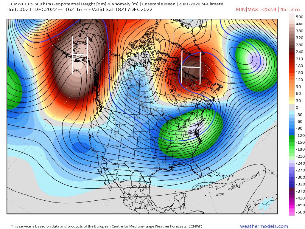
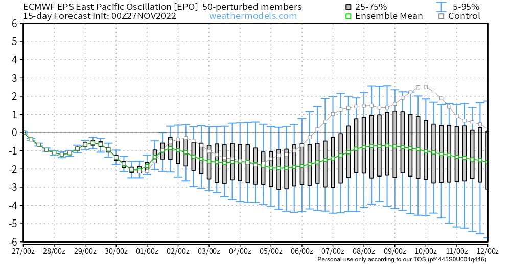
It’s worth keeping an eye on the 7-10 day timeframe in the east as an active jet stream sets up with strong blocking to the north, a deeply negative -EPO and a clipper/Miller B type storm to bring in some colder air ahead of it. As always the track of this low will be key.


English

@AnthonyMweather Snow in central nc? Usually our best snow is when the moisture comes up from the south
English
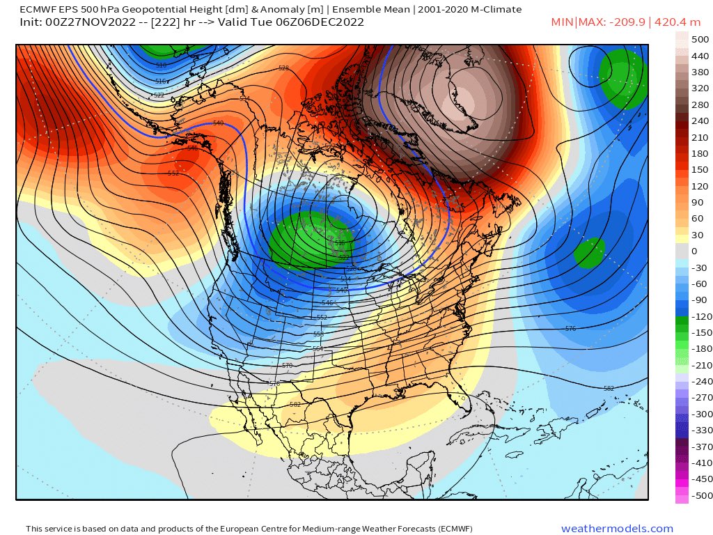
This is one of the most impressive ensemble runs I have seen in a while. We have all 4 major teleconnections (-NAO, -AO, +PNA, -EPO) lining up to deliver at the very least some cold air, but also the potential for snow even as far south as the SE. We will see. 👀🤞
English
@SethMonteith150 It would be nice, nothing is certain down here but it’s a good pattern at least.
English

@MattSenior19 It’s alright and thank you, hoping for a good winter for the entire east coast 🤞
English

@AnthonyMweather I’m sorry I didn’t look at your location ! Hopefully you get some snow too!
English
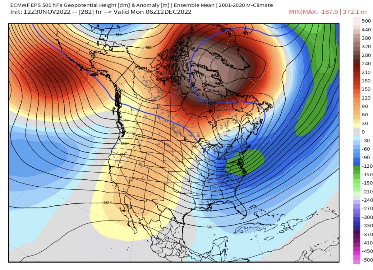
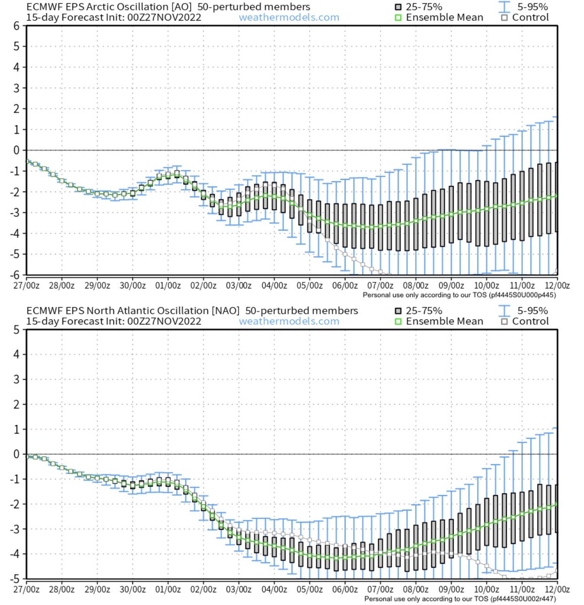
As we head into December it is looking likely that a monster ridge is going to set up around Greenland tanking the NAO index. The NAO, EPO and AO all being negative is a great look for the EC, but the only issue is the PNA struggles to flip positive making the SE ridge a concern.
English
@MattSenior19 It depends where you live, I live in NC so for us it’s a bigger concern. It definitely could end up helping areas further north as long as it isn’t too strong.
English
@AnthonyMweather Don’t see it being a concern. It’s going to help aid in storm track.
English
@BradyBGWX Yeah definitely, especially with these kind of setups we usually see a lot of changes sometimes even 12-24 hours out. It’s just nice to finally have some winter weather to track even if nothing comes out of it.
English

@AnthonyMweather Significant volatility with this current pattern we’re in too I should note
English
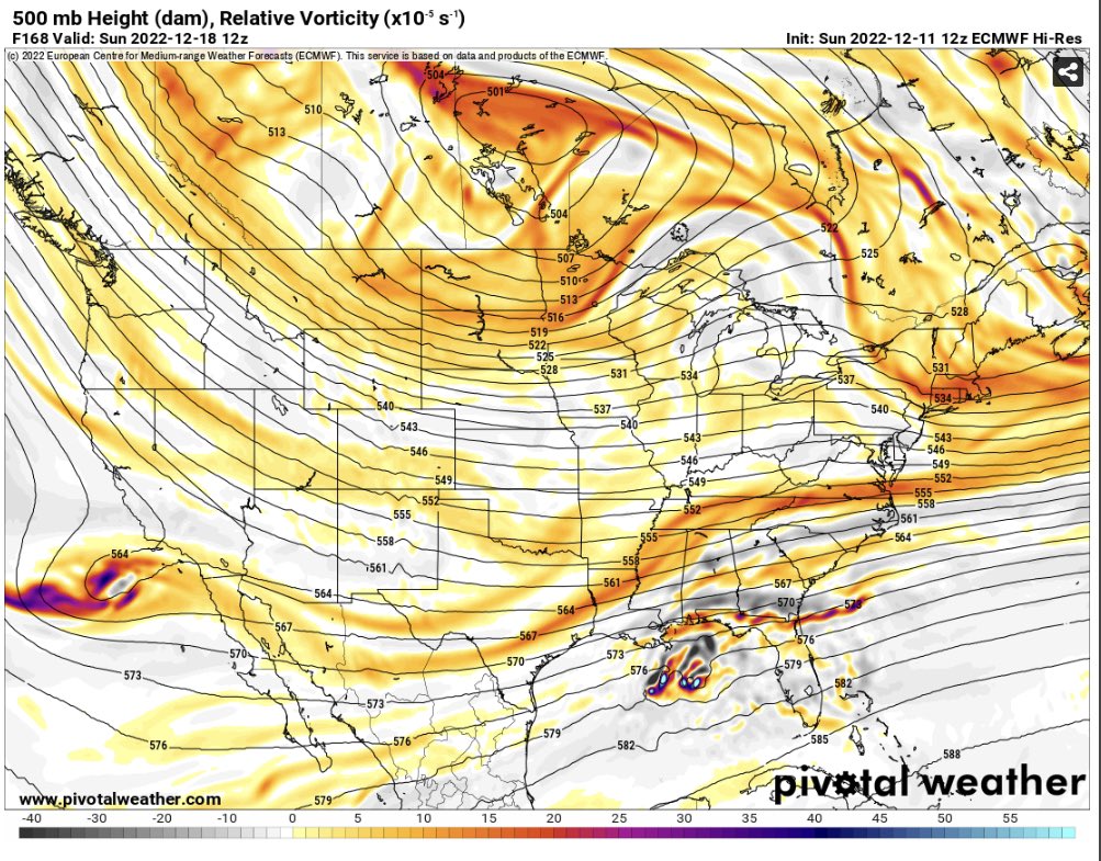
At hour 144 on the 12z Euro you can see the cold air is in place but it keeps the southern wave a lot more strung out/flat than the GFS does. The CMC is on the Euro’s side right now but we will see how things trend.
GIF

Eric Webb@webberweather
Tho model support for this system late next week looks bleak, (potential) overrunning type winter storms like this have a reputation for busting wetter/further north than modeled. I'd keep an eye on this if I was in the Carolinas & southern mid-Atlantic. #ncwx #vawx
English
@ManleyWeather @WeathersWX @wx_virginia I’m just happy too see snow show up on models even if the chances of it happening are very low. Charlotte is lucky to get snow in mid January let alone November. Lol
English

English
English