Sabitlenmiş Tweet

Memorial Day Weekend Disaster Memories
This is a tale of two disasters, 34 years apart. The 1981 Austin Memorial Day Flash Flood and the 2015 Wimberley, TX Memorial Day Flash Flood, Search & Rescue.
The 1981 Austin event was my first professional disaster response and the 2015 Wimberley tragedy was my most recent major response, although I have assisted with many small to medium size events over the years, including hurricanes, tornadoes, wildfires and even the Deepwater Horizon Oil Disaster in the Gulf, where I served as the Geospatial Intelligence Officer (GIO) setting up and running the Geospatial “Batcave” in Houma, LA on behalf of Unified Command.
When the 1981 Austin Memorial Day Flood happened, I was working as a radio personality at the number 1 station in Austin at the time, KHFI (K98). The flooding was caused by a series of storms that dumped 12” of rain over a three hour period on saturated ground that holiday weekend. The Hill Country terrain contributed to the major flash flooding right through downtown Austin, sweeping through businesses and car dealerships along Shoal Creek, including the original Whole Foods Market on Lamar. Many other area creeks also flooded, but this creek was the hardest hit.
I was on duty along with 2-3 other station staff and the News Director. Our Program Director Robb Stewart had the forethought to head up to our transmitter site in Westlake Hills at the “Antenna Farm” to ride out the storms in the little transmitter shack. Gutsy, since lightning was hitting every few seconds at times, knocking the station off the air and sounding like a bomb went off each time. He hit the resume button many times to put us back on the air. Virtually all the other TV and Radio stations in Austin did not have this type of brave soul and they went off the air. Their Engineers could not reach their transmitter sites to flip the switch to resume. So we were left as literally the only station broadcasting.
We delivered real time warnings from the Austin Fire Department as they performed swift water rescues and reported walls of water coming down area creeks to us. We went straight to air with all this, hopefully saving some lives. Sadly, 13 people did lose their lives to the flash flood. The City of Austin established their first Emergency Operations Center and an emergency messaging system for broadcast outlets in the wake of the event as a result of lessons-learned analysis.
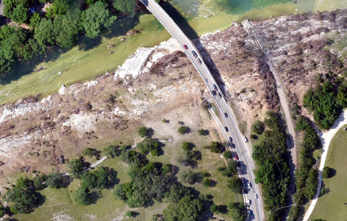
The second Memorial Day Flash Flood took place in 2015 in Wimberley, TX, well known as a small vacation and tourist community south of Austin in the Hill Country. An eerily similar situation set up over the holiday weekend. The ground was saturated from previous rains and then in the early morning hours, over 13” of rain fell over the Blanco River watershed and a 40 foot wall of water came crashing down the river toward Wimberley. Many out of town visitors and others were asleep. One home containing the McCombs family, who were gathered to enjoy the holiday weekend, was literally lifted off its foundation and floated down the river like a nightmare theme park ride. Cell calls were made to 911 from those inside but the house soon crashed into the Ranch Road 12 bridge and disintegrated. One family member and his dog survived after being swept 11 miles down river. Coincidentally, a total of 13 people were lost in this tragedy as well.
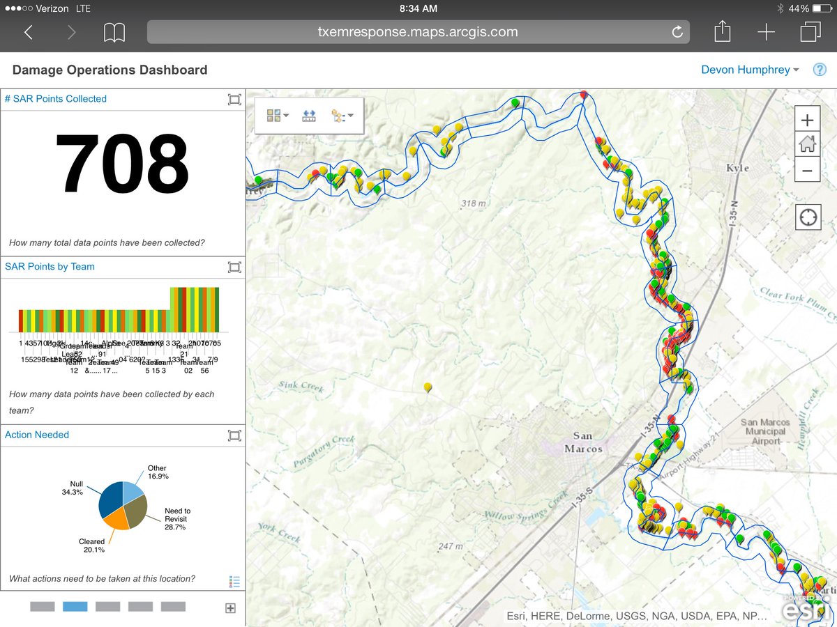
In the immediate aftermath of the flood, a massive Search and Rescue operation was launched. As local residents, my wife Bonnie and I got involved to see if mapping and geospatial intelligence could help with the search and rescue (SAR). We set up an online map tool for the command post and also for field workers, most of which were amateur volunteers. They could use the app-based system to map and send photos and notes of search locations. These were viewed in real time by both command post decision makers as well as other people out in the field to see what other teams had mapped and searched. They even uploaded notes and photos in realtime from their mobile devices.
On the day we launched this system, we were prepared to equip and train about twelve teams of SAR volunteers, or about 120 people. One the day of launch however, over 1,500 volunteers showed up to help. We quickly set up 123 teams of about 10-14 members each to head out with literally no training other than “download this app and use it”.
A few days later, my UAS (drone) mapping company Flightline Geographics was asked to participate in a drone-based damage assessment using large mapping drones (not quadcopters). My friend and fellow UAS buddy Gene Robinson flew a drone in a mapping pattern and I processed the huge volume of imagery overnight and uploaded it to the SAR Portal we had set up. So then, many users could see the damage and where to look for submerged vehicles leaking fluids and more. The SAR teams could also see the imagery as a background in the mobile app. So we continued to add value to the data visualization as time went on.
The map points began to roll in and decision makers were able to review the live data and send teams to areas of interest. It saved literally hundreds of hours of in person debriefs by these volunteers at the end of each search day. Instead, that information was posted LIVE and viewed in real time. Later we produced Heat Maps of areas to re-search based on all the 800+ map points that these volunteer Texans collected. In the end, only Mr. McCombs and his dog survived.
The Good News: By the time the 2025 Kerrville, TX July 4 Flash Flood event happened ten years later, State and Federal Emergency Managers were well equipped and trained in the use of the Geospatial Intelligence and they performed admirably. Hopefully I won’t see another event like this in the Austin and Hill Country area.
But it is Memorial Day Weekend.
And Storms are threatening the area...
@troykimmelwx @WalkerATX @TxStormChasers @NWSSanAntonio @Esri
Links:
Geospatial Intelligence at the Deepwater Horizon 2010
esri.com/news/arcnews/s…
Geospatial Intelligence at the Wimberley Memorial Day Flash Flood 2015
waypointmapping.com/WPM_ESRI_arcus…
Geospatial Intelligence at the Deepwater Horizon 16 Years Later Retrospect by Darron Pustam
linkedin.com/pulse/sixteen-…
English