Sabitlenmiş Tweet

MaxWX #saveNOAA
1.8K posts
@MXWX_Weather
| 16 | .5🌪️| SKYWARN spotter for @nwsatlanta | forecaster for FOT | Forecaster | storm photographer | he/him

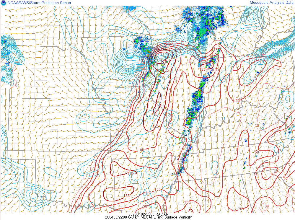
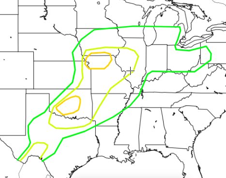
THE MOST ACTIVE PATTERN FOR TORNADOES SINCE 2011 AHEAD A historically active April for severe weather and #tornado outbreaks appears possible this month across the central ant southern Great Plains. This active stretch will begin Friday/Saturday across the Texas Panhandle and southern Plains on Sunday, then ejecting northeast on Monday. A train of large scale troughs are upstream fed by the positive North Pacific Oscillation that has persisted since 2023. Round after round of severe weather and tornadoes appears likely through much of the month of April 2026.


Wow. ⛈️🌪️


Good Morning! We’re starting off Friday with some exciting news. We’re expanding to Atlanta! We are excited to bring our brand of severe and winter weather coverage to the Atlanta metro area. We aren’t changing a thing about what we do in Nashville, but Atlanta will now get the same hype-free, hyper-local weather coverage few others can provide. @AtlantaSevereWx will go active today as part of a phased roll out beginning with socials. We hope to add blog and YouTube live coverage as we grow in that area. Tell your friends, tell your mom and them, we're in Atlanta now. #atlantaweather #atlantawx #atlwx

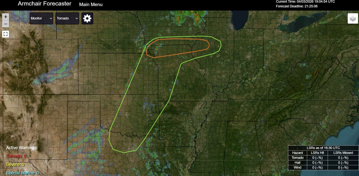

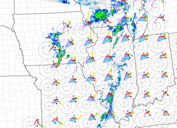
1) The main surface low weakens throughout the period 2) Cold frontal forcing -> storm mode problems 3) Destructive storm interactions & motions drift N of warm front (think 4/13/18) near triple pt 4) Preferred target is 6+ hrs away & confidence in tornadic storms is low 2/4