CPFC Rollercoaster 🎢🦅❤💙
942 posts

CPFC Rollercoaster 🎢🦅❤💙
@PremierRegulars
Red and Blue blood. Fasten your seatbelts!!! #CPFC
Croydon. Katılım Mayıs 2016
409 Takip Edilen403 Takipçiler

Convective Outlook: Tue 19 May ⚡
UPDATE: The most recent run of my Ai model has expanded the MARGINAL risk area from this mornings run, expecting the Midlands and Yorksire to be the main focus where the LOW signal would be.
⚠️: Risk: 🟦MARGINAL / 🟨 LOW focus across the Midlands and central England, with isolated thunder possible across Wales, SW & SE England.
⚙️: Profile: 200–600 J/kg CAPE, 24–28°C lapse rates, DLS 16–30 kt, weak to no CIN Cap.
⛈️:Pulse-to-modest cells. Hail-led in any deeper updrafts. Peak 13-18 BST. #ukstorms #ukweather

English
@TorCastAi Ah. Cool about the windsheid. Nice one.
English
@TorCastAi Do you not follow along live with any of the US chaser guys and girls on Twitter? Lively day today.
English
@TorCastAi 2/2. He has a fair few chasers report in live to him, then I can switch to them if I can
English
@TorCastAi youtube.com/live/20A0ZsM5U…
I normally flick around from 1 to another. Reed is great. Aaron Jayjack , Freddie Mckinney among others. Joined Sarah above yesterday. She had a great intercept then stepped in with search and rescue. Ryan Hall y"all live on you tube can be good too. 1/2
YouTube
English
@PremierRegulars Something satisfying about watching showers initiate, grow and then die.
English
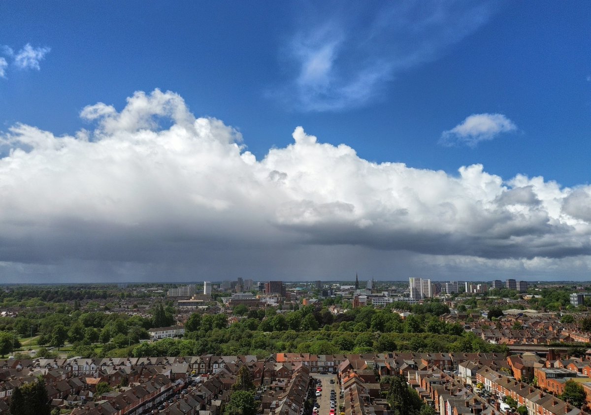
Today’s time lapse, not a lot of activity for me today, but still some nice cloud structure.
#ukweather #ukstorms
English


Heavy, locally thundery with hail, showers continue into this evening, but will start to ease from the west 🌦️
Temperatures quickly falling away too 🌡️
English


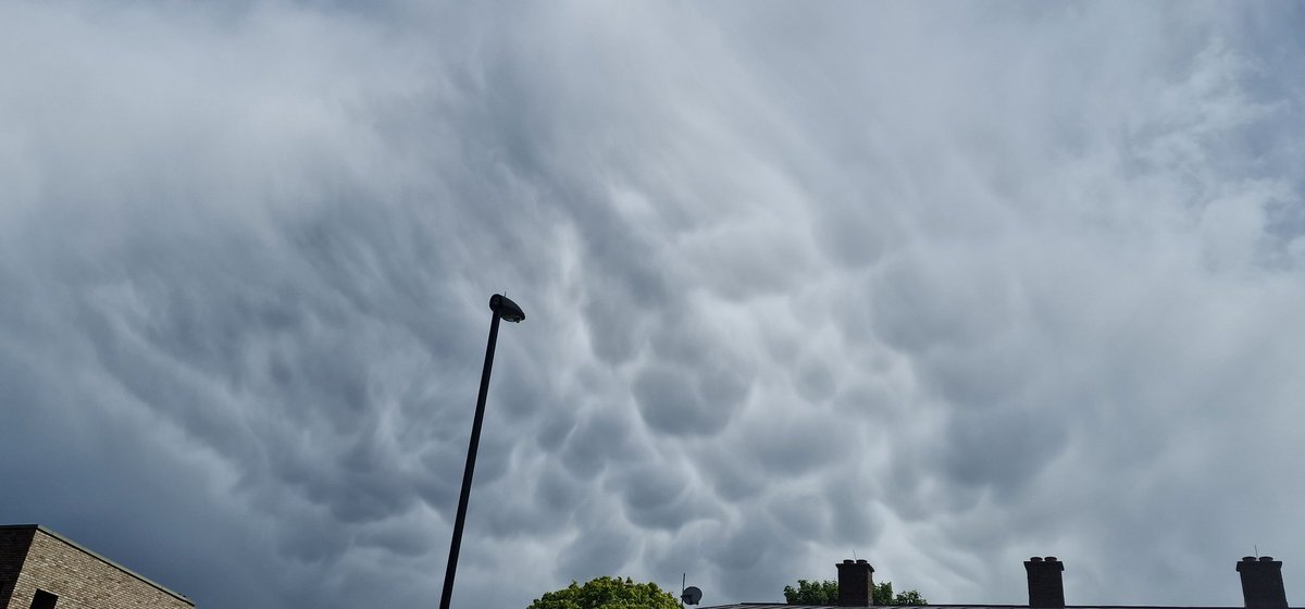
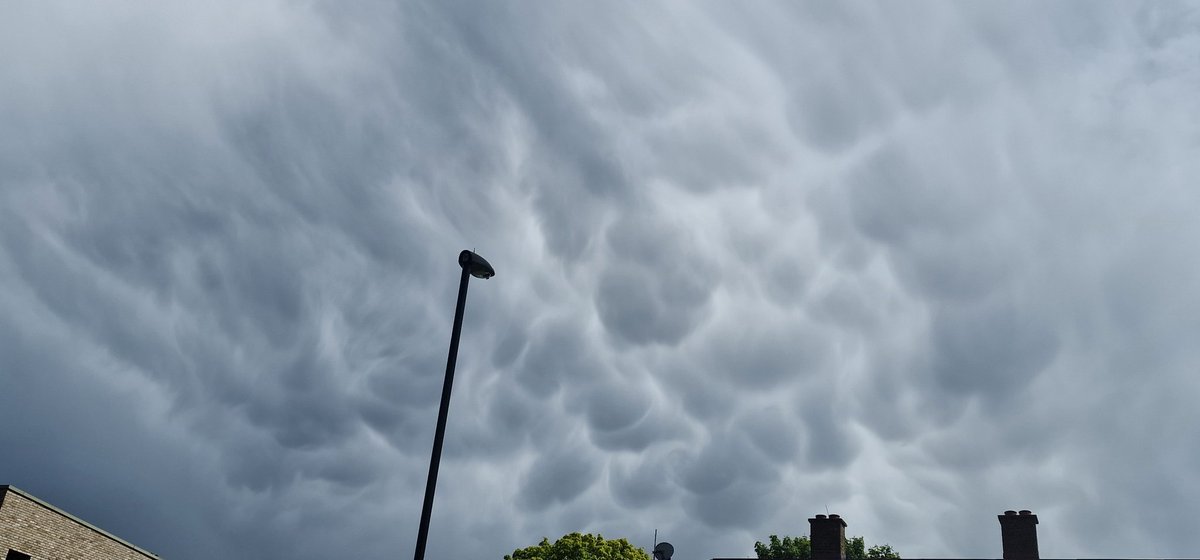
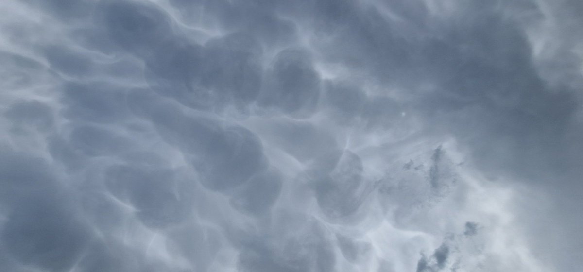
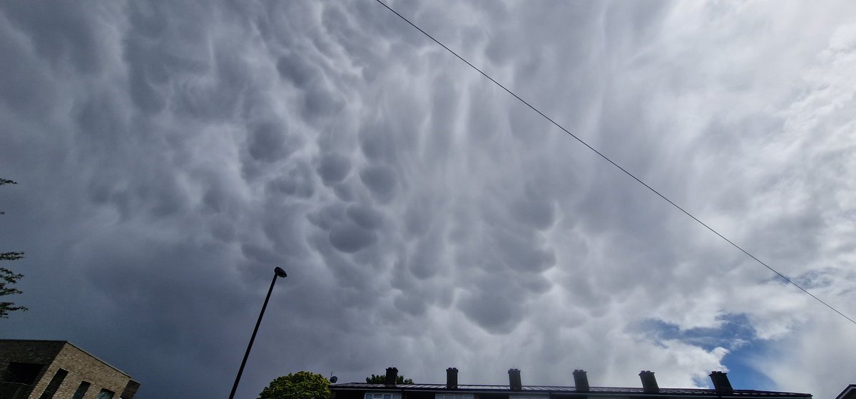
Nice bit of mammatus on the back edge of cumulonimbus cloud to the west of London looking from Southall.

English
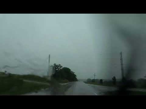
A timelapse of the showers that have moved through this afternoon!
Even what looks like some Mammatus clouds in the last few seconds
#ukweather #Timelapse
English

Heavy, and at times thundery, showers will continue to drift across the country this evening ⛈️
Staying chilly, with brisk winds 🥶
English

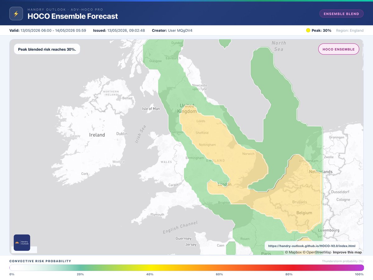
Today’s HOCO and HOCO ensemble
handry-outlook.github.io/HOCO-V2.0/inde…

Handry Outlook- UK Weather Forecast@Handry_Outlook
Convective outlook has been updated ⛈️ Valid: TMR 06:00 - THURS 05:59 Widespread scattered showers will develop across the UK and Ireland, bringing frequent lightning in places during the afternoon. Discussion: handry-outlook.github.io/Thunderstorms/…
English

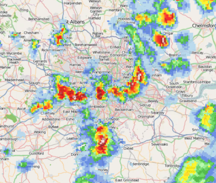
A few thunderstorms moving east through London right now, with hail likely accompanying these.
English


A lot of showers around today with some containing hail and lightning!


English


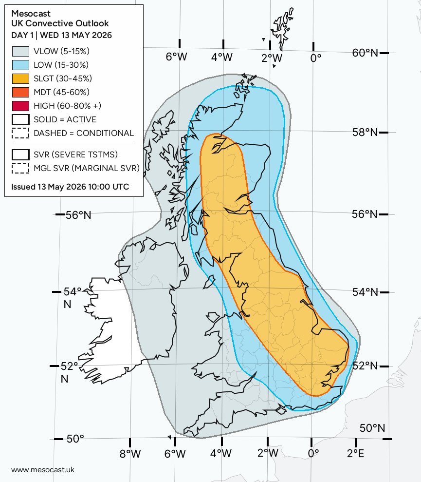
WED 13 MAY 2026: mesocast.uk/forecast/?date…
Heavy showers already underway this morning with a few becoming thundery in the last few hours. These thundery showers will become more widespread through the rest of today. Slight adjustment has been made to the advance watch issued yesterday to extend the coverage of the slight polygon slightly further S and W - only minor adjustments which are negligable. Main threat today will be widespread heavy locally torrential showers and downpours with the risk of hail, gusty winds to 40mph, pockets of lightning and localised surface water flooding in most intense cells.
English
@NickJF75 Shame. Hopefully you're seeing some awesome skies, non the less.
English
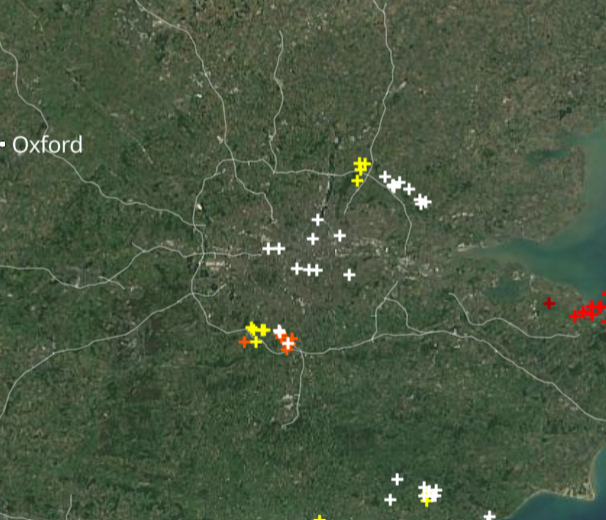
Thunderstorm with hail moving SE over south London at the moment ⚡️- radar from Netweather.tv

Nick's Weather Eye@NickJF75
THUNDERSTORM WATCH - WEDS 13TH MAY 2026 Issued 2026-05-13 06:15:15 Valid: 13/05/2026 0600 to 14/05/2026 0600 Forecast details in the link below 👇netweather.tv/weather-foreca…
English
@LondonSnowWatch @Teamsnow65 Another storm just coming. In a bit of a sweet spot at mo.
Got woke by a mahoosive bolt about 0.4 miles away. Accompanied by some pretty impressive hail. Best I've seen for a few years. At last I finally saw something white falling from the sky. 😅
English