JamesWeather retweetledi

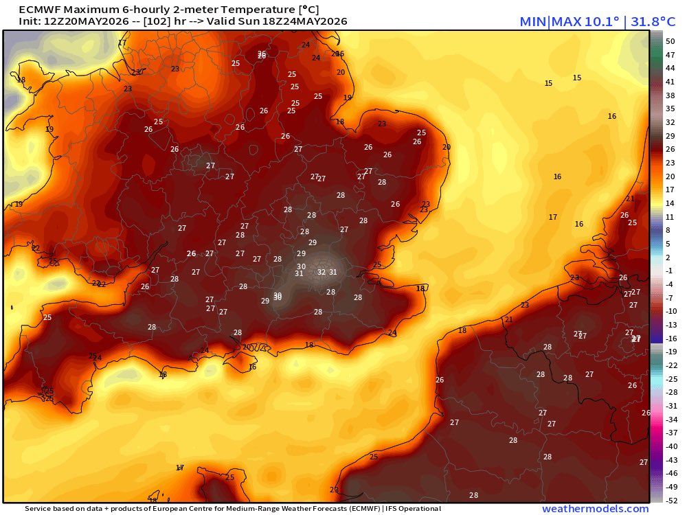
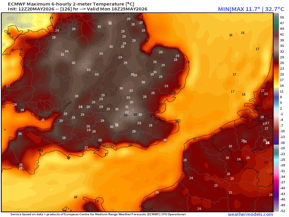
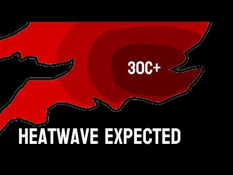
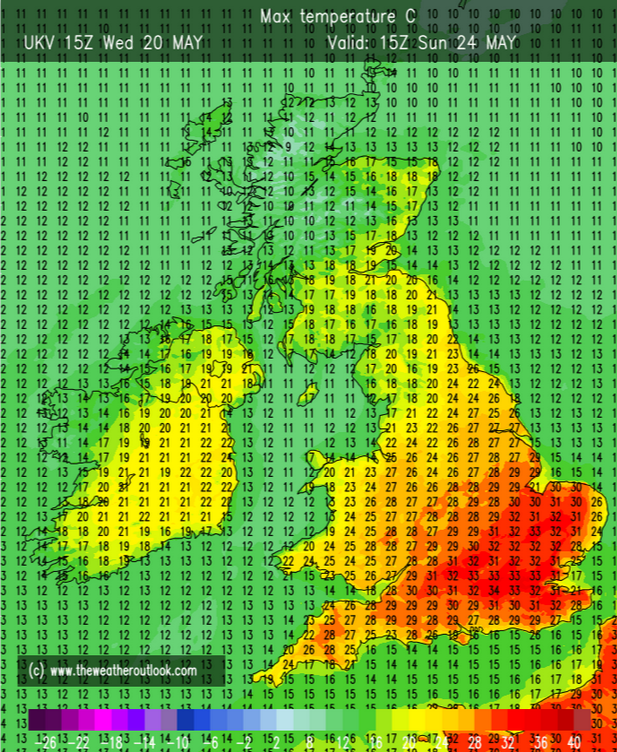
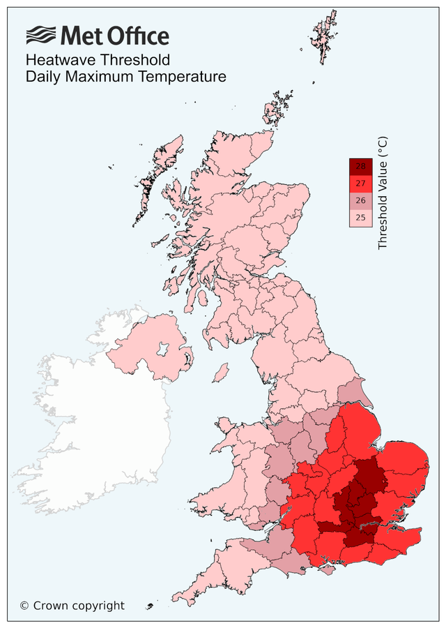
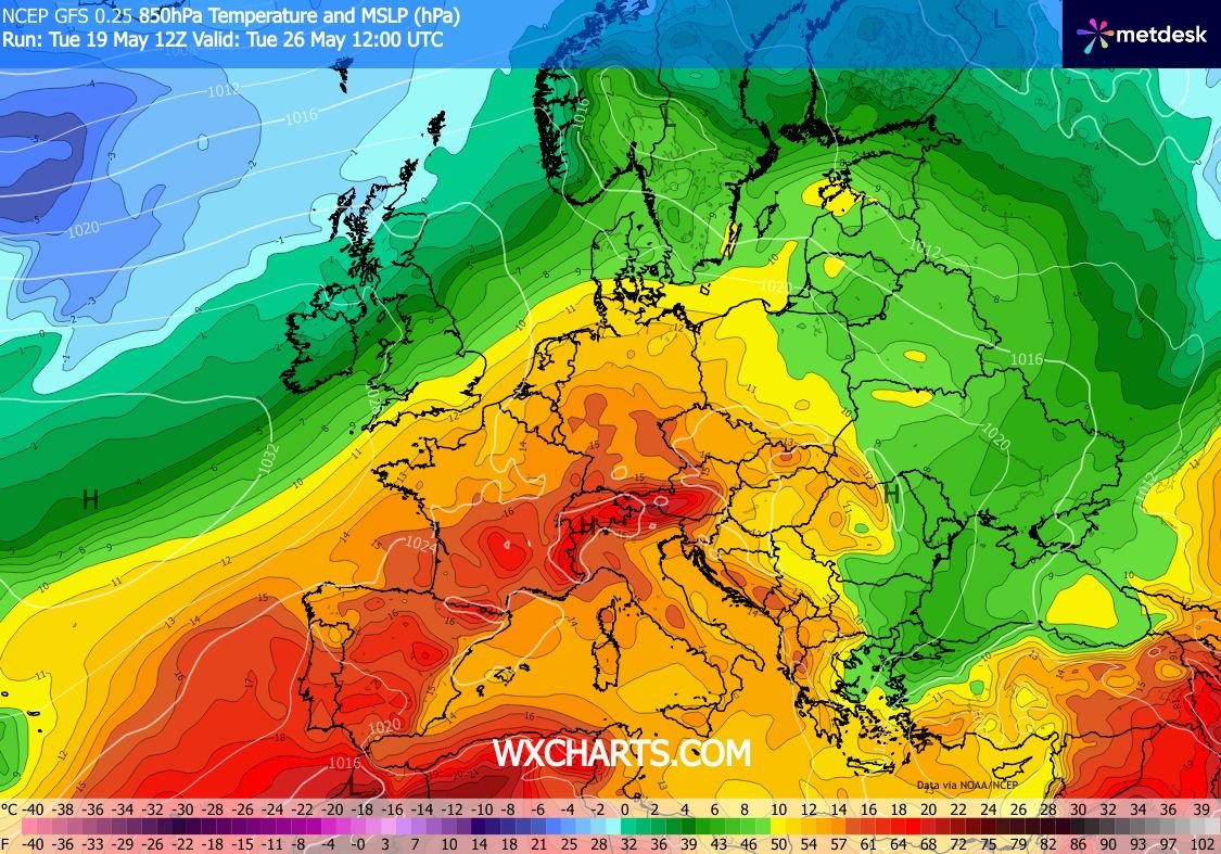
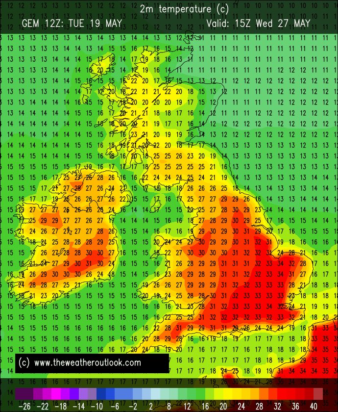
Is record breaking heat on the way for the end of this week ? The maximum temperature recorded was reached on the 29th may 1944. If this comes off then this record will be smashed out of the park. The UKV over does the temperatures by a lot. But if correct we could see 34+C

English