The blind food critic
18.4K posts
The blind food critic
@blindblog
hi i am The blind food critic, certified vision rehab therapist, spanning the globe from New York City to San Sebastian (Basque country), go YANKEES!
New York City and San Sebastian! Katılım Mart 2010
427 Takip Edilen782 Takipçiler
@LuxeTiffany hi could we chat about travel for the blind?
English
@MissMadeleine1 Hello, I am coming back out of town. I have been trying to call all morning to reserve two baguettes for today. The voicemail says customer service is only available during the week. Can you please help? Thank you.
Daniel Aronoff
English
@MikeMasco @PIX11News Sorry Mike, how do we watch your next live stream?
English

10AM STORM UPDATE… we are in the “LULL” of the storm… why I don’t have 24-30” snow bands on our forecast maps
@PIX11News
English
@MikeMasco Hi Mike, I have to travel from Maryland to New York City on Sunday. Any comments about the roads? I assume that airline travel will be nearly impossible. Thanks.
English
@MikeMasco Hi Mike, I have to travel from Maryland to New York City on Sunday. Any comments about the roads? I assume that airline travel will be nearly impossible. Thanks.
English
**2ND CALL SNOW FORECAST**
This is the human forecast snow map for Sunday - Monday with a starttime morning on Sunday which accounts for MIXING, RAIN, LOWER SNOW RATIOS, and SNOW BANDING FEATURES SUNDAY NIGHT - MONDAY.
Overall I could see the pink area overachieving if we indeed hit the perfect phased situation an assuming we get a low to bo sub 985mb on Sunday evening.
TRENDS CONTINUE TO BRING MORE MOISTURE AND A STRONGER COASTAL LOW ONSHORE…
The baseline forecast I went with this morning for this storm was 3–6" of snow, but there’s still some lingering uncertainty with precipitation coverage and how quickly colder air can work into the system. The new baseline of 6-12" area-wide as I look at the new CURRENT (HAPPENING IN REAL LIFE) DATA as well as how the models handle it.
The European model has now trended snowier in 5 consecutive runs, shifting the focus of the highest snowfall totals toward the coast, assuming roughly a 10:1 snow ratio. The latest is now in the ballpark of 12" according to the models. I could make that argument now that we have some model support.
Below is the model trend along with the latest 12z run.
There is legitimate support for this solution, especially for increasing totals across eastern zones, where stronger forcing and snow banding are more likely to develop.
What is a major wildcard is the GFS which is even more explosive with snow. Is there more room to run in snow totals? Possibly.
PIX11

English

@MikeMasco if I am flying in to JFK on Sunday in the late afternoon, am I screwed?
English
LOOKING BETTER...BUT NOT PERFECT...
FOR SNOW LOVERS & SUNDAY’S STORM…
As mentioned yesterday, I felt the European model was too far east and that a correction would come as upstream features “shifted” west and the jet stream sharpened.
Ultimately, this points to a closer-to-the-coast track, which supports more precipitation, a better cold-air source, and MORE SNOW.
The latest trend in the European ensemble guidance (multiple members vs. a single run) reflects that correction, with the operational model now playing catch-up. I think this ends up closer to the GFS idea — without the insanity of a full-blown GFS bomb cyclone producing 20″ of snow.
I’ll have first-look snowfall maps at 7am on TV, then on social media.
Words of caution with this storm:
Ground temperatures may struggle due to limited cold-air sourcing
Watch for erratic, last-minute shifts in either direction
Climatology matters — higher elevations do better, and daytime accumulation will depend heavily on snowfall rates with temps around 32–35°
@PIX11News
GIF
English
Please have a look if you can, I feel embarrassed for all of us that this travesty of justice is occurring in this incredible world that we live in. Long live the Basque country! facebook.com/share/v/17xzey…
English
@MikeMasco Hi Mike, I am enjoying all the updates, but I am confused: are you saying upper er Manhattan will get more? That is where I live, I am confused why lower Manhattan is separated. Thank you.
English
⭐️❄️ 1ST CALL SNOW MAP ❄️⭐️
I’m comfortable enough now to put real numbers on a forecast map — not raw model output, but a forecast built from actual meteorological reasoning.
This forecast is based on:
• Snow ratios
• Lower DGZ placement
• Front-end focused snowfall
• Dry dew points early
• Mixing potential near 800 mb (~6,000 ft) as coastal redevelopment occurs
🩶 ZONE 1: 4–6"
Lower Manhattan • Long Island • NJ Coast • Philadelphia
The front end of this storm should deliver 4–6" of snow, with locally higher amounts, before a transition to sleet and possibly freezing rain.
⚠️ I do NOT see this turning into “just rain.”
Ground temperatures will be in the upper teens to lower 20s — meaning freezing rain is a legitimate concern and should not be ignored.
🟦 ZONE 2: 6–10"
Interior North/Central NJ • North Shore LI • Upper Boroughs • Lower Westchester • Lower Fairfield CT
Soundings support some sleet here, but also a longer-duration front-end snowfall.
This is a challenging transition zone — and there is still a realistic scenario where no meaningful changeover occurs due to strong dynamics.
➡️ Higher-end totals are very much on the table.
🟪 ZONE 3: 10–15"
NW NJ • Poconos • Lower Hudson Valley • Central CT
This area benefits from very high snow ratios for nearly 90% of the storm before eventually shifting to wetter snow.
I am very confident that areas in purple do not switch to sleet or freezing rain.
This is the jackpot zone.
📌 SIDE THOUGHTS
This is my First Call.
Adjustments will be made.
Forecasting for more than 7+ million homes is never perfect — especially in a setup with this many microclimates and boundary-layer challenges.
But this is the best possible forecast with the data we have right now.
More updates coming.
Stay tuned ON tv UNTIL 10AM @PIX11News ❄️📺
English
@MikeMasco Please help me out here, and thanks for the great info. I heard that with La Niña the winter would be cooler, no?
English
EL NIÑO LOADING ⏳🌊
A very clear signal of La Niña collapsing, shown by warming subsurface water extending from the surface down through deeper layers of the Pacific. You see this most prevalent in NINO 4 region but slowly moving east. This isn’t just surface noise — it’s a structural shift in the ocean-atmosphere coupling.
As La Niña fades, the jet stream typically becomes less suppressed, allowing more interaction between northern and southern stream energy. That opens the door to increased storm amplification, more frequent coastal development, and a higher ceiling for snow events in the East when cold air is available.
This evolving background state is a key reason forecasts remain bullish on additional winter weather opportunities as we move deeper into the season. @PIX11News
GIF
English
@hivemindassoc A big thank you from all of your fans who are blind like me.
English

how did it age is now available for audio listeners too! all 45 episodes up with the new one going up soon:
open.spotify.com/show/3XgZptQu1…
English
NEW EPISODE OF HOW DID IT AGE!
Dog Day Afternoon (1975)
Watch: youtube.com/watch?v=K2lsYD…
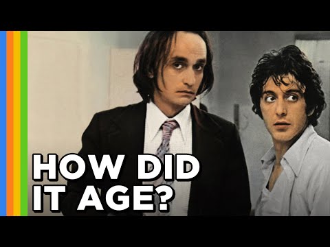
YouTube

English
@MikeMasco @united @Delta @JetBlue @AmericanAir Dear Mike, my parents and sister are also stuck in Aruba with you, please keep us up-to-date about any news. Thank you for all the updates. Please take care.
English
.@UNITED @Delta @JetBlue @AmericanAir — is there a plan to add recovery flights to the ABC islands/Caribbean? Has your operations teams started to coordinate these planes to get in the air?
We’re hearing the NOTAM/no-fly restriction may be lifted around 1am Sunday. Many travelers (myself included) are currently stranded with little to no communication from the airlines only being told to rebook on their app... the next available flight showing is 5+ days out!
Hotels cannot handle the overflow now from cruise ships arriving asking guests to find other place... Very unsettling situation. Soonest flight I can get is FRIDAY nearly a week away.
English
Reposting sorry @patkiernan
The blind food critic@blindblog
@patkiernan Dear Pat, if you wouldn’t mind, could you please take a look at this? I am helping out with the auction for my six-year-old’s son school and we would love your help in any way. I’ve been watching you on TV for so many years now, thank you. docs.google.com/document/d/1-I…
English
@patkiernan Dear Pat, if you wouldn’t mind, could you please take a look at this? I am helping out with the auction for my six-year-old’s son school and we would love your help in any way. I’ve been watching you on TV for so many years now, thank you. docs.google.com/document/d/1-I…
English
Anyone awake? 2 in the morning but so intriguing and fun!! Going to the bottom of the 17th inning!! #WorldSeries
English
Hello everyone, long time! Could you please be so kind as to support my son with his charity Ronald McDonald run? All funds go to pediatric cancer patients. Thanks! secure-give.rmh-newyork.org/fundraiser/670… #ronaldmcdonald
English
@TLincontro Hi big fan who is vlind
I saw your post about tomato sauce do you plan to sell it?
English

I get my “by any means” on
When ever there’s a drought 🎵
English
Happy all star game! Photo contains ruth mantle and other alltime great yankees.

English