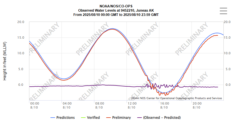
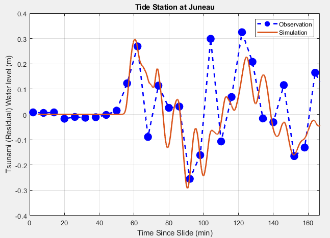
Another huge landslide and tsunami in coastal Alaska yesterday morning. Still a bit of a puzzle, but working with the @AKearthquake source location, the timing of waves from eyewitnesses on Harvest Island and in Endicott Arm, and the @NOAA Juneau tide gage recording, it appears that a massive slide occurred ~5 km east of the end of Tracy Arm. With this info guiding simulations, a plausible/likely scenario (there are others!) is that the slide ran down Sawyer Glacier, impacted into the water at the end of Tracy Arm, and displaced somewhere between 100-200 million cubic meters of water. A simulation with this info matches eyewitness tsunami observations and the tide gauge, shown below. Animation here as well. If this source pans out (the slide location is still uncertain – need satellite imagery to confirm), there were likely *very* large waves within ~5 km of the slide-water impact location at the end of Tracy Arm.
English