@Cubskickass100 The weather is going to be cold today, which means cubs either win off 3 solo HRs and tallion pulls thru. Or we get shut out. There’s no in between
@panickedvampire@SRussellWeather It’s just beyond me that the NWS, with government funding, struggles to be as accurate as X bedroom meteorologist, with $0 in funding
@has_ipad@NWSChicago Speaking from Chicago, it’s mainly due to population, if you’ve ever heard, not sure the correct term but it’s basically to keep NWS from always putting out a watch to large population areas because people will start ignoring these warnings if they are always put out in the areas
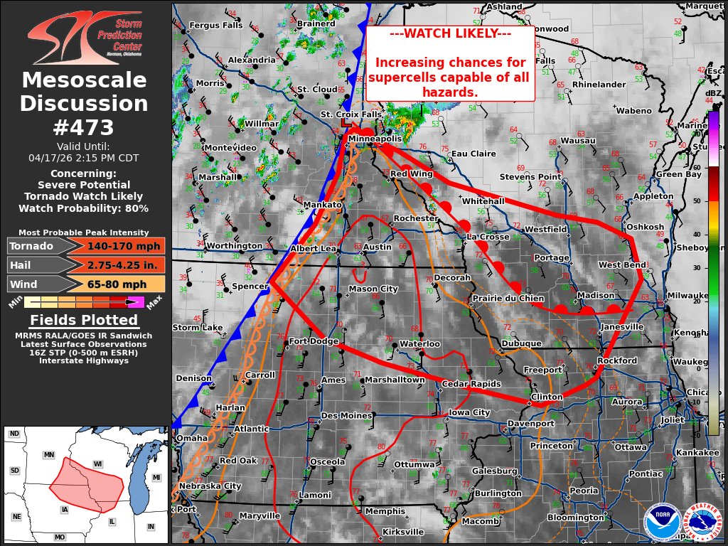
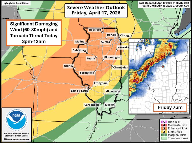
*Significant Damaging Wind and Tornado Threat Today across Illinois*
- The environment this afternoon and evening will be primed for severe weather across northern Illinois and surrounding areas. A cold front will be moving quickly across Iowa and Illinois later today. Ahead of that front, thunderstorms will develop as soon as 2-3pm, and these will have the potential for all hazards into tonight with significant damaging wind gusts and several tornadoes likely.
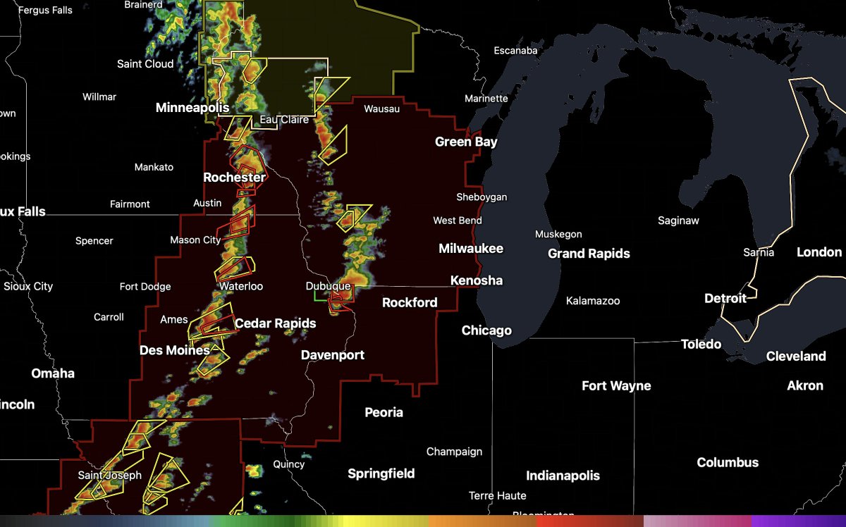
- Storms will get started around 2-3pm across central and eastern Iowa. These storms will have very large hail potential to start and should transition to potentially tornado-producing storms as they move east and mature. Eastern Iowa, northwest Illinois (along and west of I-39), and Wisconsin will have the greatest tornado risk today from 3pm-10pm, during which a strong tornado could be possible. As these storms progress this evening, they will transition from tornado and large hail producers to significant damaging wind and embedded tornado producers across northern Illinois, and that threat will continue into Chicago tonight and even into northwest Indiana. Storms will move through and exit Illinois after midnight tonight.
- Timeline for storms across Illinois will be from 4pm-12am, 5pm-12am for Chicagoland, 3pm-10pm across eastern Iowa, 4pm-12am across Wisconsin, and 8pm-2am for northwest Indiana.
- Tornado threat is greatest across northwest Illinois; a significant damaging wind threat is in place for everyone. #ilwx
@nilwxreports just got extremely noticeably cooler in southern dupage, no rain, no thunder. Tell me the bad news. Does this mean I’m not getting a storm tonight?
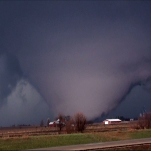
@HypertensionCub@RFDSurge *too much daytime heating can cause temperatures and dewpoints to become too far apart, which is 'overmixing', that would cause storm bases to be too high and inhibits tornado potential.
But I don't think that will happen today, dewpoints will be mid-upper 60s. Tornadoes likely.
Clearing skies in northern Illinois and southern Wisconsin when parameters are already forecasted to be off the charts later… if you want tornadoes you don’t want it too clear or else dews could start mixing slightly. Potentially Dangerous situation is possible with storms that convect later #ilwx