d⚽️b retweetledi

fwiw, despite "us officials" providing the scoop, "us officials" also deny it. Regardless, something is going on in the Strait and there has been multiple exchanges of fire/shooting at boats in the last 24 hrs.
English
d⚽️b
155.5K posts

@RealDBell
Nerd prince//word sentinel


BREAKING: MICROSOFT JUST ANNOUNCED TO BAN ITS OWN ENGINEERS FROM USING AI DUE TO THE COST OF USING IT. VP OF NVIDIA SAID, “THE COST OF AI FOR MY TEAM WAS MORE THAN HUMANS” “AI CAN COST MORE THAN HUMAN WORKERS NOW”


The last male-line Piłsudski was Kazuyoshi Kimura (d. 2022), grandson of Józef Piłsudski’s brother Bronisław. Bronisław was an anthropologist who was deported to Sakhalin, married an Ainu woman, and wrote many important works on Ainu language & culture.

someone should make a coffee table book of the billboards of san francisco
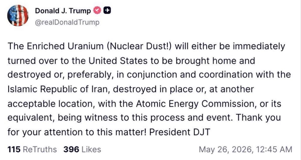
This is a thinly-veiled mafia threat: Trump weaponizing Iran's ability to destroy the GCC states to blackmail GCCs into joining the Abraham Accords, which Trump needs to sell his own capitulation to Iran. "If you don't join the AbrAccords, we'll bomb Iran, and Iran destroys you!"

George Galloway: "Tucker Carlson must run. He's the only man who can save the country, and perhaps save the world."

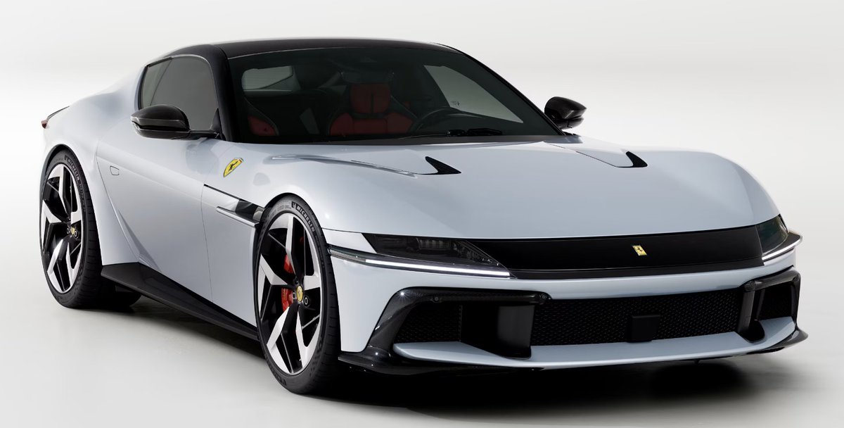
Something must be done. This is a national tragedy. This is worse than the national team no longer qualifying for the World Cup. This is even worse than the death of Italian Cinema. Ferrari *is* Italy. Jony Ive can make slabs. He can't make cars. Give the job back to Pininfarina.