@AceGrrl31415926 @mattvanswol @MayorFrey *the innocent who are falsely accused. Which can be any one of us. That’s why we all have a right to a fair trial, rather than being killed on the spot
English
Kaitlyn
2.6K posts

@kait2478
Follower of Jesus, wife, mother, writer










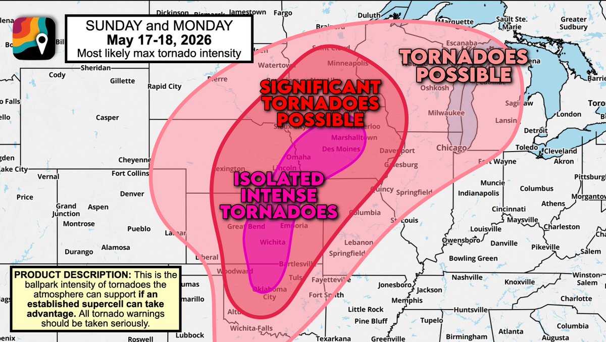
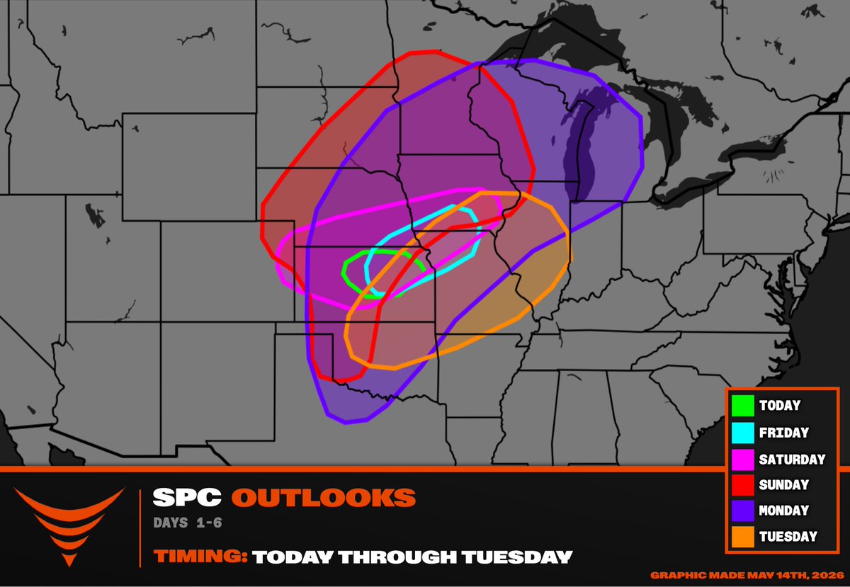
SUNDAY and MONDAY, May 17-18, will feature a multi-day significant severe weather episode. A severe weather outbreak is increasingly possible, with the potential for a couple strong to intense tornadoes. We're expecting multiple waves of low pressure to accompany an eastward-moving cold front. Very warm, moist air ahead of the front will provide ample instability, or thunderstorm fuel, to make for severe thunderstorms. An approaching jet stream dip will also lead to ample shear, or changing winds with height, that will encourage some storms to rotate. Sunday's threat may be concentrated in the Corn Belt. Monday's will be largely predicated on how Sunday's storms evolve, and if they leave behind any boundaries to serve as foci for redevelopment. However, Monday may have a bit of a double-bullseye (we call that a "bimodal risk". There may be a more concentrated area of severe weather somewhere over the Corn Belt/Upper Midwest closer to the high-altitude dynamics, but then a second zone of more dangerous storms may occur somewhere in southern/central Kansas or northern Oklahoma. That's where there may be fewer storms (since the main trigger passes north), BUT fewer storms = less competition between storms = more intense storms. A couple rotating supercells MAY try to intensify across the southern/central Plains Monday evening, particularly as the low-level jet stream (a river of winds a mile above the ground) intensifies. For now, it's important to note that tornadoes, hail etc. are possible BUT the greatest impacts will be relegated to localized areas that we can't pinpoint yet. We'll do our best to iron out specifics in the days ahead.







Dog sheltering from baseball size hail in Chattanooga, OK 6:35pm