Incredible reception of Keet today and our Holepunch vision. Can't wait for the explosion of P2P apps to continue. Very optimistic about the future of the Internet!
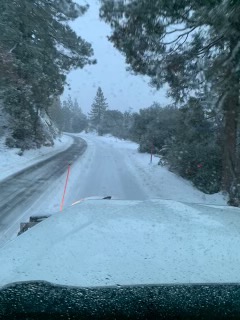
More opening and closing info will be posted on the forest website tomorrow. Our website server has been down much of today, plus staff are checking again on the status of sites in the high country today. One update so far: Buckhorn Campground will not open until the snow melts.
🌱We are hiring a senior back-end developer with 5 years experience to join us on a 12-month contract (with potential long-term) starting asap. Work on decentralized, offline-first applications to solve big challenges that make the world a better place! bit.ly/3Ax4Bke
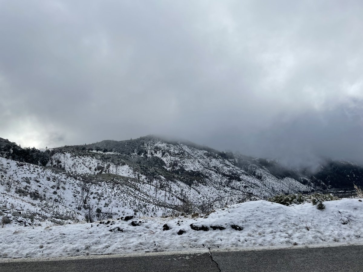
TRAVEL ALERT: @CaltransDist7 today was clearing SR-2/Angeles Crest Hwy in @Angeles_NF north of @TheCityofLCF. CHAINS REQUIRED. Storm Wednesday (12/29) is expected to bring heavy snow / possible closure. Check quickmap.dot.ca.gov for latest conditions. Watch out for Workers!
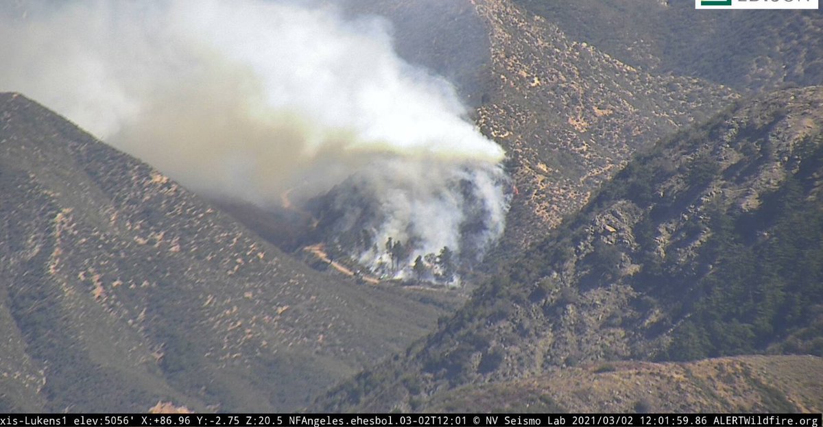
Notice: Pile burning is scheduled for near Angeles Crest Fire Station and Clear Creek Fire Station on Tuesday, Mar 2. Smoke may be visible. ANF Firetrucks will be on hand. This will benefit natural resources and reduce future risks of wildfire. #PrescribedFire#GoodFire
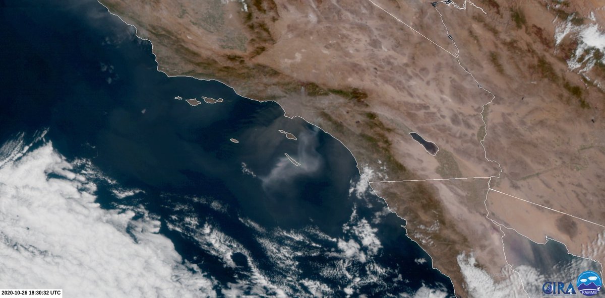
@Angeles_NF Angeles National Forest fire in Altadena near Chaney Trail info from "Felix LA" on Nextdoor, 6 minutes ago: "It's being worked with 2 helicopters, looks like they have a good grip on it. There's a slight breeze, hopefully it won't kick up."
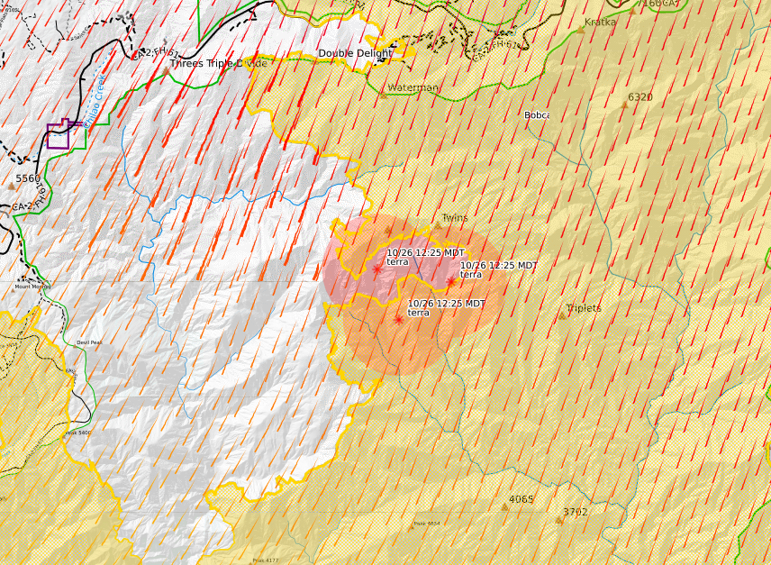
@Lacfirealerts There is a fire burning on Twin Peaks, which is extending the western perimeter, it is not inside containment lines. alertwildfire.org/orangecoca/ind…#ll=34.31048,-117.96621&z=13&b=mbh&o=mbr&n=1&a=modis_mp%2Cwxd_wspd-01" target="_blank" rel="nofollow noopener">caltopo.com/map.html#ll=34…
Fire Updates:
#SantiagoFire 4000 acres, 0% containment. Rapid ROS, fire is being fueled by winds gusting up to 45 MPH.
#BobcatFire Reports of a possible flare up inside the containment lines. It could be ash or dirt being kicked up into the air.
Due to the high winds and #RedFlagWarning, residents in the foothill communities of the San Gabriel Mtns. might see some ash or dust from the #BobcatFire. The fire is 95% contained and poses no immediate threat.
@smbjettyfiremen@Angeles_NF This is burning on the western perimeter. It's not an island. It's also visible from GOES-17 and SCE Sunset Ridge Webcam. There are no current interior flare-ups visible from GOES-17, this is the only one
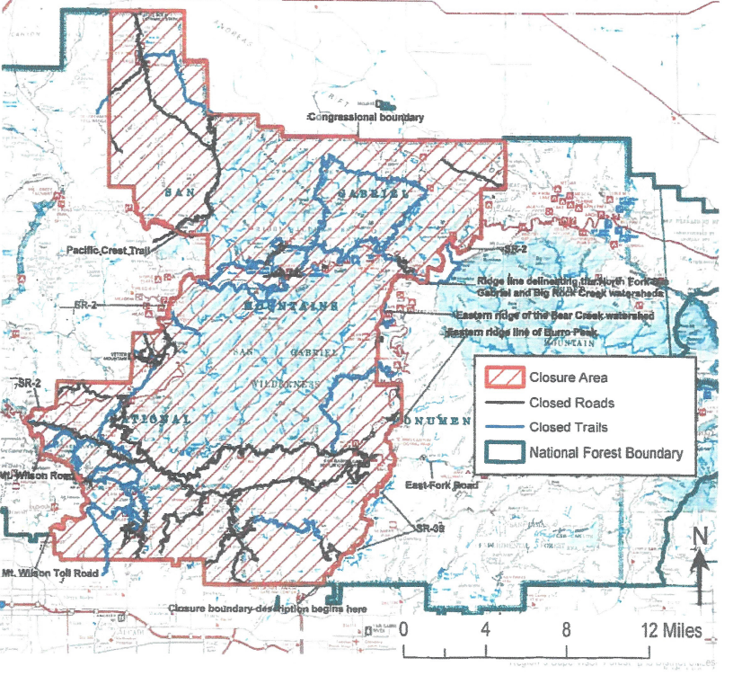
@Angeles_NF I see this map on the ANF website now, maybe you can provide the raw shapefile and GIS data as well so the community can render higher quality maps?
@maxogden Thank you, Maxwell! We are in fact working on the maps. Unfortunately the burned area is so large and crosses so many roads/trails/boundaries, that creating a maps that are useful, and have clarity, is taking some time. It's in the works, but won't be ready until later today.
Closure UPDATE: The USFS emergency closure order for the Angeles National Forest expired last night. Much of the ANF reopens today, Oct 9. Please note: BURN ZONES remain CLOSED for public safety, fire recovery & restoration. THANK YOU for your patience & understanding! #ANF