

Jaiden Shaw-Brierley
1.2K posts

Jaiden Shaw-Brierley
@JAIDENSB2004
I love weather have a habit of it. Feeding the Wildlife and looking after them as well. I don’t post that much but you may see the odd post now and then.
England, United Kingdom Katılım Şubat 2022
443 Takip Edilen70 Takipçiler

@oliverek7 Yup. Can talk about the risk on text. Text me saying about it as oddly my twitter is weird lol.
English

@JAIDENSB2004 Yes also tracking that. Perhaps a bit more widespread activity if the upper trough overlaps favourably 👀
English
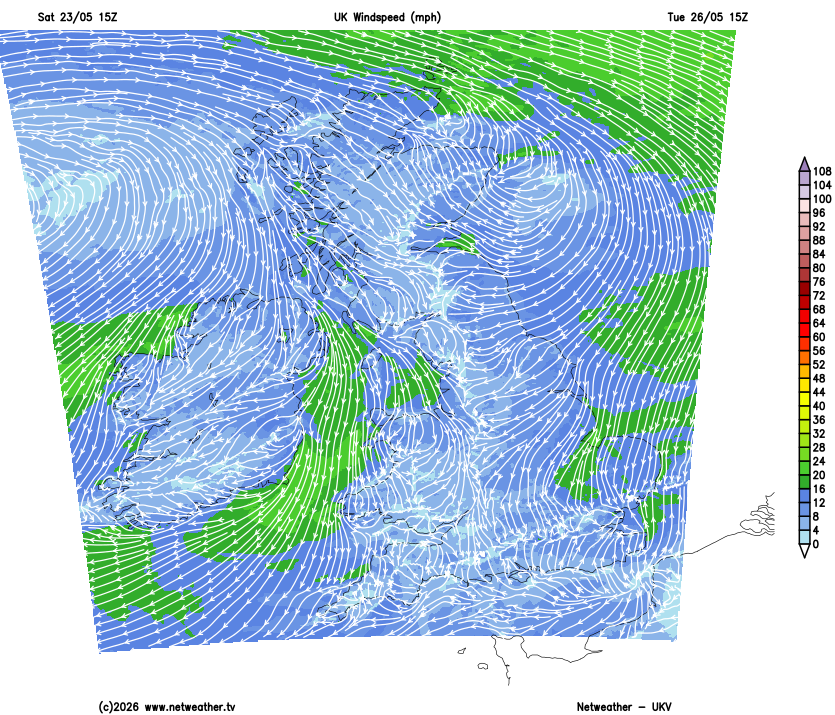
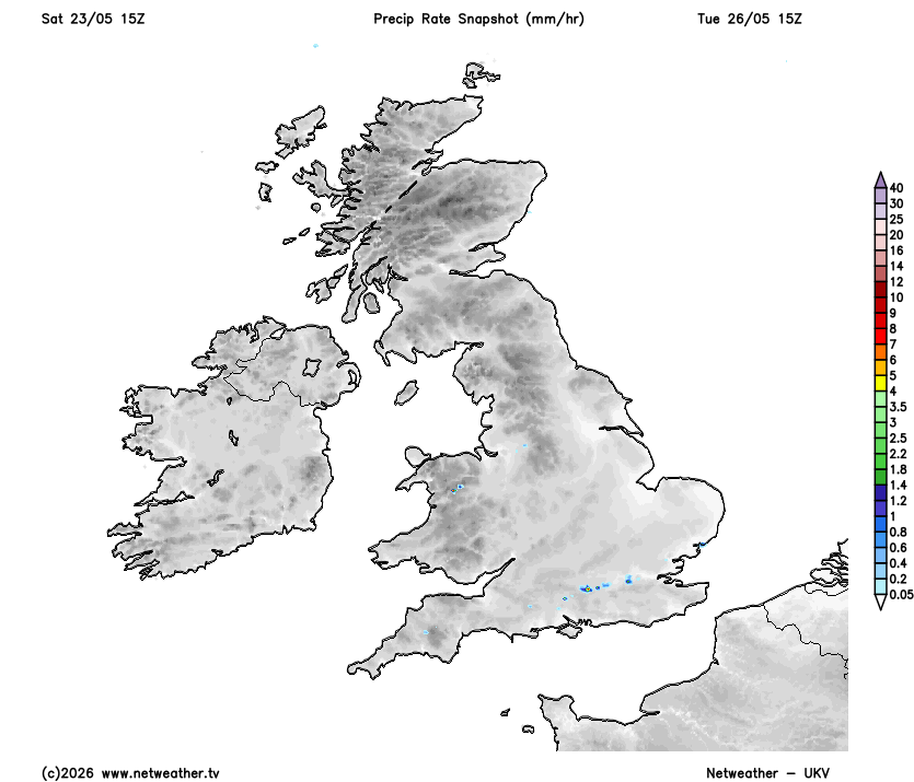
#ukweather A more detailed thread to come tomorrow or Monday should trends hold. Next day of interest for convective activity looks to be Tuesday 26/05. A few convergence zones could set up, focused around Wales, Midlands into SW and CS England. These could provide enough forcing to trigger pulse storms (given weak shear) in places should subsidence from high pressure be overcome. Most models within range of this day are showing interest in initiation, including UKV.
English
@oliverek7 @MesocastUK I think Thursday - Saturday next week we MIGHT see something again.
English
Well it did go bang over Lincolnshire and E Yorkshire⚡️ solid verification. Those storms are still flashing away over the North Sea. #ukweather

English

Putin: I asked the Ministry of Defense to prepare options for responding to the Ukrainian attack on Luhansk
🇺🇦🇷🇺‼️‼️‼️‼️‼️‼️‼️‼️‼️‼️‼️‼️‼️
English
@LondonSnowWatch Very small risk of some high elevated thundery showers across the south coast tonight. But towards Eastern and NE Eng there’s a more better chance of storms.
English
Any chance of storms tonight have faded
Just some drizzle or light rain moving east across the south tonight into Saturday morning
In terms of temps, Monday still looks the peak with maxes into low 30's quite widely inland & one or 2 locations hitting 30c over the weekend too
Sᴏᴜᴛʜᴇʀɴ ᴇɴɢʟᴀɴᴅ ᴡᴇᴀᴛʜᴇʀ@LondonSnowWatch
what about u crazy ones that want some heat? Nothing definitive, but With legacy of ssw fading, gentle final warming & other bkgrnd signals, we shud see n'rn blocking fading from ~mid May So if we're to see sustained build of heat from south, late May would be earliest chance
English
@JAIDENSB2004 Hmm interesting, think that would be the only model showing it that far south then. We’ll see what ends up being right haha, an intriguing little setup to watch.
English
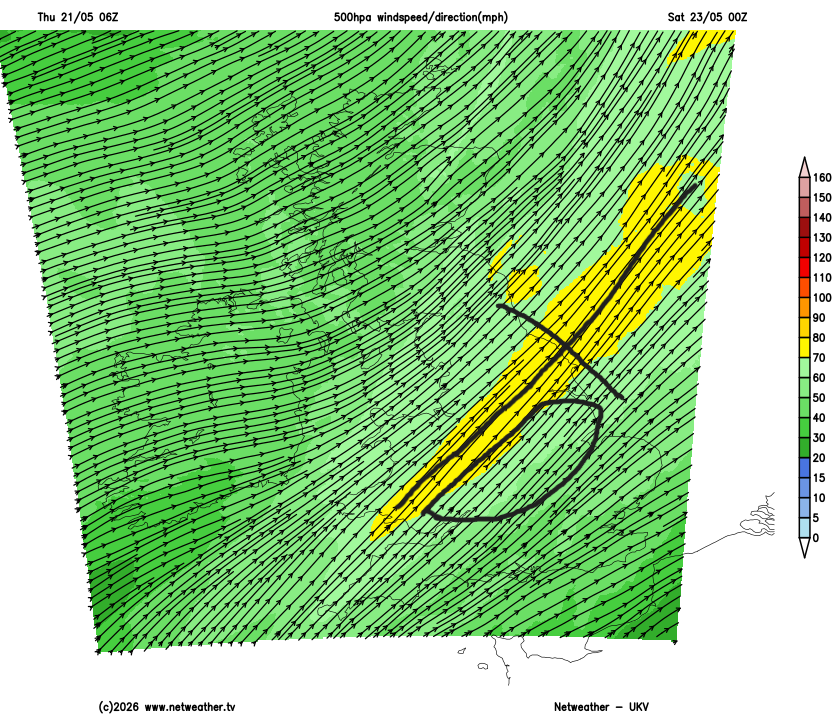
1/ What now catches my eye for Fri night into Sat morning is UKV showing a plume of moisture at 850mb translating NE through the overnight period across the Midlands into parts of NE England and East Anglia, potentially overlapping with the jet right-entrance region providing lift. However, this moist layer (at least on the 2km UKV 06z profile) is very shallow and sits right at the base of an EML.


oliverek7@oliverek7
1/ Early saturday morning is looking quite tricky over SE England. Box soundings from models including ECM and ICON show the presence of elevated instability, along with a favourable wind profile for organised storms. However, the 2km UKV shows a very pronounced inversion - thwarting any convective potential.
English
@oliverek7 GFS is showing south coast better risk and usually GFS is more greater when it comes to plume setups.
English
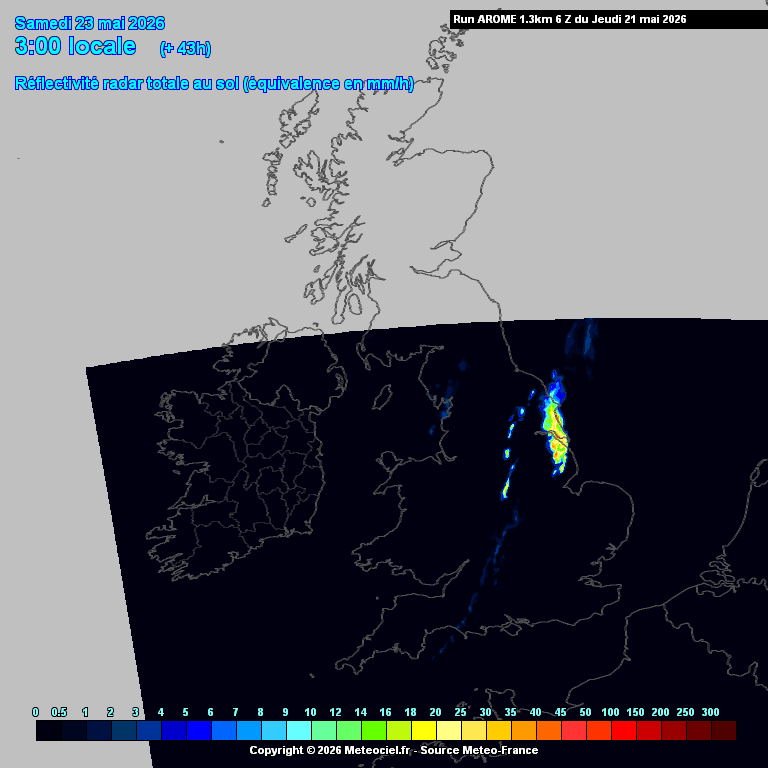
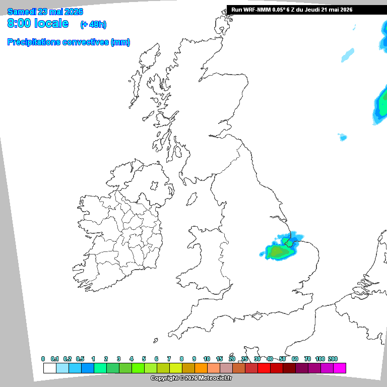
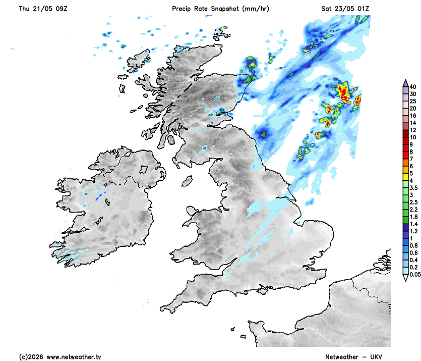
3/ Several models have been firing convection through this corridor during the early hours of Saturday. Even the UKV has fired some storms, although preferring to initiate them offshore over the North Sea within a secondary moisture plume in the jet left-exit region and where 500mb temps are colder. Others, like AROME and WRF, have done so within the right-entrance region where instability is greater. Confidence remains low overall, but the signal has become more consistent in higher-resolution guidance over recent runs.
English
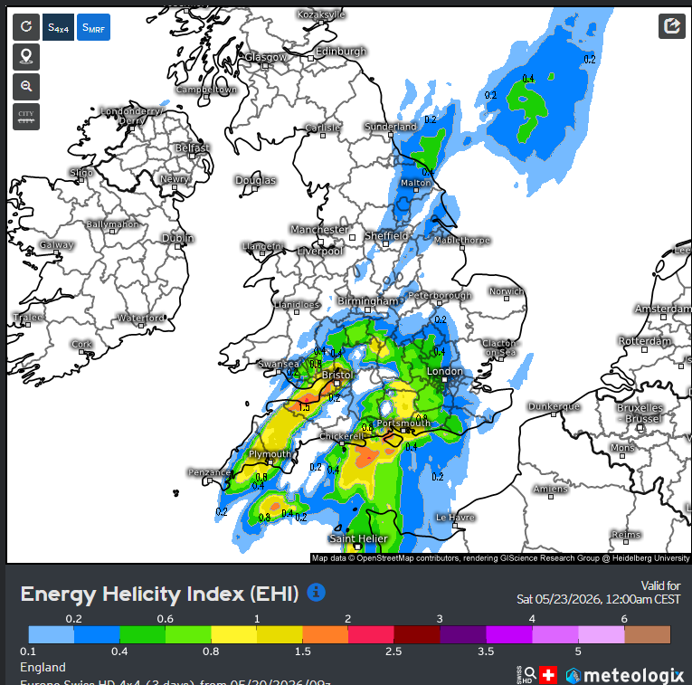
@SkiesOfTheUK I’ve noticed the SWISS model is really good for elevated. So I’d pay attention!
English

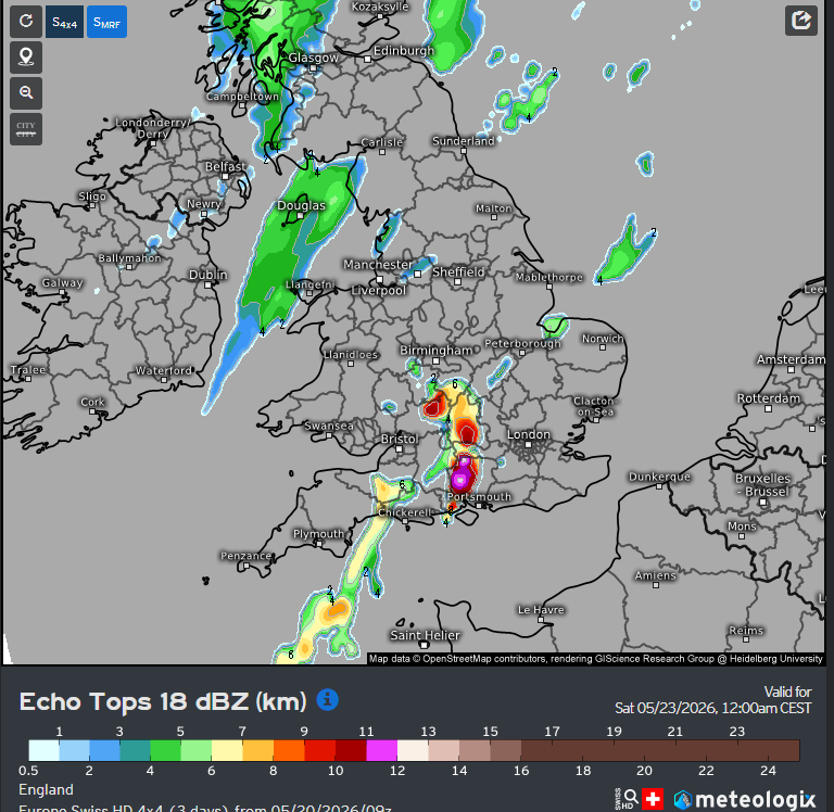
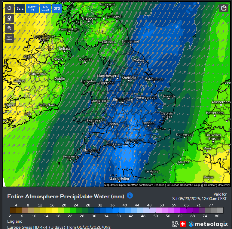
S4x4 wants some proper overnight storms Friday night. GFS is also hinting on this but is much weaker.
I must say, if this does verify (unlikely at this current stage), there could be one of a lightning display for many.
English
@LondonSnowWatch I’ve seen that thunderstorm risk. Could be rather good for Hampshire and London if I’m right.
English
Looks like some inland parts of the east will reach high 20's Friday ➡️ Wednesday
Not a bad call from 17th April
Mostly dry but watching a small chance of thunderstorms on Friday eve/night
Unfortunately, as usual, with the increased temps comes increased humidity booo 😰
Sᴏᴜᴛʜᴇʀɴ ᴇɴɢʟᴀɴᴅ ᴡᴇᴀᴛʜᴇʀ@LondonSnowWatch
what about u crazy ones that want some heat? Nothing definitive, but With legacy of ssw fading, gentle final warming & other bkgrnd signals, we shud see n'rn blocking fading from ~mid May So if we're to see sustained build of heat from south, late May would be earliest chance
English

@JAIDENSB2004 @PaulBlight6 Disrupting means the low cuts off from the jet stream and high pressure builds back over the top of it, this would bring a warmer and more settled Weekend so no storms. L
English

models are struggling to resolve details of the upper trough which is going to move East at the end of the coming week. Whilst there is generally adequate agreement on the build of the high pressure, it is not clear on how transient it will be.
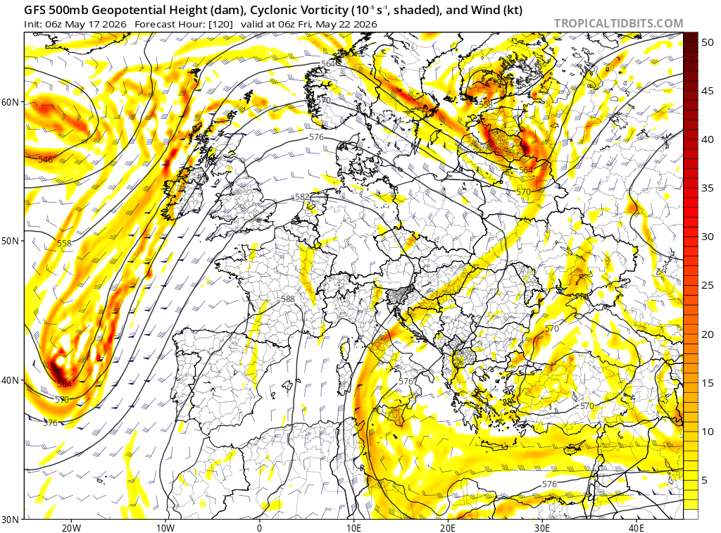
Here we can see the driving longwave trough coming east into the Eastern Atlantic by Friday, with relatively good agreement from the ECMWF/GFS
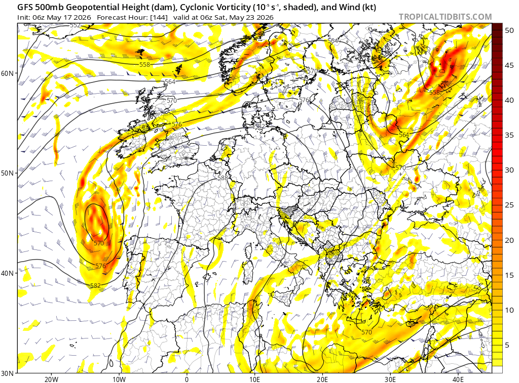
However as it runs east, models are unsure what happens, in some runs it slows down and partially disrupts leaving an element stranded in Biscay with ridging building back over the top, and in others (UKMO/06Z ECMWF) the trough doesn't partially disrupt, this leads to a much more progressive pattern as early as Sat across much of the UK.
The differences are shown below. on the GFS the vortex is stranded in Biscay vs over the Celtic Sea, Ireland on the ECMWF./
However if we look at the 00Z ECMWF >>>>>>>>>>


English
Jaiden Shaw-Brierley retweetledi

"They're all as bad as each other"
Kemi Badenoch declares she "can deal with any" future Labour leader
trib.al/KekXRTp | @TrevorPTweets
English


Much warmer days are coming to extent nighttime lows might be as high as recent afternoons.


English
Jaiden Shaw-Brierley retweetledi

Yesterdays thunderstorm here. Hail and some impressive lightning too! @PaulBlight6 , @danholley_ , @west_weather , @MetJayy , @MetJam_
English